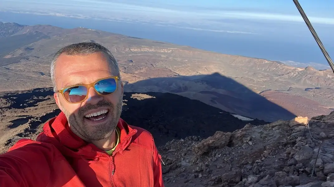
WHY TRUST THIS INFORMATION? I hiked A LOT, including a quest to hike all Anaga trails during my family’s year in Tenerife from 2022 to 2023. This and other articles are based on my personal experience, while hiking alone and with our kids.
This guide will help you to orient yourself in Anaga Rural Park, which is one of the three official nature parks in Tenerife along with Teide National Park and Teno Rural Park.
While every other article about hiking in Tenerife has the title “X best hikes in Tenerife”, very often it appears that these were the only trails the blogger went to. Be critical and judge visely.
Anaga hiking trails from best to worst – ranking
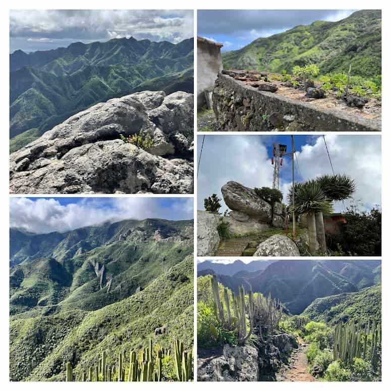
There are 12 official trails in the Anaga Rural Park in the North of Tenerife. These trails are numbered from TF-1 to TF-12 and some have additional sections like TF-6.3 to add variety to your hikes or connect between trails or to villages with parking and bus stops.
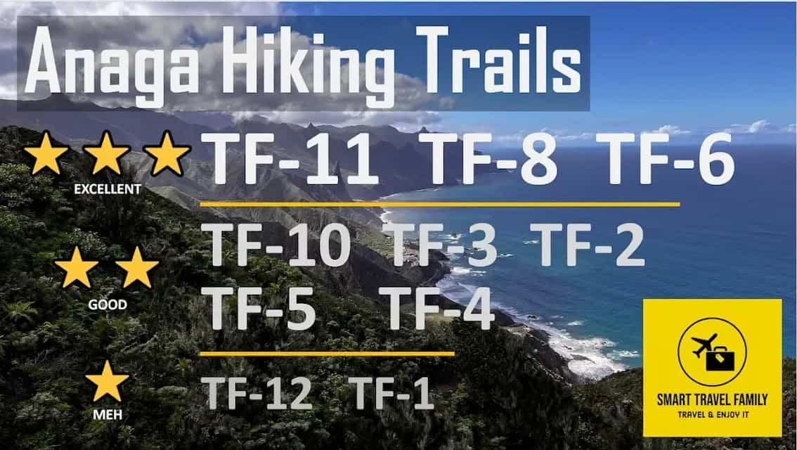
In case you do not want to read further, here’s my experience-based ranking of Anaga hiking trails from the most impressive to the worst in the sense of being boring or otherwise dull. If you have limited amount of time on the island, just start from the top trails and you won’t be disappointed.
For most visitors to Anaga, I’d recommend to start with the TF-8 trail that you can start from either the Afur or Taganana villages.
It’s a circular trail, which means that you’ll be able to return to your rental car, if you’ve decided to rent one. My absolutely favorite trail was TF-11 trail, but that’s a one-way trail, so it might not be suited for most visitors. TF-6 is quite similar to TF-8, but a tad wilder and harder to reach.
To be fair, most Anaga trails are quite nice. The ones I’d really recommend avoiding are only TF-1 and TF-12.
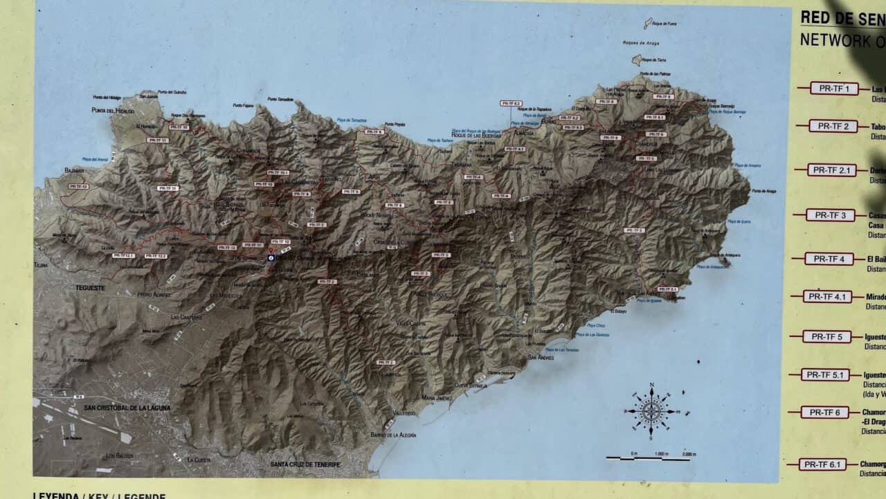
Map of Anaga hiking trails
The above is a map of all hike-worthy official Anaga Rural Park trails. The map doesn’t have the TF-1 and TF-12 trails, as Google allows me to only place 10 trails on a map and these two trails are definitively the less impressive. To see TF-1 and TF-12, open this map.
Anaga trails comparison: length, difficulty, circularity
Length information is based on my GPS readings when taking the trail, as quite often Anaga Rural Park Administration information lists shorter trail lengths for some reason.
| Trail | Length (miles / km) | Vertical ascent (feet / m) | Difficulty | Additional Information |
|---|---|---|---|---|
| TF-1 | 2.36 / 3.8 | 1014 / 309 | Easy | Child-friendly |
| TF-2 | 7.46 / 12 | 1562 / 476 | Medium | Child-friendly |
| TF-3 | 6.03 / 9.7 | 2133 / 650 | Hard | Circular |
| TF-4 | 2.11 / 3.4 | 66 / 20 | Easy | Child-friendly, downhill trail |
| TF-5 | 6.84 / 11 | 1230 / 375 | Medium | |
| TF-6 | 7.89 / 12.7 | 3044 / 928 | Hard | Circular, top choice |
| TF-7 | 4.77 / 7.68 | 1089 / 332 | Easy | Child-friendly |
| TF-8 | 9.63 / 15.5 | 3353 / 1022 | Hard | Circular, top choice |
| TF-9 | 3.85 / 6.20 | 667 / 203 | Medium | |
| TF-10 | 7.41 / 11.91 | 853 / 260 | Hard | |
| TF-11 | 7.71 / 12.40 | 1292 / 394 | Hard | Top choice |
| TF-12 | 7.12 / 11.45 | 331 / 101 | Easy | Child-friendly, boring |
In all cases, I took the trail from the middle of Anaga Rural Park to the ocean side. The vertical ascent shown in the table is in the direction of the ocean. If you would take any of the trails in the opposite direction, they would be much harder.
Short Anaga trail descriptions
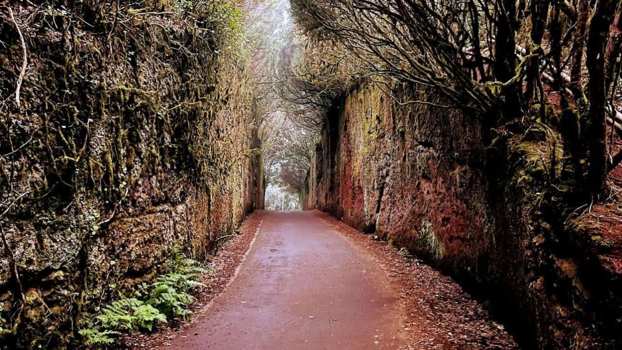
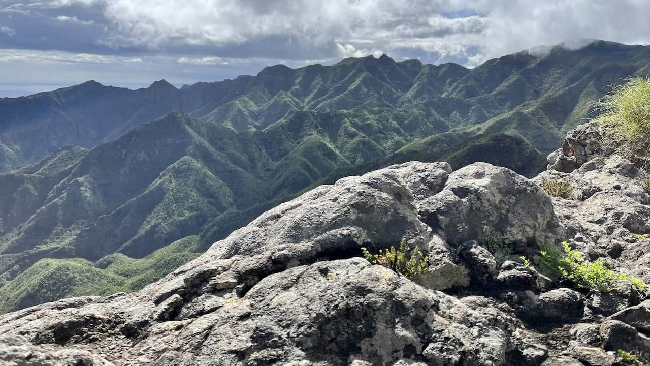
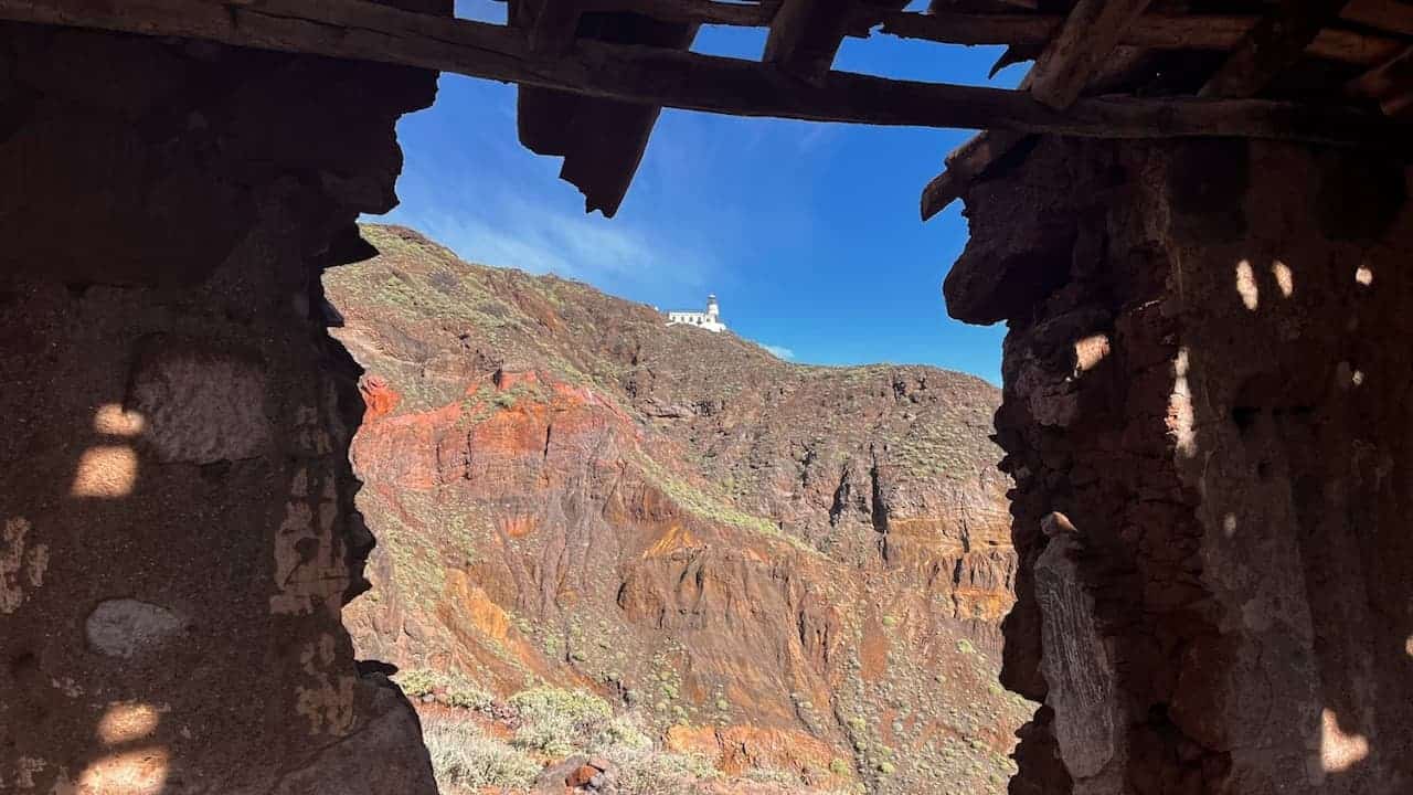
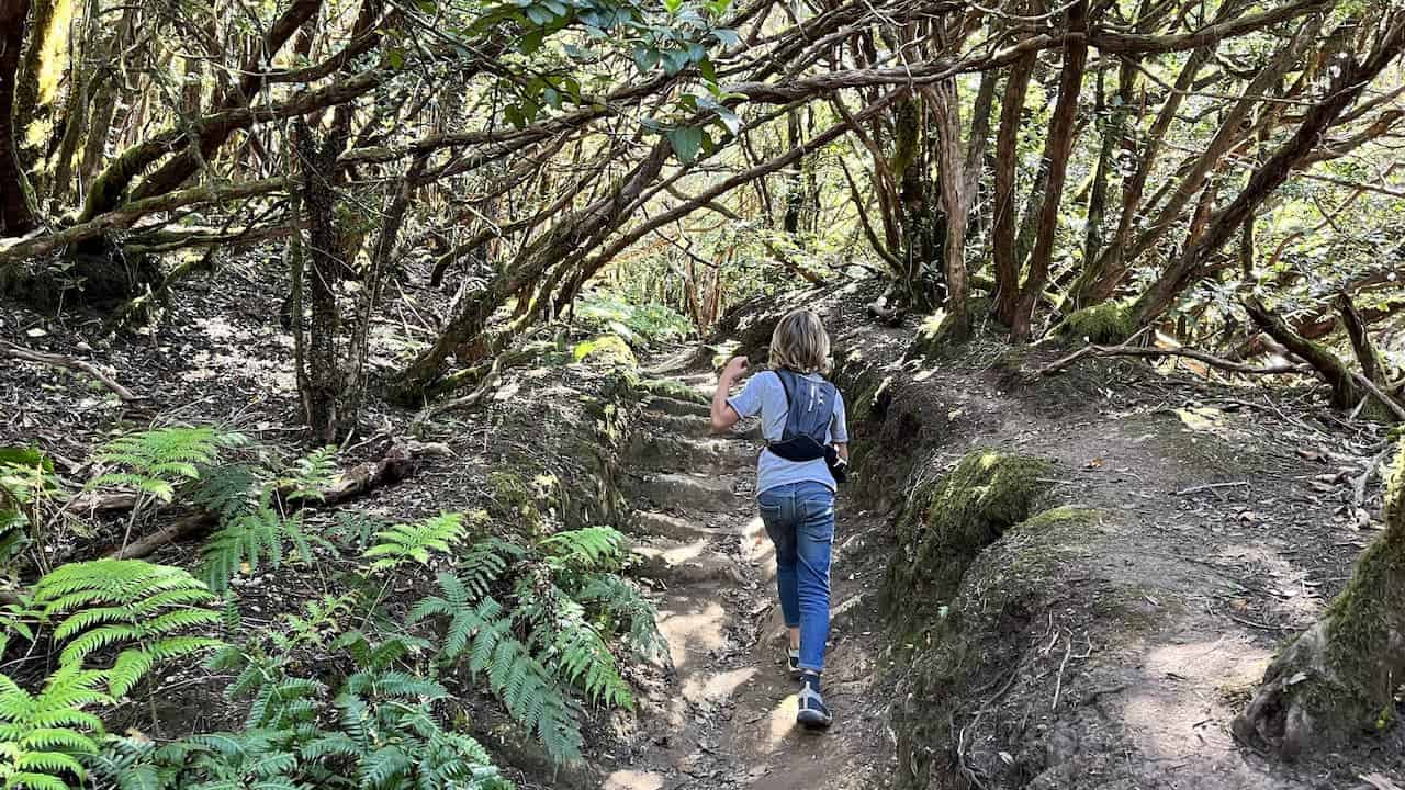
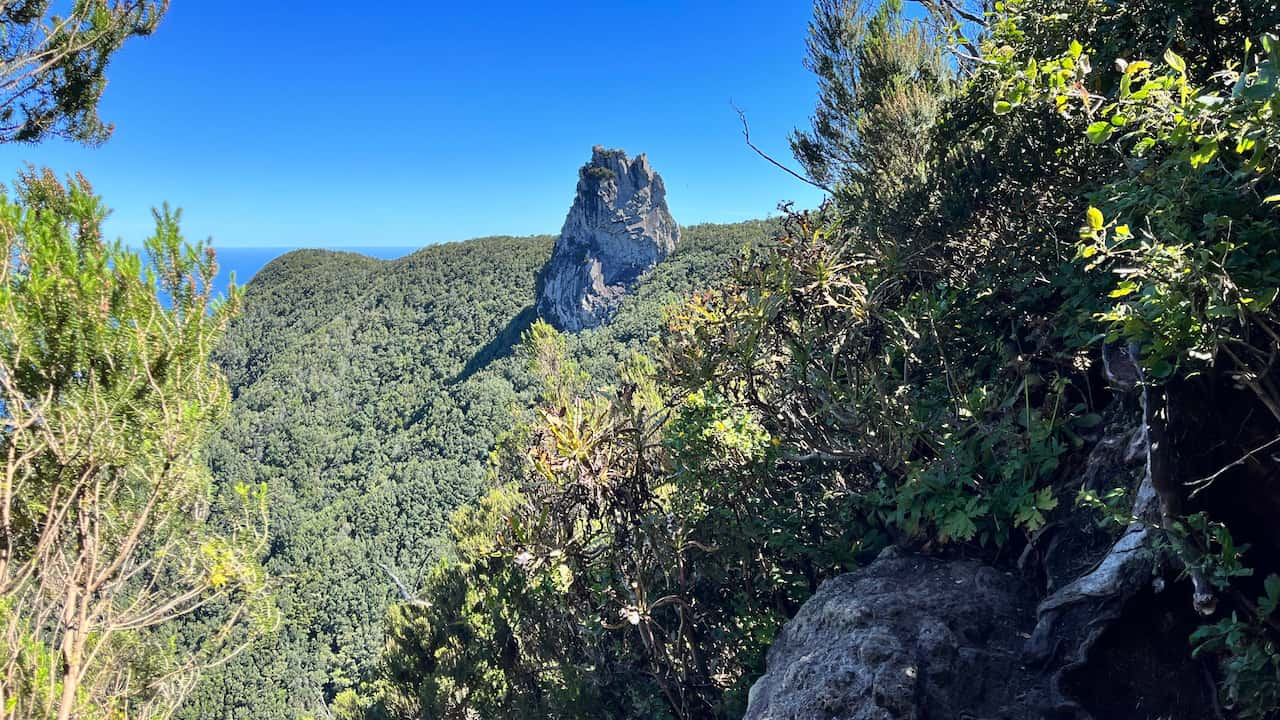
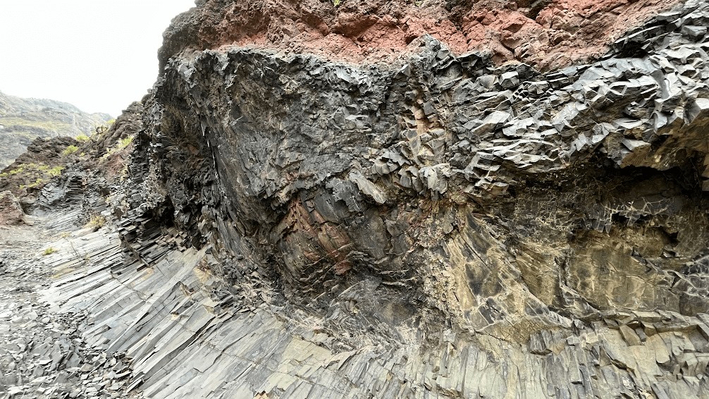
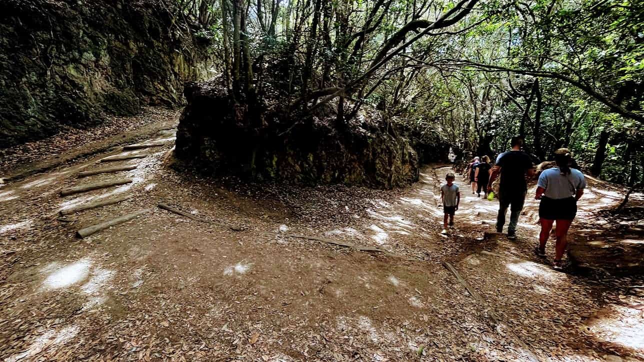
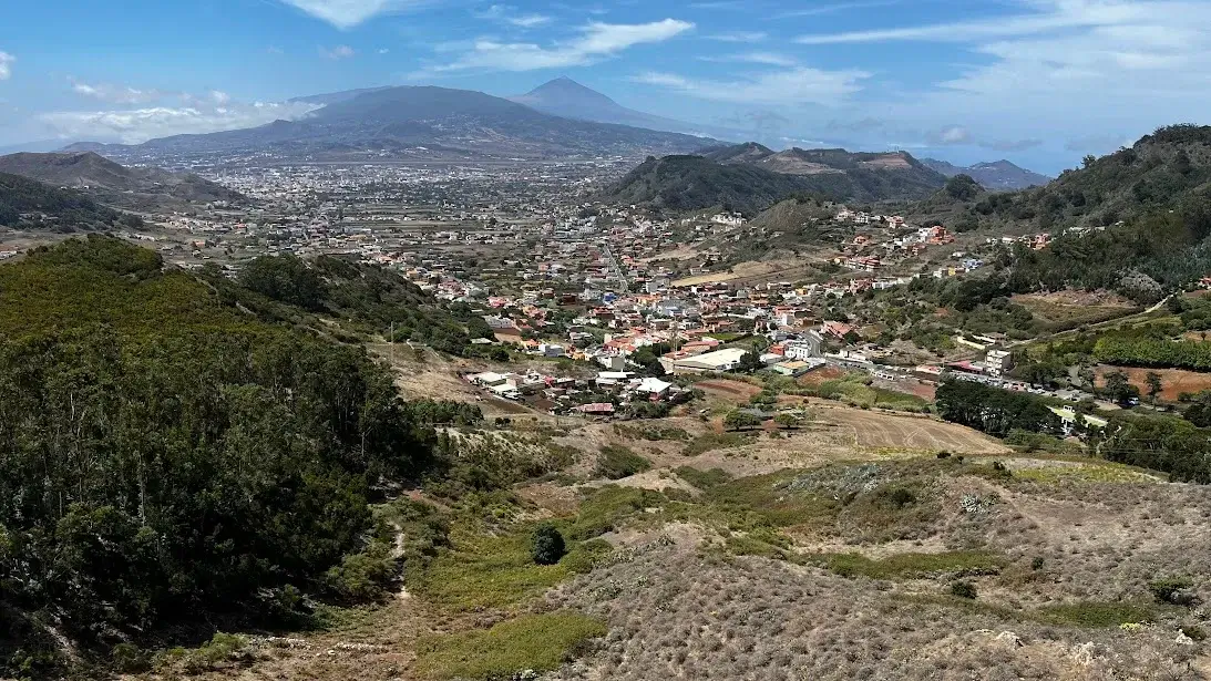
Below are short trail descriptions with an image that either gives you an impression of the trail or shows its highlight.
TF-1 | Las Mercedes – Cruz del Carmen
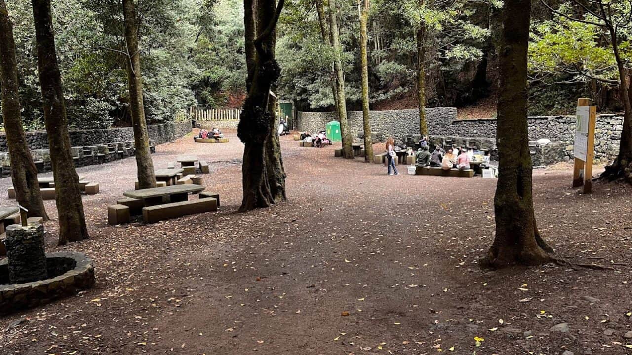
Historical trail between La Laguna and Anaga. Fastest way to get up to Cruz del Carmen and start of longer trails. Intersects with Path of the Senses. Has a public barbecue spot mid-way.
TF-1 trail video
TF-1 in-depth article

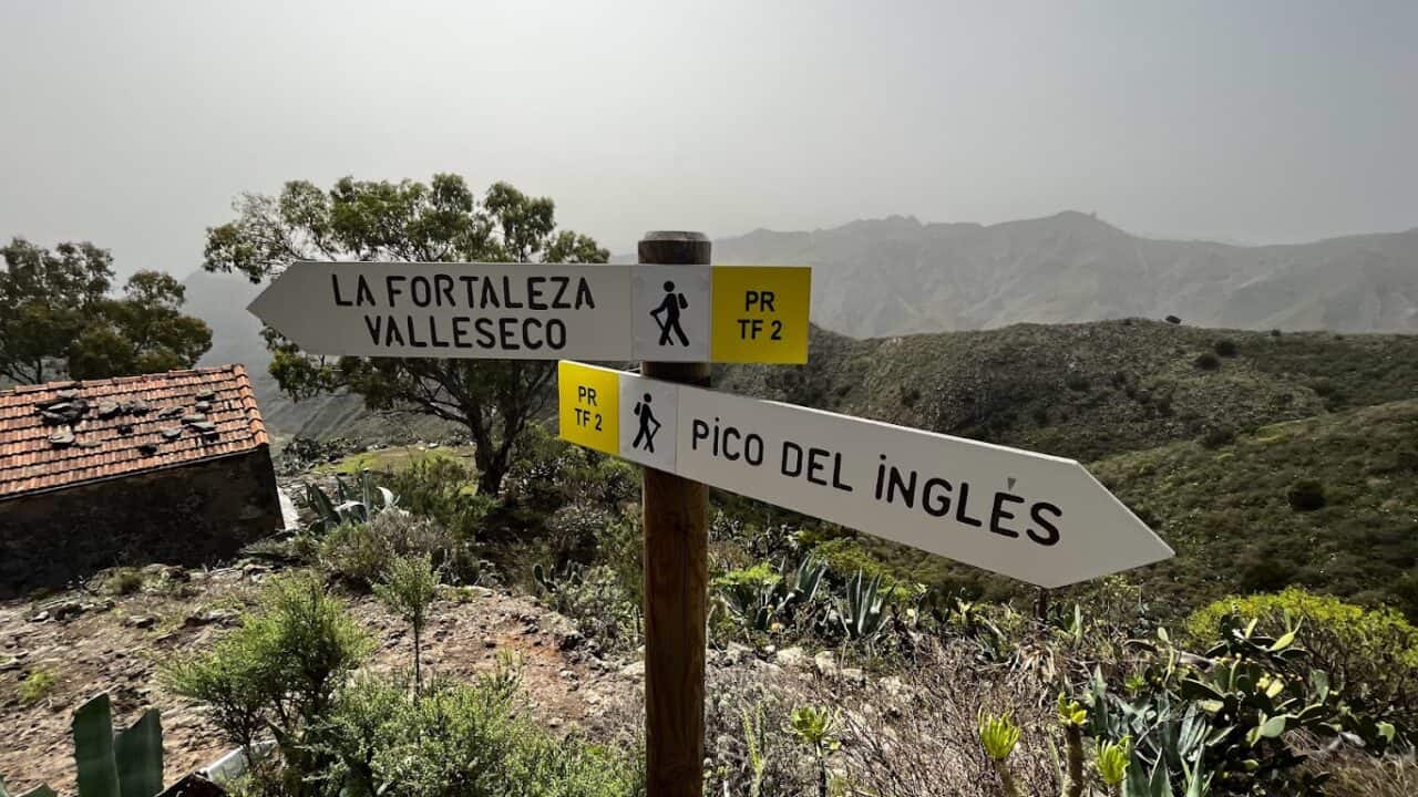
TF-2 | Taborno village – Cruz de Taborno – Camino Viejo Pico del Ingles – Pico del Ingles – La Fortaleza – Valle Seco
Scenic one-way trail from Taborno village to Valle Seco passing the very Instagram-able old Pico del Ingles road (Camino Viejo del Pico del Ingles). Great introduction to the variety of Anaga landscapes.
TF-2 trail video
TF-2 in-depth article
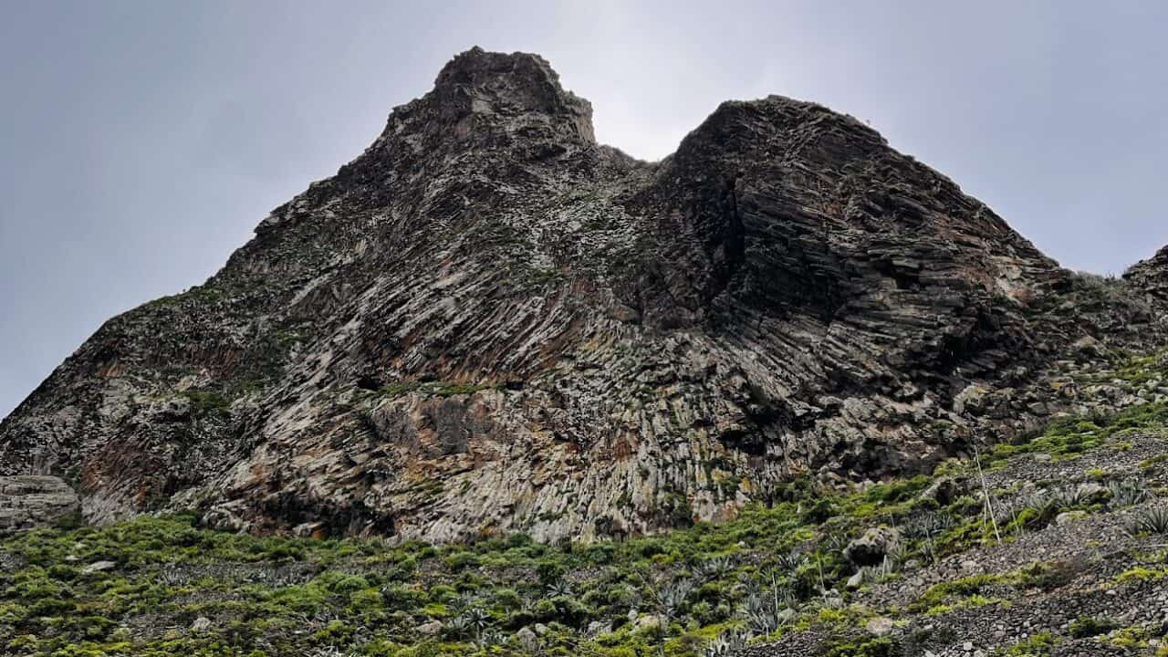
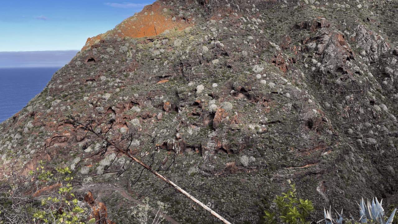
TF-3 | Valle Brosque – Cruz de Taganana (Casa Forestal)
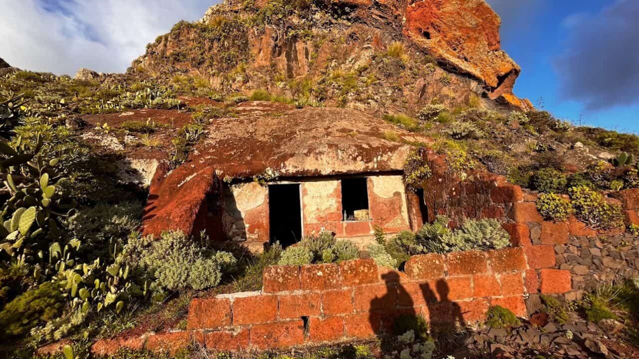
Circular trail between an Anaga village in Valle Brosque and the Forest Warden’s House (Casa Forestal). Steeper than most trails, but many great vistas and two easy-to-miss cave houses. Don’t miss the rock houses on the way.
TF-3 trail video
TF-4 | El Bailladero – Amogoje – Taganana village
Short, kid-friendly trail from El Bailadero to Almaciga via Taganana. Variant TF-4.1 from Almaciga – Amogoje will bring you back mid-way between Taganana and El Bailadero bus stop. This route is more scenic than TF-4 trail, but significantly steeper.
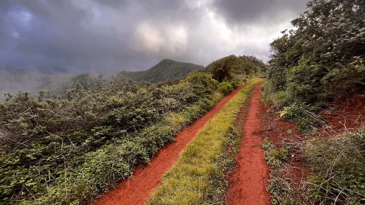
TF-5 | Chamorga village – La Cumbrilla – Lomo de las Bodegas – Igueste de san Andres town
Sibling of the TF-2 trail, but much deeper in the Anaga Rural Park with a trail head at the remote Chamorga village. TF-5 has one of the longest ridge walks among all Anaga trails.
Variant TF-5.1 from Igueste de San Andres to El Semaforo will take you from the San Andres township to the 18th century sea observation station.
TF-5 trail video
TF-5 in-depth article
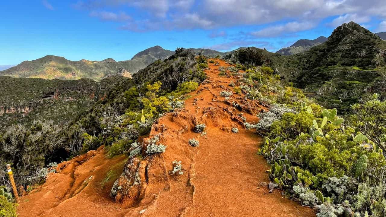
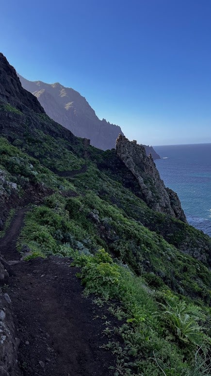
TF-6 | Chamorga village – Roque Bermejo – Faro de Anaga – Las Palmas village – El Draguillo village – Chamorga village
One of the two iconic (and, hence, most popular) Anaga hiking trails along with the TF-8. TF-6 is a circular trail. It starts in the remotest Anaga village – Chamorga. This trail hits many of the must-visit Tenerife spots and has a superb and long walk with ocean vistas. We recommend walking the extra 5-6 km to add TF-6.2 & TF-6.3 extensions to your hike through Benijo village for some additional views and the opportunity to take a selfie on a giant rock.
Variants:
- TF-6.1 | Chamorga village – Faro de Anaga
- TF-6.2 | El Draguillo village – Playa de Benijo – Playa de Almaciga
- TF-6.3 | Playa de Benijo – Cabezo de Tejo
TF-6 trail video
TF-6 in-depth article

Sendero de El Pijaral (Bosque Encantado) | Former TF-7
Eagle-eyed hikers will notice that the TF-7 trail is nowhere to be found in official communication. This is because the TF-7 trail is now renamed to just ‘Sendero de El Pijaral’ to draw less attention to it. One also needs a free permit to access it, that needs to be booked 2-3 weeks in advance.
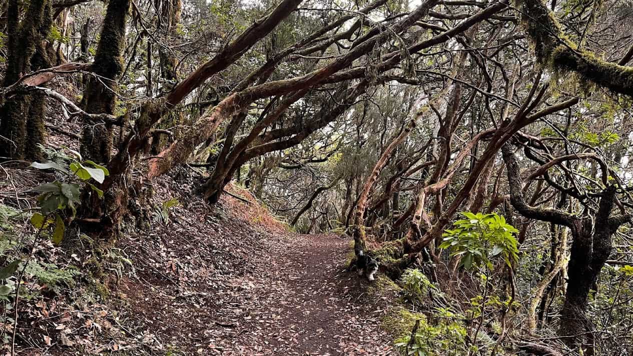
This trail is also known as the Enchanted Forest Trail. This trail is most suited for bird watchers, biology buffs and parents with smaller children, as for other hikers there are more interesting and longer trails in the neighbourhood. As to the “enchantendness” factor, there is little difference from high altitude sections of other trails such as segments of TF-2 around Pico del Ingles lookout and TF-8 around Casa Forestal or Forest Warden’s House.
TF-7 or ‘Sendero el Pijaral’ trail video
TF-7 in-depth article
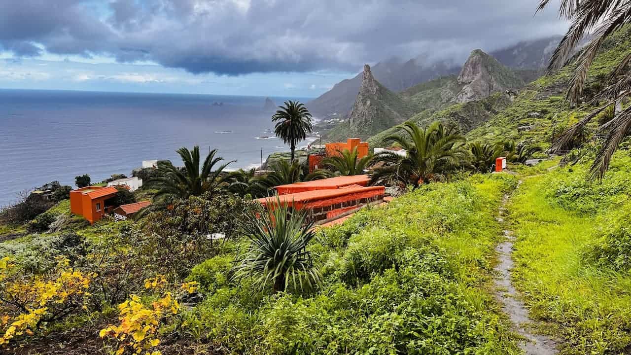
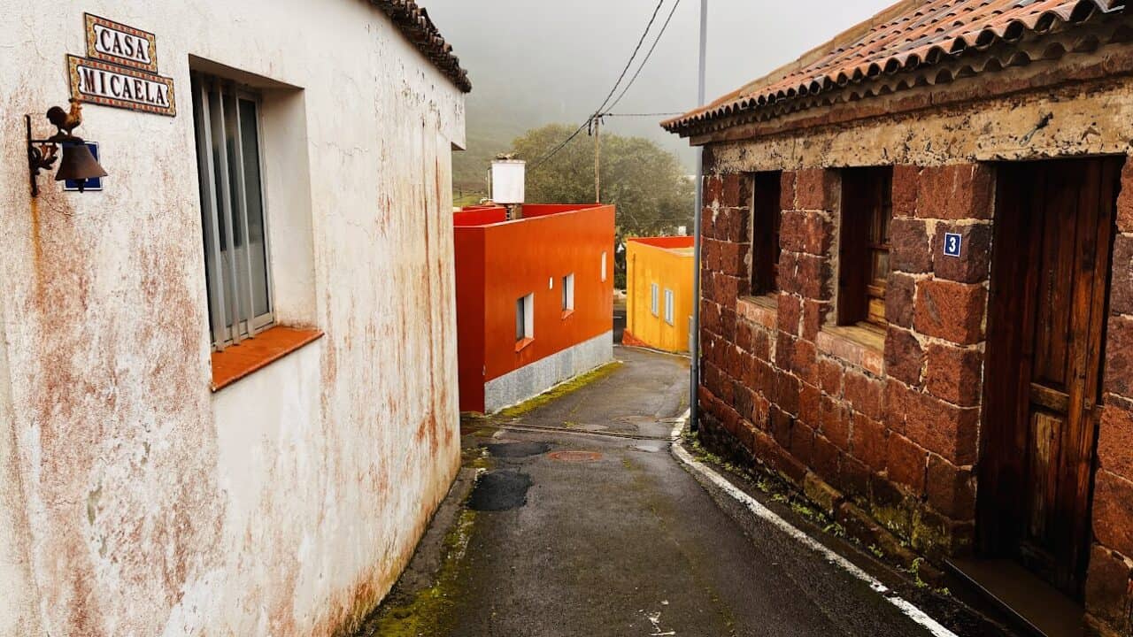
TF-8 | Afur village – Cruz de Taganana – Las Vueltas – Taganana village – Playa Tamadiste – Afur village
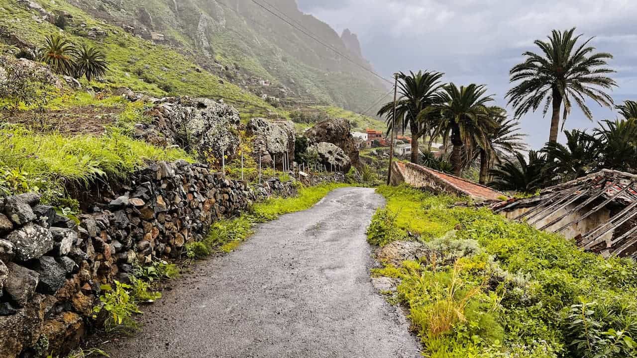
This circular trail allows you to see all the diversity of Anaga Rural Park from nature to ow locals lived in the past and live today in one hike. One of the two iconic Anaga trails along with the TF-6. The trail is physically hard due to the ascent to Casa Forestal (Forest Wardens House). Enjoy the El Chorro historical vine region with remains of old wine presses.
TF-8 in-depth article
TF-9 | Afur village – El Fronton – Taborno village – Las Carboneras village
This is a short and sweet one-way hike connecting three villages: Las Carboneras, Taborno, and Afur. Take this trail for the sociological experience and the great ridge walk between the Taborno and El Fronton villages.
TF-9 trail video
TF-10 | Cruz del Carmen – Chinamada village – Chinamada caves – Punta del Hidalgo town
This is a linear trail from Cruz del Carmen to Punta del Hidalgo. Most hikers get great pleasure from passing the Chinamada caves after a traditional lunch at the Restaurante la Cueva. Take the 600m to Mirador Aguaide lookout right after your meal for some superb vistas.
Variant: TF-10.1 | Las Carboneras village – Chinamada village, which is a short detour from the TF-10 trail. Worth taking if you want to see an Anaga village, but otherwise not worth it as the original trail is more scenic.
TF-10 trail video
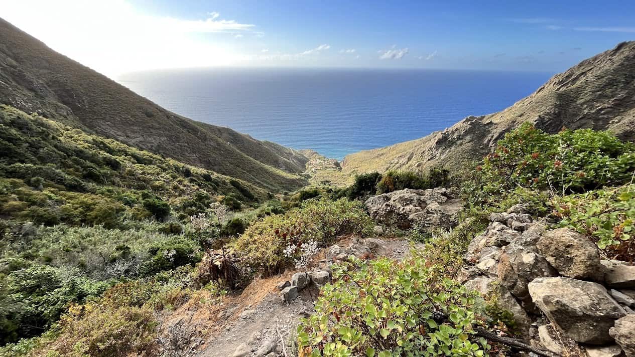
TF-11 | Cruz del Carmen – El Batan village – Bejia village – Punta del Hidalgo town
This trail is a lesser-known gem of a trail in Anaga. While phisically hard due to multiple ascents to ridges and descents to valleys, it will reward you with breath-taking landscapes. The one-way trail goes from Cruz del Carmen to Punta del Hidalgo and is roughly parallel to TF-10 and TF-1.
TF-11 trail video
TF-12 | Cruz del Carmen – Bajamar town
This is a trail for those who want to do a fast trail run as it’s mostly wide and level all the way to Punta del Hidalgo. For everyone else – go for TF-11 and TF-10, as TF-12 is rather underwhelming. Take this trail for the variants TF-12.1 and TF-12.2 to end up in Pedro Alvarez and Tegueste villages and near to public transport stops or cafes and restaurants.
Variants:
- TF-12.1 | El Moquinal – Tegueste
- TF-12.2 | La Quebrada – Pedro Alvarez village
TF-12 trail video
Trails by difficulty
This is a subjective ranking of the trails by difficulty. This means both the total vertical ascent against of the length of the trail, plus the number of ascents and descents, as well as a bit of subjective experience.
N.B. When evaluating trail difficulty, for all one-way trails I’ve written these with the assumption that you will start the trail at the highest end in Anaga Rural Park and then descend towards the ocean. If you are a seasoned hiker and plan to go the other way – from ocean to the Anaga mountains, most trails would fall in the “hard” category as the difference between the ocean and the Anaga peaks is between 800 and 1000 vertical meters.
Importantly, the trails below are also ranked as some of the scenic to take. This is because, due to the altitude differences, you’ll get to see several climatic zones and geological phenomena.
TF-11 | Cruz del Carmen – El Batan village – Bejia village – Punta del Hidalgo town
I consider this trail to be among the hardest in Anaga because it crosses at least three mountain ridges, descending after each into a valley after which you have to ascend again to the next ridge. Also – there is a mistake in some official information sources which list total vertical ascent as 40 meters. My Strava app calculated vertical ascent at 394 meters, but I guess that this figure is off, and I didn’t have a watch with an altimeter at the time. It is definitively in the same category as the three trails below, which come in at 650-1000 vertical meters.
TF-8 | Afur village – Cruz de Taganana – Las Vueltas – Taganana village – Playa Tamadiste – Afur
The trail is very pleasant and would be even considered easy/intermediate if not for the very steep ascent from Afur village to Cruz de Taganana (or up from Taganana village if you go in the opposite direction). The total trail vertical ascent is 1022 meters and I would guess that 700 of these meters are in this one ascent, due to which I suggest that you tackle it first. Then you will be able to enjoy the rest of the trail without a major struggle at the very end.
TF-3 | Cruz de Taganana – Valle Brosque
In this circular and relatively short trail you will have to descend and ascend the same amount of vertical meters/yards – 650 in total. The ascent is again concentrated in a short distance between the village and Anaga mountain tops. I suggest you start this trail not from the Cruz de Taganana in Anaga mountains, but from Valle Brosque. This way you’ll have the ascent at the start of the hike, followed by a nice descent on the returning route.
TF-6 | Chamorga village – Roque Bermejo – Faro de Anaga – Las Palmas village – El Draguillo village – Chamorga villa
Like the TF8 trail, this trail would also be easy/intermediate, if not for the challenging ascent from El Draguillo village to the ridge before Chamorga village. The ascent to Faro de Anaga will also be a challenge to some hikers, particularly, if you decide extend the hike a bit to visit Playa de Roque Bermejo.
Most (and least) picturesque trails
Most picuresque Anaga trails in priority order
- TF-11 | Cruz del Carmen – El Batan village – Bejia village – Punta del Hidalgo
- TF-6 | Chamorga village – Roque Bermejo – Faro de Anaga – Las Palmas village – El Draguillo village – Chamorga village
- TF-8 | Afur village – Cruz de Taganana – Las Vueltas – Taganana village – Playa Tamadiste – Afur village
Least picturesque Anaga trails from worst to least worst
- TF-12 | Cruz del Carmen – Bajamar
- TF-1 | Las Mercedes – Cruz del Carmen
Circular trails
- TF-6 | Chamorga village – Roque Bermejo – Faro de Anaga – Las Palmas village – El Draguillo village – Chamorga village
- TF-8 | Afur village – Cruz de Taganana – Las Vueltas – Taganana village – Playa Tamadiste – Afur vilage
- TF-3 | Valle Brosque – Cruz de Taganana – Valle Brosque
- TF-10 and TF-11 trails in one loop Punta del Hidalgo – Cruz del Camen – Punta del Hidalgo. I suggest to start with the TF-10 from Punta del Hidalgo to have the ascent in the first half of the hike, and descend the TF-11 when you are more tired. This will
Trails suitable for kids
The following trails are suitable for kids and hikers who are not willing or able to undergo strenuous exercise.
Anaga is generally not well suited for toddlers, unless you are carrying them in those special toddler bags/harnesses. However, kids from ages 6 and up can consider the hikes below. My youngest was 8-9 years old when we hiked on the island, and he would have been able to accompany me on all hikes except TF-10 and TF-11.
Section between Afur village and Playa Tamadiste on the TF-8 trail
While the whole trail is too long and challenging for kids, with some sketchy bits, parents and kids will absolutely enjoy the section between Afur village and Playa Tamadiste, returning the same way. The scenery is superb in this section, probably best on the whole trail. Kids will be rewarded with a small beach and a fresh water natural pond at the end (the pond is suitable for swimming, while the sea is not). After the hike we suggest you visit the small lovely tavern with an 80-year-old very very kind bartender in Afur village, where kids can get a fizzy drink, and there’s local vino de casa for the non-driving parent.
Sendero de los Sentidos at Cruz del Carmen
If if you want to let your kids experience the Anaga Rural Park without much physical effort and worry very little about their safety, also consider the very short 1-2.5 km circular trail that starts and ends in the parking lot of Cruz del Carmen.
The trail has 3 variants to suit the needs of diverse drivers. The shortest trail is accessible to wheelchairs and strollers. The last 400 meters of this trail overlap with the TF-1 trail coming up from the Las Mercedes village.
TF-1 | Las Mercedes – Cruz del Carmen
A short 2.5 km route from the Las Mercedes town to Cruz del Carmen (or down the reverse way). Quite many hikers take this route in order to move or to return from other Anaga trails, particularly, Sendero del los Sentidos, TF-10, TF-11 and TF-12.
While not particularly interesting, it will be a nice introduction to Anaga for the smaller hikers, has a rest area for barbecue mid-way, and overlaps with Sendero de los Sentidos in the trail’s last kilometer before Cruz del Carmen.
TF-3 | Cruz de Taganana – Valle Brosque
This trail will be suited for kids and teenagers who are a bit more experienced hikers or are comfortable with physical exercise. While the trail is physically challenging on the ascent, it has very few spots where parents would really have to watch out for their kids, which is not the case for many other trails that have quite a number of sketchy or outright dangerous sections, at least from a parent’s perspective.
Trail review videos
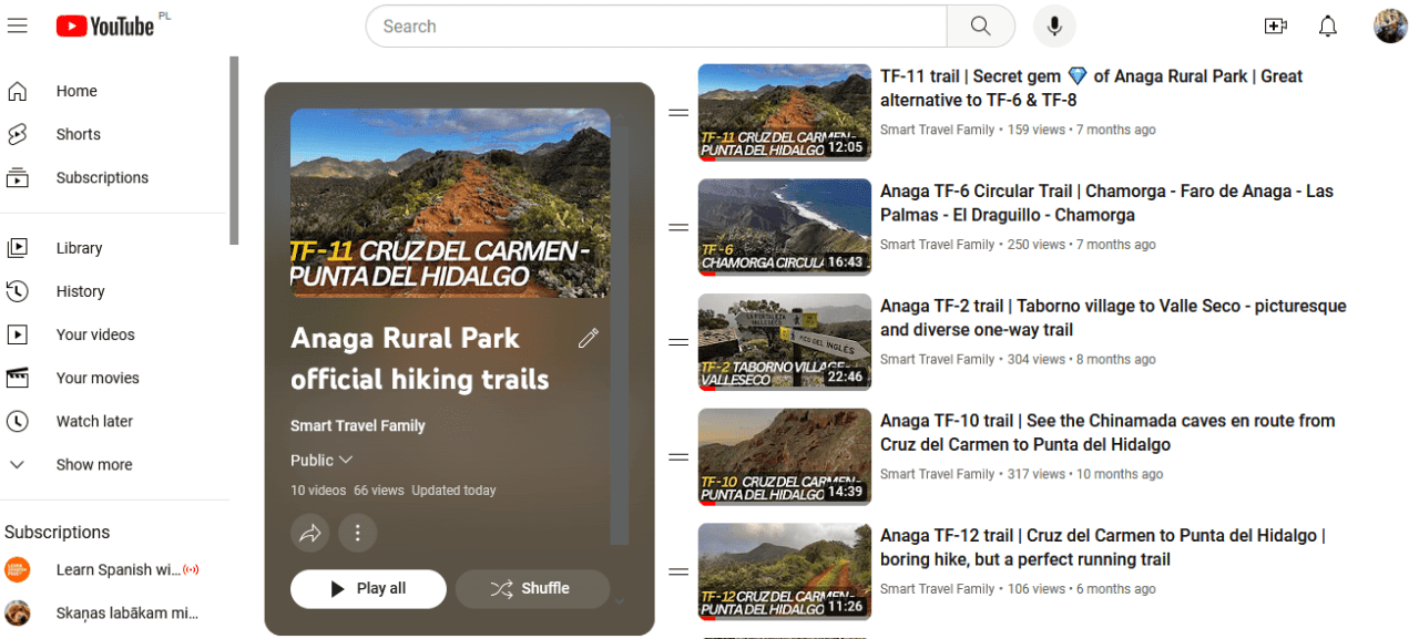
In case you like video better, you can also check out our YouTube channel Smart Travel Family. I have already posted videos about the following trails there:
Only TF-4 and TF-8 are missing videos at the moment.
This article provides overview of the official trails based on various characteristics like best overall, length, “circularity“, difficulty, but also the scenery, suitability for kids, etc. Each trail description links to an in-depth article about the particular trail (if I will have already finished it) so that you would very clearly know what to expect and whether it’s worth prioritizing this over other hikes in Anaga.
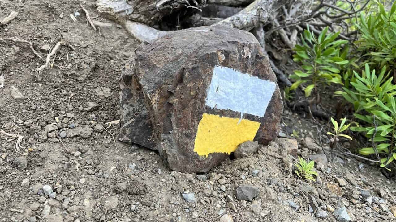
I suggest that you always use a navigation app (Maps.me, Wikiloc, AllTrails or other) when hiking in Anaga. While the trails are superbly marked, each trail has 1-3 forks where for some reason the trail markers are not clearly visible and it’s easy to make a shorter or longer detour.
My personal approach is to download the full set of GPS pointers for a trail from Wikiloc (an annual subscription of around 10 EUR is necessary), and then share/upload them to Maps.me. I personally do not use Wikiloc for navigation as it drains the phone battery relatively faster than navigation by Maps.me.
Public transport availability
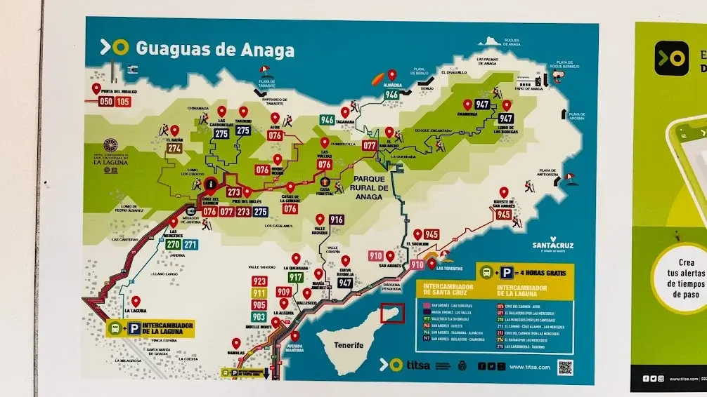
If you want to explore the Anaga Rural Park by bus, you will have to be very organized and hope that the buses run on time and are not cancelled. Having patience is also recommended as some locations in Anaga can take as much as 2 hours to reach by ‘gua gua’ as the busses are called in Tenerife if you depart from La Laguna or Santa Cruz.
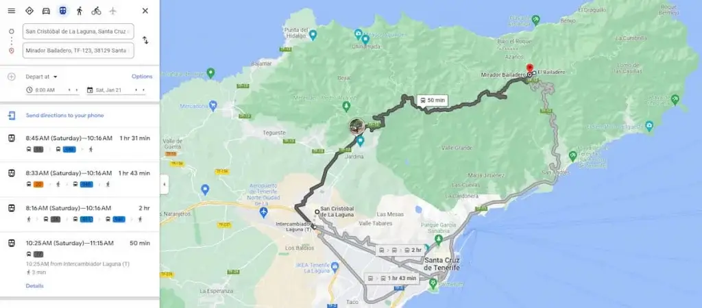
To give an example, if you want to head on a Saturday morning towards the furthest parts of the park in the morning, like the Taganana village (TF-4 trail) or Chamorga and Anaga Lighthouse (TF-6 trail), there is a direct and faster bus at 10:15 or routes with 2 or three connections that will take 1,5 hours and more to reach your destination. There might be only one or two other buses in the afternoon.
For the above reason, it is usually advised to rent a car to visit the Anaga Rural Park and start with circular routes so that you depart and return from/to your vehicle. However, buses or a separate driver are the only solutions if you plan to take the one-way trails like TF-5, TF-10, TF-11, or TF-12.
If you plan to take the bus when visiting Anaga, it is another reason why to start your hikes from the centre of the park and go towards the ocean – the Titsa public transport network serves towns on the ocean coast much more frequently compared to the historic Anaga villages.
Where to find fellow hikers and guides

“Tenerife Hiking Community” is one of the most useful Facebook groups I’ve encountered. It is regularly monitored by hikers residing on the island, and short-term visitors. If you show the courtesy of first using the “Search” function and still cannot find the necessary information, at least a few group members will pitch in at short notice and provide super useful tips.
The group is also great if you are looking for hiking buddies or professional guides. You can either join one of the announced hikes, or (what is most appreciated by the group) announce your own hike so others can join.
Leave a Reply