Ventanas de Guimar – Most Unique Hike in Tenerife
Ventanas de Guimar Business Card
Ventanas de Guimar is probably the most unique trail in the Canary Islands, blending the best of nature with human ingenuity. You’ll get to hike almost 3 miles / 5 km in man-made tunnels carved out in rock of mountains.
It is sometimes also known as the “1000 Windows of Guimar” in English, although there seem to be slightly less than a hundred rock openings or ‘ventanas’ in Spanish on the whole trail.
You’ll also get to see the best side of Tenerife’s nature in an area high up between Guimar and the Teide National Park. Hiking this trail is not for the faint of heart. However, lots of impressive pictures for your Instagram account are guaranteed.
Ventanas de Guimar trail ranking among other Tenerife hikes
We would rank Ventanas de Guimar among the top 4 ‘bucket list’ hiking trails in Tenerife along with:
- Ascent to the top of the Teide Volcano past the Pico Viejo volcano crater, in the Teide National Park
- TF-8 circular trail from Afur village, in the Anaga Rural Park
- Arc of Guam or El Agujero trail on top of Los Gigantes cliffs
If you just want inspiration while planning your next trip to Tenerife, watch the video above or jump to the “Visual guide” section below. If you have already committed to doing this trail, the practical details are further below.
Visual trail guide

While the actual Ventanas de Guimar trail starts a bit further, you can park your car around the ‘Antena de comunicaciones’ location – a cluster of radio masts with a technical buidling underneath. The image above shows you the directions and distance to get to the parking location from Guimar city centre. If you come by foot from Guimar, bear in mind that there are no real shortcuts to decrease the distance to this location, as there is a substantial ravine between the city and the trail.
Paragliding launch point

Tenerife is a bit of a paragliding mecca. There are several locations from which paragliders take off on the island, and one of these on the way to the Ventanas de Guimar trailhead. Even if you arrive by car, it’s worth stopping over here briefly and take a look at this interesting construction. And – try to imagine whether you’d be able to jump off from this location to fly over the Guimar town towards the ocean.
Car parking location at Antena de comunicaciones

This is what the radio antennas near the trail head look like. Car parking is a bit higher, past the antennas, where the road is without an incline. When parking, always use the hand brake in Tenerife, as there’s at least a small incline in many places, and your car might roll away.
Official starting point of the trail

This is the official starting point of the trail. Yes, it’s a warning sign that the trail is closed, there are sudden drops, risk of landslides, etc. Please be aware of this when setting out on the hike. Emergency services access is particularly difficult on this trail, and they might take a long time to arrive. I’m also not certain if a travel accident insurance would work on this trail, as it’s officially closed.
By the way, in case you can’t make up your mind about which way to start to hike, you definitively want to do the tunnels section first. This means that you have to go on your right when setting out. If you reach the signs above, you are on the right track.
With these warnings out of the way, let’s get crackin’ with this unique trail’s overview.

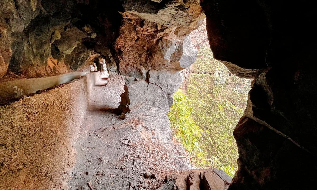
This what the trails looks like in the beginning and in quite many sections throughout the end of the tunnels. You sometimes can walk on top of the plates covering the water canal, but most often you’d walk on the side.
The iconic excavator

Very soon in the trail you arrive at one of the most iconic places of the trail – the tractor that has fallen down from the ridge, and is secured in place with metal ropes. It’s an epic Instagram spot or simply a great place for a photo souvenir.
Entrance to the first tunnel
Entrance to the first tunnel is right after the fallen excavator. However, you can bypass the first tunnel and walk on the mountainside path. As this trail is all about the tunnels, I’d choose the first and all the other six tunnels to get the full experience.

This is what the tunnels generally look like. In this one you can see a light at the end of the tunnel, or this might be just an opening where the tunnel bends. You really should get a headlight or a torch for this hike, as phone flashlights are often too weak for proper illumination.
How low are the tunnel ceilings?

Some hikers recommend or even wear helmets. In my opinion, it’s an overkill, even for taller persons. I’m 6’4″ / 197cm, and I only slightly bruised my head on some of the tunnel ceilings when I didn’t watch out ahead.

Me posing at one of the ventanas.
Watch out for sloping floors near the windows

There are many rock openings in the tunnel, but not all are equally safe. In this one – watch out that you don’t get too close to the drop, as the opening slops down and you might slip more easily.

Some tunnels still have remains of tracks and other construction items in them. It was cool to see this, although, I’m not sure if they are from the time the tunnel was built. Sorry for the poor image quality, as this is a frame from a video.

Some really cool vegetation on the tunnel’s ceiling.
There is a very nice lunch spot between tunnels 3 and 4, if I remember correctly. It has a very nice panorama of Guimar surroundings and a place to sit down.

On sunny days and weekends you can expect to meet more people on the trail. I enjoyed some of the brief conversations very much. It’s also a chance to ask how far till the end of the tunnels section, and anything else you might want to clarify.
Trail outside the tunnels

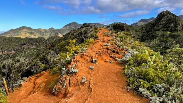
When you are not in the tunnels, this is what the trails looks like on average. Vegetation on one or both sides, and almost always a very steep drop on your right.
Tunnel 7 (the last tunnel) has the best views
The most iconic tunnel views are towards the end of the tunnels section of the trail, the best one being the last one – tunnel 7. It’s very long, some 400 yards / meters, and doing a curve in the cliff, so you can see the tunnel’s beginning or end as you move through it.

This is one of the best spots of the whole trail, and my photographer’s skills clearly do not do justice to it. What you see here are the ‘ventanas’ or rock openings on both sides of the view.

Another try to show the cool view.
What to expect after the tunnel section
After you’ll finish the tunnels section, you’ll have to do a slight 1,3 miles / 2 km ascent in a valley/ravine to an old abandoned mine.

As you get closer to the mine, you’ll see a man-made pile of mined rock, with an abandoned card on top of it. Again – it’s a very scenic spot.

This is what the abandoned mine entrance looks like. It appears to be still maintained as they are pumping water out of it. I have no idea what was mined here and until when. If you know, please drop a comment.

This is a still from my trail video. I’m standing near the closed mine at around mile 5 / kilometer 7 in the trail after the brief barranco ascent from the tunnels. Here I’m showing where you’ll need to ascend to return to the trailhead. It’s a serious climb – probably some 600 – 700 vertical yards / meters – in a short distance, so pace yourselves.

While the ascent is hard, the higher you get, the more mother nature rewards you with more spectacular views of the Guimar city and, as you get higher, also outskirts of the Teide National Park.

Return from the trail with Gran Canaria island in the distance. You can also see the paragliding lift off spot center rigth of the image.
How to get to the trail head

The best way to get to the trail is with a car. If you can’t afford to rent a car alone, offer to split costs with other hikers, or contribute to somebody else’s rental and gas costs.

Another way to more easily get to the trail is by joining the “Tenerife Hiking Community” Facebook group. People from the community regularly organize hikes to many trails, including this one. You can either join an announced hike, or announce your Guimar hike yourself and invite other to join. You’d indicate that you need a car and would chip in to cover petrol costs.

Taking the bus to the trailhead is a theoretical possibility, but highly impractical. It does not matter if you are coming from the South or the North, you are anyway looking at a complicated 2+ hour journey with 2-3 bus changes, plus, the ascent to ‘Antenas de comunicaciones’. The nearest bus stop to the trail is still 4 miles / 6 km of a rather steep uphil walk. And you’d have to get down back to civilization after finishing the trail.
The trail is moderately popular, so you could try to hitchhike as you get closer to its starting location, but there’s no guarantee someone will pick you up.
If you decide to go by bus anyway, there is at least one good news! Google Maps works well on the island and is superbly integrated with the public transport authority TITSA routes and schedules. Just get Google Maps public transport directions from your location to “Las Ventanas de Güimar“, and you’ll get the optimal route and bus schedules.
Trail segments
- SEGMENT 1: Out of all the 9 mile / 15km trail, the “windows” or tunnels section is in the first 3 miles / 5 kilometers.
- SEGMENT 2: Miles 4-5 / 6-7 km are done in a canyon that ascends to an old and closed mine.
- SEGMENT 3: Mile 6 / 8-9 km is the ascent on top of the mountain ridge (be aware that it’s a non-stop hard ascent of around 3300 feet / 1000 vertical meters).
- SEGMENT 4: Miles 7-9 / 10-15 km are the descent back to start of the trail at the radio towers.
Trail difficulty varies depending on which segments you’ll choose to hike. Ventanas de Guimar can also be visited in an “easy hiking” mode:
- Easy if you just go in the tunnel system and return to start of trail. Total vertical elevation will be only around 300-400 feet / 100-150 meters. To get the full experience of this trail, you only have to go to tunnel 4 out of 7 and then turn back.
- Moderate if you take the one-way route from the radio towers through the tunnel system to the Guimar city. You will encounter some vertical ascents, but much less than in the full circular route. Suggested route on Wikiloc.
- Hard if you’ll do the full circular route with ascent to the mountain ridge and descent back to the radio towers.
How dangerous is the Ventanas de Guimar trail?
This trail has a bit of a reputation for being dangerous and extreme. As beauty lies in the eye of the beholder, judge for yourself. I definitely would not recommend doing this trail with kids. However, it should be very hike-able for most adults, unless one has a) fear of closed spaces, b) fear of heights (vertigo). If you are in one of these categories, choose many of the other great trails on the island.
The first video shows the most sketchy place on the trail.
This video shows you how steep is the drop next to some sections of the trail.
Here’s a more cautious advice, again from the great Tenerife Hiking Community on Facebook. Laura is one of the managers of the group, with lots of Tenerife hikes under her belt, so it’s probably a more balanced evaluation of the this trail for the average hiker.

History
The main attraction of the Ventanas de Guimar trail is its tunnel system. It’s a series of interconnected passages carved out in rock, located next to the town of Guimar.
The tunnels were dug at the start of the 20th century to channel water for agricultural needs and to support other needs of the local population.
The tunnels were built using traditional techniques, with workers digging through the volcanic rock using hand tools. The openings or “windows” in the tunnels were created to let in light to aid the workers, and allow for easy discarding of rock.
Sadly, the tunnels were never used for the intended purpose.
Safety
Headlight
The most important thing to take along is a flashlight or a headlamp. You can, of course, use your mobile phone flashlight, but that won’t be as comfortable in the confined tunnel space.
Helmet – yes or no?
Some blogs advise to wear a helmet. We personally think that this advice is exagerated. The only danger is from knocking your head on the tunnel ceiling that has sharp protruding rocks, but using a flashlight should allow you to crouch at the right spots.
Power bank
We would advise to take along a power bank, as you are bound to take many pictures with your mobile phone, as well as use a navigation app with GPS on. If you will also use your phone flashlight, this will ensure you will not run out of battery mid-trail.
Sturdy shoes
Do not wear flip-flops, but mountaineering boots are also not necessary. You can absolutely do the trail with your regular sneakers. The trail is generally event, but you’ll want to use shoes with a sole that can’t be punctured by sharp rocks in the tunnels, nor ones that slips off on the ascents.
Watch out for occasional mouflon hunting

If you will do the whole circular trail instead of returning to the trailhead after reaching tunnel 7, you have to be aware that sometimes areas are closed for mouflon shooting. If you see this sign following your ascent from the abandoned mine, you’d either have to return through tunnels, or at least announce yourself to a hunter so that you can safely pass through the forests on the ridge above the trail back to your car.
If mouflon shooting is planned around the trail, this is usually announced in the Tenerife Hiking Community group, so I highly recommend you join it a few weeks before your arrival in the island and follow closely on the days around your hikes.
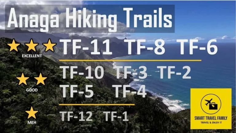
Ventanas de Guimar compared to Anaga Rural Park trails

In the picture above there is a ranking of all Anaga Rural Park trails we did and ranked from most interesting to most boring. Ventanas de Guimar trail is definitively on par with any of the best Anaga trails, as well as those in the Teide National Park.
Frequently asked questions
Can I do the trail with children and teenagers?
With teenagers – maybe. If they are responsible and have some experience of hiking and mountains. This trail is definitively not suited for children.
How many windows does the Ventanas de Guimar trail have?
Hikers who’ve tried to count the windows, seem to agree that there are between 92 and 98 windows in the Ventanas de Guimar trail.
It’s a tough question to answer precisely because in tunnels 7 and 8 it’s sometimes hard to decide what counts as a window and what is already open space. If you did your own count, please share in the comments below.
Can I hike the trail without a guide?
Yes, a guide is not necessary to hike this trail. However, it is highly recommended to use a navigation app like AllTrails or Komoot and download the trail GPX file in advance.
Some hikers report difficulty finding the trailhead and the right way after the tunnels finish.
Can you do the trail in bad weather?
Doing this trail in bad weather is not advised, even for experienced hikers.
The main threat comes from the fact that rocks frequently loosen up in wind and rain and can seriously injure hikers. There are also plenty of uneven surfaces with steep mountain facades next to them, and a slip can be fatal.
The trail is officially closed. Can I still hike it?
While the trail is officially closed, there is only a sign prohibiting hiking it. There are no reports of park rangers controlling access to the trail.
Important – if you will have an accident while doing the Ventanas de Guimar trail, most likely your insurance will not work and you’ll have to pay out of pocket.
Are there any entrance fees or permits to hike this trail?
This hike is free to hike and no permits are required.
There are only 5 hikes that require a permit in Tenerife.
Questions or comments?
If you have a question, the best solution would be to post a comment below. This way we not only get to reply to you, but also let other readers benefit from the information. But, of course, you are also welcome to contact us by email.
