TF-11 Trail Guide: The Hidden Gem of Anaga Rural Park
WHY TRUST THIS INFORMATION? I hiked A LOT, including a quest to hike all Anaga trails during my family’s year in Tenerife from 2022 to 2023. This and other articles are based on my personal experience, while hiking alone and with our kids.
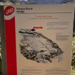
TF-11 ‘Business Card’
TF-11 is a less popular trail compared to TF-8 and TF-6. However, TF-11 is my favorite of all Anaga trails and I’d call it the hidden gem of the rural park.
While the trail is phisically demanding due to multiple ascents to ridges and descents to valleys even in the direction towards the ocean, it will reward you with frequent breathtaking views. This trail has the best views of the Chinamada caves that are even superior to ones of the TF-10 trail.
Our TF-11 hike video
If you have any questions about this hike, please leave them below or under the video on YouTube, and I’ll try to respond ASAP.
You are welcome to check out videos of all other official Anaga hiking trails from TF-1 to TF-12 on our YouTube channel.
TF-11 Ranking Among Other Anaga Hiking Trails
If you do not want to do further research, below is an overview of all Anaga hiking trails ranked from best to not so impressive.
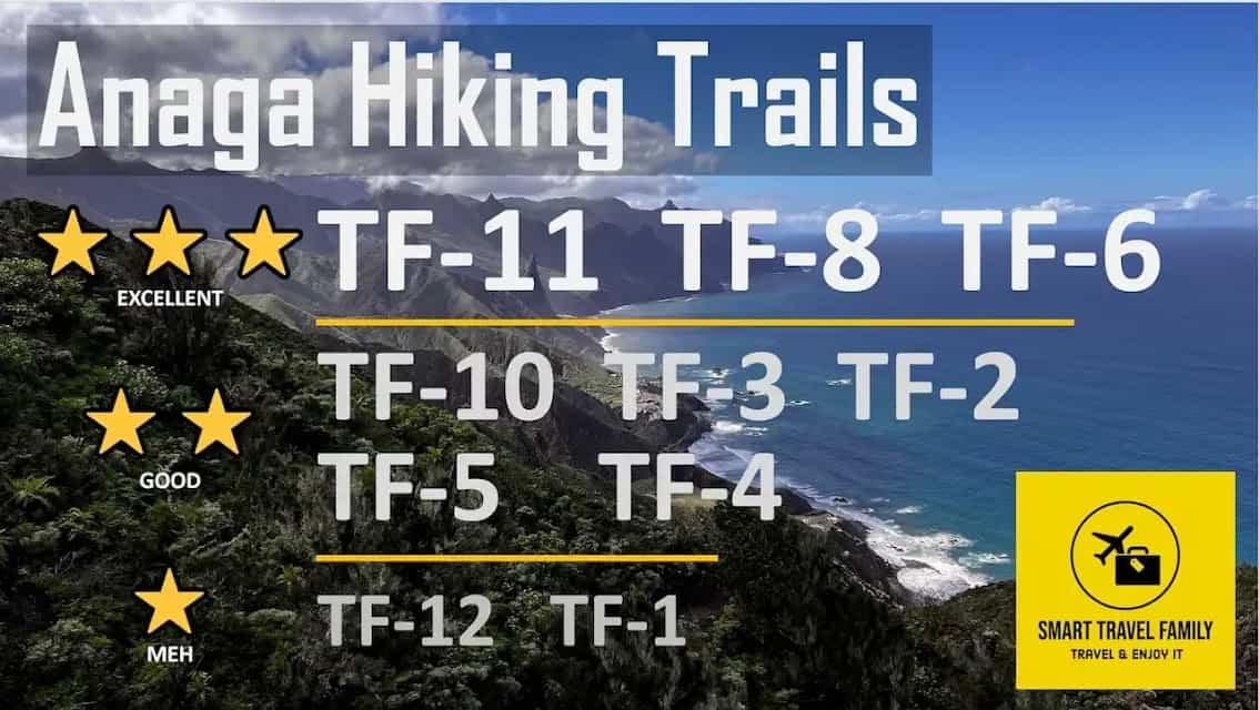
This rating should be useful for the average hiker, traveling without children and not having any health issues or low physical form. If you are looking for a list of trails arranged by ease, child-friendliness, and other criteria, read this article about all Anaga Rural Park hiking trails.
TF-11 is a strong contender for the top trail if you plan to do a hike in the Anaga Rural Park. It is on par with the TF-8 and TF-6 trails. If you have the time to do two trails in Anaga, do both the TF-11 and TF-8. You might not choose to do the TF-11 if you need to return to your rental car as it’s a ‘linear’ trail.
If you are a very strong hiker, I suggest ascending from Punta del Hidalgo on the TF-10 trail that goes directly past the Chinamada caves, and then return from Cruz del Carmen and view the Chinamada caves from a distance.
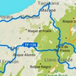
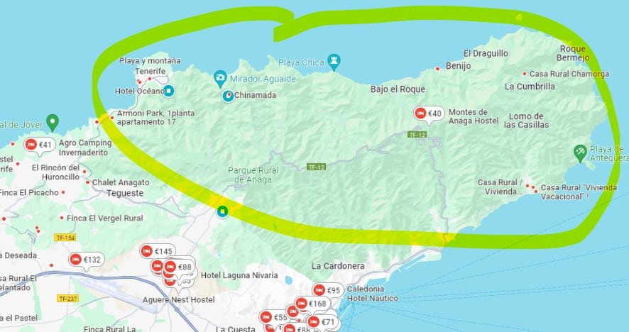
Map of TF-11 trail
The TF-11 trail is marked in red in the above map. The TF-11 trail overlaps with the TF-12 trail for the first kilometers / 1000 yards.
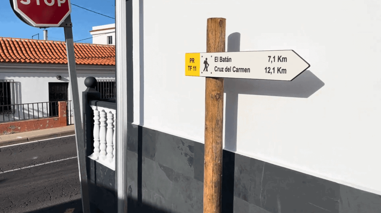
The main waypoints of the trail are as follows:
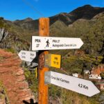
- Cruz del Carmen (trailhead)
- Cabeza de Zapata
- Abandoned Forest Warden’s hut
- El Batan village (chance to visit del Lino cave)
- Bejia village
- Church Iglesia Punta Del Hidalgo (trailhead)
The above trail length and elevation numbers are based on my GPS watch readings when doing the trail. They may differ from figures in information of the Anaga Rural Park Administration. In general, there was at least a slight discrepancy between official and hikers’ GPS readings for most Anaga trails.
This particular trail has an egregious mistake in the official park information. In Cruz del Carmen the information plaque indicates that the total elevation of the trail in the direction of Punta del Hidalgo is only 40 meters (around 120 feet). However, the actual elevation is almost 400 meters / 1200 feet, and it definitively feels like much more, as the trail goes up and down a lot.
How to Make Sense of Anaga Trails? Which to choose?
There are 12 official trails in the Anaga Rural Park in the North of Tenerife.
These trails are numbered from TF-1 to TF-12 and some have additional sections like TF-6.3 to add variety to your hikes or connect trails or villages with car parking locations and bus stops.
| Trail | Length (miles / km) | Vertical ascent (feet / m) | Difficulty | Additional Information |
|---|---|---|---|---|
| TF-1 | 2.36 / 3.8 | 1014 / 309 | Easy | Child-friendly |
| TF-2 | 7.46 / 12 | 1562 / 476 | Medium | Child-friendly |
| TF-3 | 6.03 / 9.7 | 2133 / 650 | Hard | Circular |
| TF-4 | 2.11 / 3.4 | 66 / 20 | Easy | Child-friendly, downhill trail |
| TF-5 | 6.84 / 11 | 1230 / 375 | Medium | |
| TF-6 | 7.89 / 12.7 | 3044 / 928 | Hard | Circular, top choice |
| TF-7 | 4.77 / 7.68 | 1089 / 332 | Easy | Child-friendly |
| TF-8 | 9.63 / 15.5 | 3353 / 1022 | Hard | Circular, top choice |
| TF-9 | 3.85 / 6.20 | 667 / 203 | Medium | |
| TF-10 | 7.41 / 11.91 | 853 / 260 | Hard | |
| TF-11 | 7.71 / 12.40 | 1292 / 394 | Hard | Top choice |
| TF-12 | 7.12 / 11.45 | 331 / 101 | Easy | Child-friendly, boring |
In all cases, I took the trail from the middle of Anaga Rural Park to the ocean side. The vertical ascent shown in the table is in the direction of the ocean. If you would take any of the trails in the opposite direction, they would be much harder.
The internet is full of Anaga trail suggestions that present a segment of these 12 trails as a unique trail, confusing both novice and experienced hikers.
The table above provides a useful overview of the 12 trails. You should also read our Guide to All Official Routes in the Anaga Rural Park.
Why Is the TF-11 Trail Worth Hiking?
One would hike the TF-11 trail for the following reasons:
- It’s an unexpectedly scenic trail, who’s reputation is overshadowed by the TF-8 and TF-6 trails, and even the TF-10 “Chinamada caves” trail.
- TF-11 has the most superb view of the Chinamada caves. The TF-10 is advertised as the trail to see the caves, but you are almost too close to appreciate them. From the TF-11 you see the caves from a distance and can appreciate this unique geological phenomenon much more.
- The trail goes through at least two village – Los Batanes and Bejia – allowing you to observe traditional Anaga living conditions and local architecture.
- There are a few inhabited rock houses on the trail, providing you a nice introduction to this type of dwellings.
- There are a number of nice rock formations – at least one cave and Anaga’s own “finger of God”.
- You can make this a circular hike if you start on the TF-10 and finish on the TF-11.
Visual TF-11 Trail Guide and Key Landmarks
The TF 11 trail starts in Cruz del Carmen, which is a location in Anaga that’s known for it’s excellent Tourist Information Centre, a parking lot, a lookout, as well as that it’s the starting of 4 Anaga trails: TF-11, TF-10, TF-12 and short and child-friendly Path of the Senses (Sendero de los Sentidos).
Lookout Mirador Cruz del Carmen
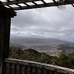
This is the view from the lookout during daytime. If there wouldn’t be this many clouds you could see the Teide volcano. On most days, you at least get a very nice view of the La Laguna city and its surrounding villages.
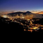
Here you can see the same view during an evening just after sunset, and the Teide volcano is clearly visible in roughly centre of the image. Even if you want to start your hike as quickly as possible, I suggest you visit the lookout.
Anaga Tourist Information Centre
The Spanish name of the centre is ‘Centro de Visitantes del Parque Rural de Anaga’. This is the place to go if you have any remaining questions about hiking in the park. In my experience, the stuff were truly knowledgeable as they had personal experience of hiking in the park and gave really good and practical advice.
Parking lot
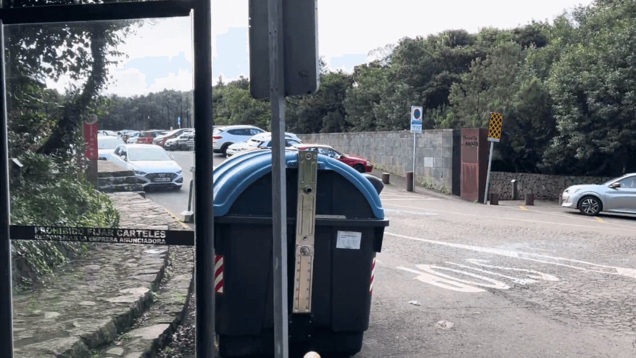
Cruz del Carmen has a convenient parking lot. If someone drives you up to the Anaga Rural Park, this is an excellent location where to drop hikers off. However, if you want to leave your car here better come early or late in the day as it gets very crowded during the most popular hours between 10 AM and 3PM. Sometimes you will have to wait for up to half an hour to get a spot if you want to leave your car here.
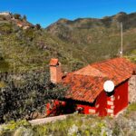
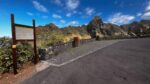
Cruz del Carmen restaurant and beginning of the trail
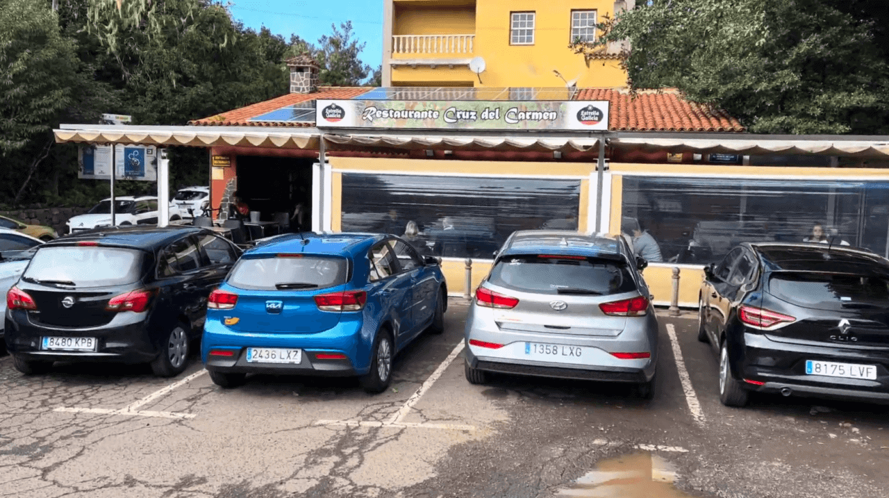
The TF-11 trail starts on the left of the restaurant, as does the TF 12 Trail. The TF-10 trail starts on the right of the restaurant.
The restaurant is nothing fancy, but you can definitely have a hearty breakfast or afternoon lunch here, along with some decent Spanish beer and wine.
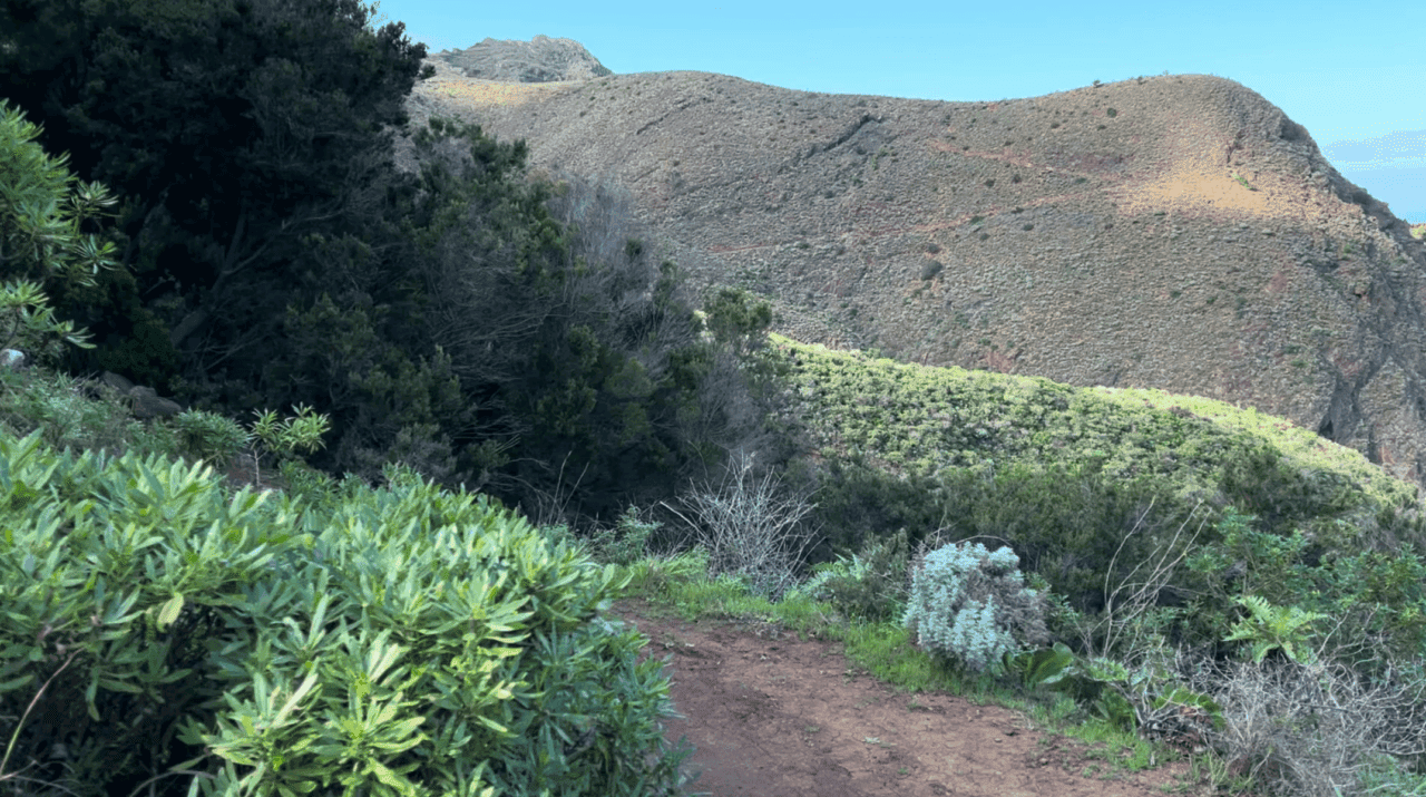
First two kilometers / first mile of the trail
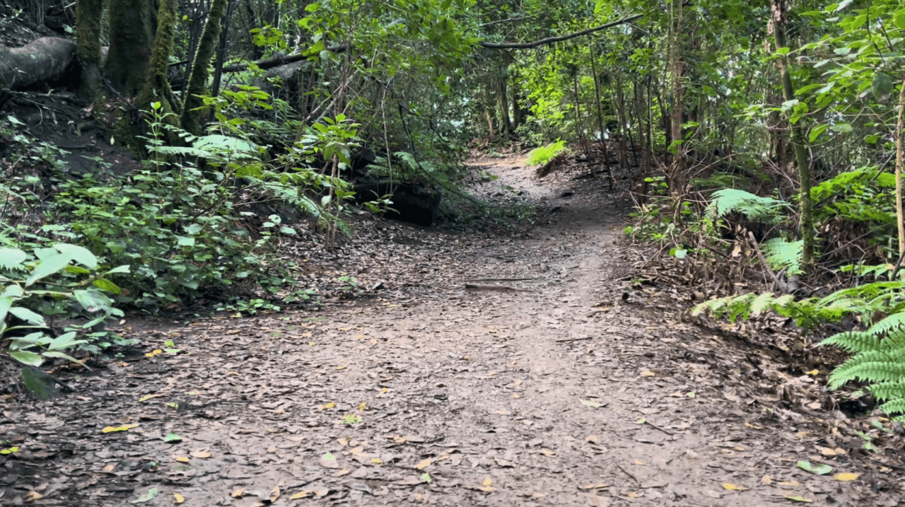
To be honest, there’s not much happening in the first 2 km / first mile of the trail. It goes on a very wide trail that starts next to the Cruz del Carmen restaurant and then descends towards a valley and the ocean.

However, if this is your first Canary Islands trail, you can enjoy the typical laurisilva forest, and the shade (while it lasts). While the trail is wide, it’s packed soil so does get quite slippery. Walk cautiously if you hike in early mornings right after night fog or after rain.
Closed trail warning
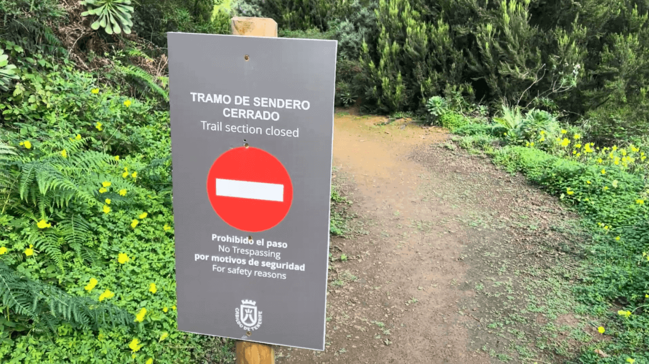
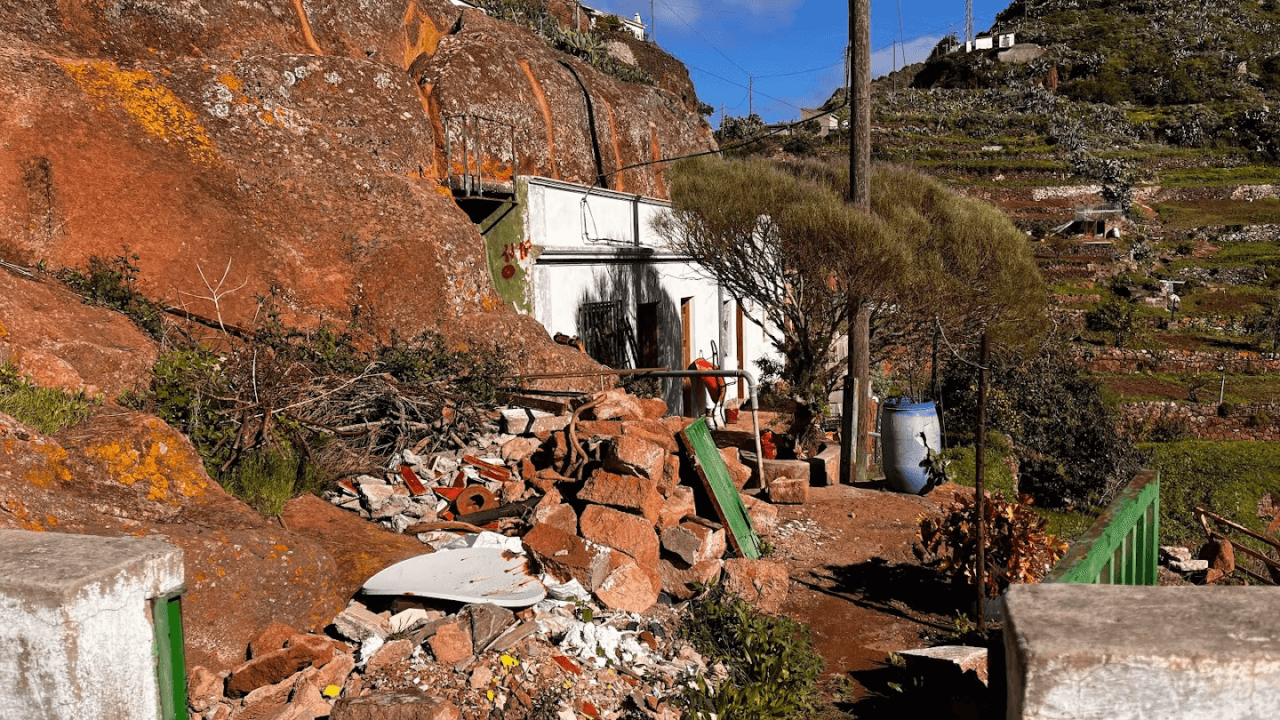
After you descend from the main Anaga ridge, you might stumble upon a warning about a closed trail. This sign is usually put up if there’s road construction around the Los Batanes village. You can see the reason for the formal closure of the trail below. Totally pasable for hikers!
The park management is super cautious and puts up these signs at the slightest deviation from regular circumstances. No hikers so far have reported that there would be any issues in getting through the village, nor did I experience any difficulties. At the time of my hike the road pavement was dug up and the road was simply not usable for cars.
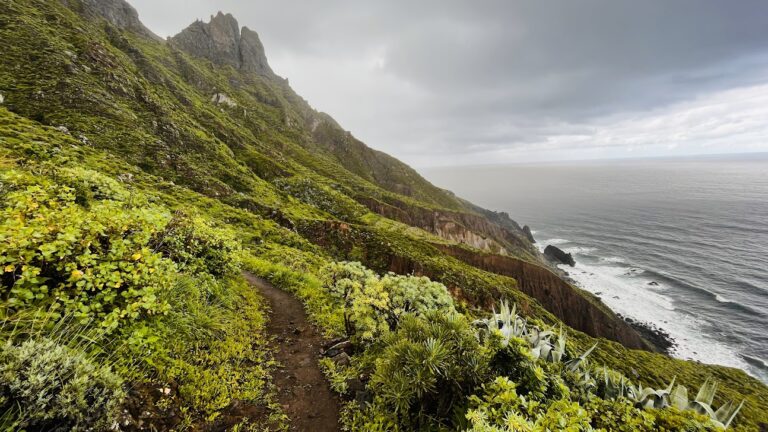
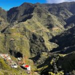
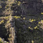
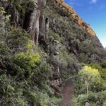
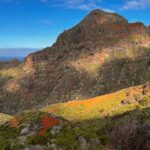
Views through the Anaga cloud forest
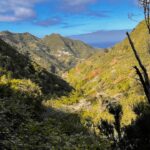
A peculiarity of this trail is that it goes up and down. Hence, it’s more difficult than some other trails, but this has the benefit of more scenic vistas. In the picture above you can see the ocean and the Bejia village in the distance. During your hike you will walk through the village.
I personally find it very satisfying to reach objects that I’ve seen from afar. If you also like this, the TF-11 trail will offer many such opportunities.
Even by the high Anaga standards, this trail is very lush. Enjoy the wild vegetation. You pass next to a number of cultivated and abandoned gardens and orchards.
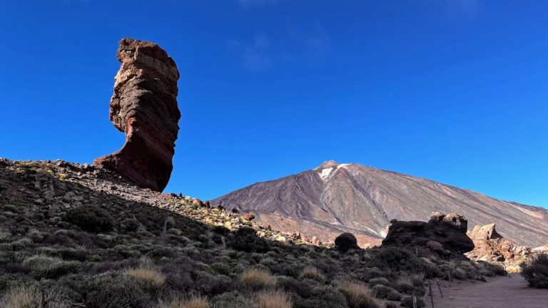
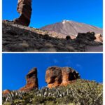
One of the most popular landmarks of Tenerife is the ‘Finger of God’ rock formation in Roques de Garcia (Google Maps link) in Teide National Park.
The TF-11 trail has its own small Finger of God formation. You will walk past it as you ascend the trail through the Bejia village.
One of the best tips I give to fellow hikers in Anaga is to regularly look back. In this day and age people are often very driven to go forward and finish the trail. But in Anaga the best views might be right behind you.
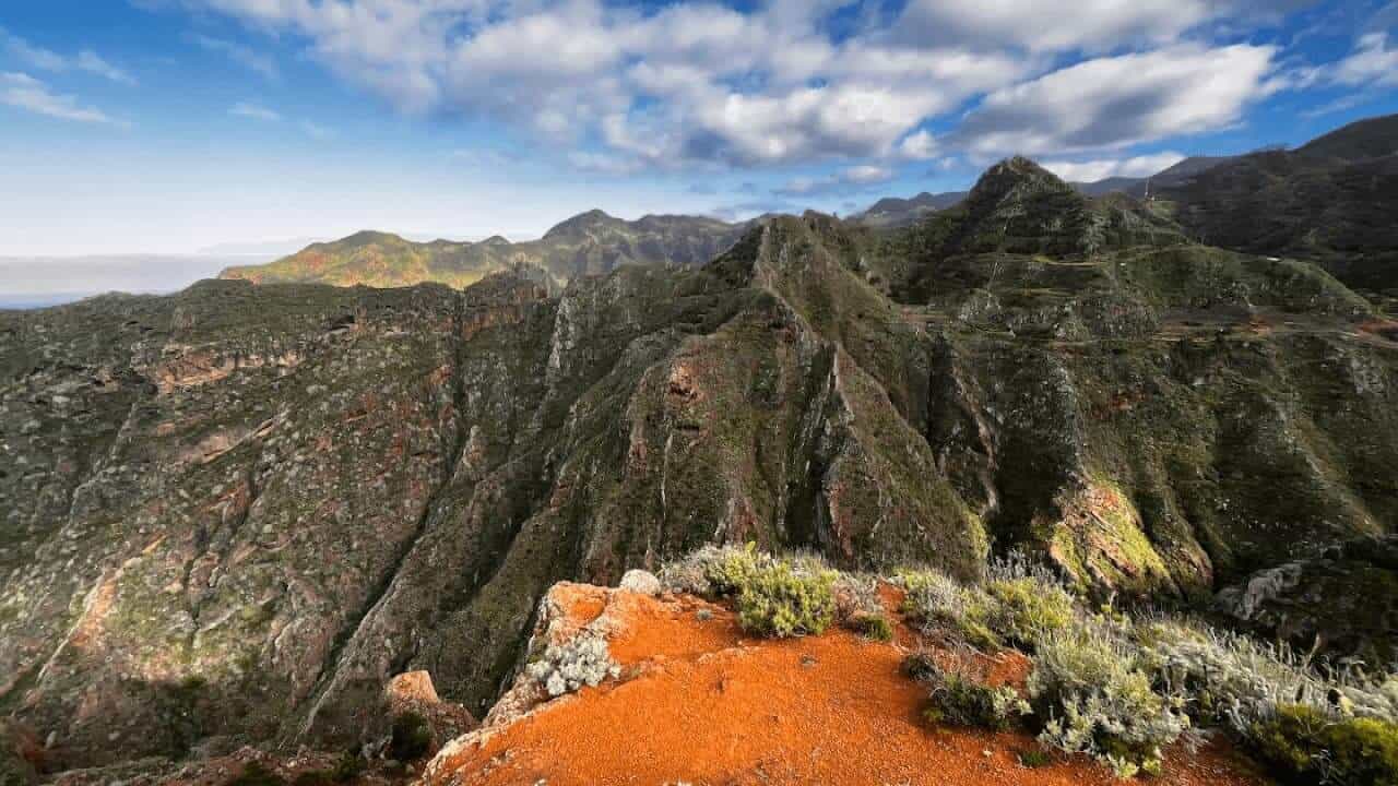
In this pic you can see the central Anaga ridge in the distance, and a nice walley.
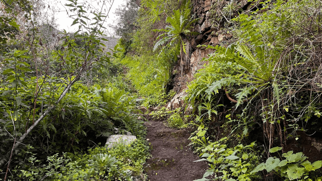
TF-11 is one of the trails with the most diverse floor. I put in this pick just to illustrate what the trail is like in some sections.
Valley before the Bejia village
In case you will not watch the entire trail video, the one above greatly illustrates the views you can expect to get. Sometimes you need a video as the pictures don’t fully convey the beauty of Anaga mountains.
This is a pic of the same view as in the video above.
Sketchy bit near Bejia village

In my trail reviews I usually try to cover if there were any sketchy or dangerous bits.
This was the most sketchy bit of the TF-11 trail before the Bejia village. To pass through here, you do not need any safety equipment, nor to hold on to anything. But it might be good to know about this with people who have vertigo or don’t like steeper drops next to their trail. But this was pretty much the only such spot on the entire trail.
Traditional architecture
The TF-11 trail is great if you want to see traditional architecture of Anaga villages, as the trail passes next to some very old houses.
Cueva del Lino
Just before the Bejia village you have the opportunity for a 2 kilometer / 2000 yard detour to visit the del Lino cave.
The detour also brings you to a site where linen was produced in the past. I do not know more about this, as one is supposed to either get a brochure at the Anaga Tourist Information Centre or download an audio guide somewhere.
Picnic spot in Bejia village
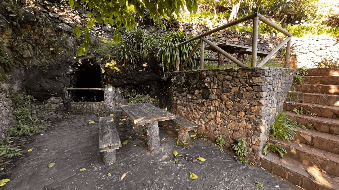
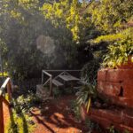
As you’ll reach the Bejia village, there’s a perfect picnic spot location. This is the Google Maps location of the spot.
On some maps the faucet is marked as drinking water, however, I didn’t test how nice the water was. At the very least you can use it to wash up.
Wine presses
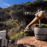
Very close to the picnic spot, there’s this original ancient wine press (Google Maps link). I suggest you check it out as it’s not more than a 200-meter detour. However, you have to return to the picnic spot to continue the trail, or you’ll wander off.
Panorama from Bejia village
This will be the panorama as you ascend through the Bejia village. As I said, regularly look back when hiking in Anaga, particularly, in this trail.
Bejia village’s own Finger of God
And here’s the promised ‘Finger of God’ formation. The original rock formation is in the above image, and the TF-11 “copycat” is below. If you are interested in a precise location, here it is. However, it’s impossible to miss it while you hike this trail, as the path goes next to these rocks.
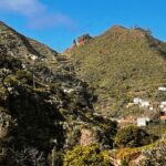
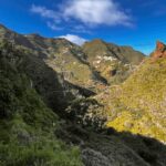
First glimpse of the Chinamada caves
Next to the Finger of God formation you also get the first glimpse of the Chinamada caves in the distance. Don’t worry, you’ll get plenty more views of this unique natural phenomenon as the TF-11 trail regularly weaves past it.
Bejia village up close
The Bejia village has probably a dozen or so houses. At the very top of the village peak is probably the most picturesque part of the village.
Cave houses
On the outskirts of the village you also get to see some rock houses. Interestingly, these are still inhabited.
We really wanted to find an opportunity to stay in a cave house. However, during our stay on the island we were not able to find any offers neither on Booking.com, nor on Airbnb. If you know of a cave house that is being rented out for tourists, please leave a comment under the post and will be happy to feature this property.

We are very big fans of the Anaga signposts, so here’s a picture of one just for its esthetic beaty.
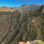
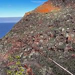
Lava dykes
The best Anaga hikes let you see a fair selection of geological phenomena related to the islands volcanic past. The TF-11 trail does not let you down in this regard. In this picture, you can see a lava dyke – a former crack in the earth through which lava squeezed towards the surface and then solidified.
In case someone in your company will ever wonder what are these stone walls in Anaga, now you’ll be able to tell them.
There are also plenty of other interesting lava-related objects.
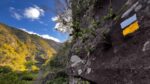
Another thing that we very much love in the park are these yellow and white flag trail signs. Here’s a nice example of one.
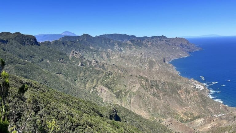
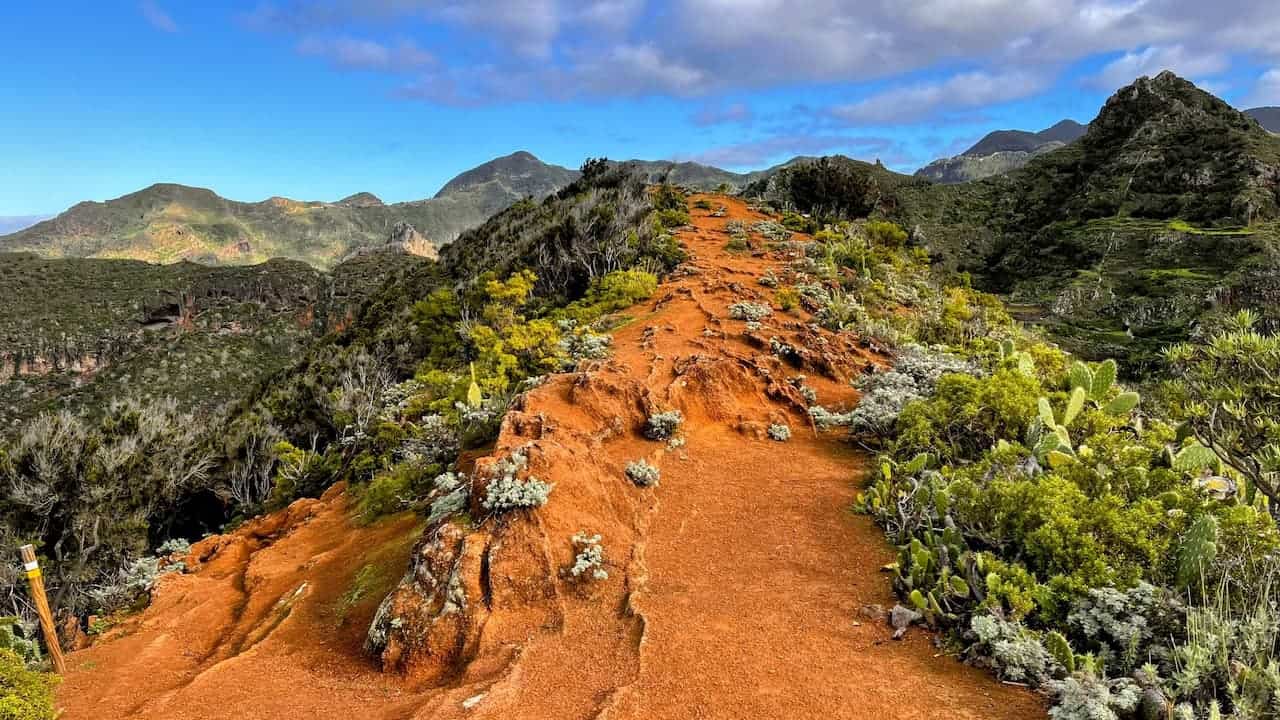
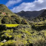
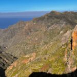
Approaching Punta del Hidalgo and the best views of the Chinamada caves
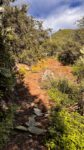
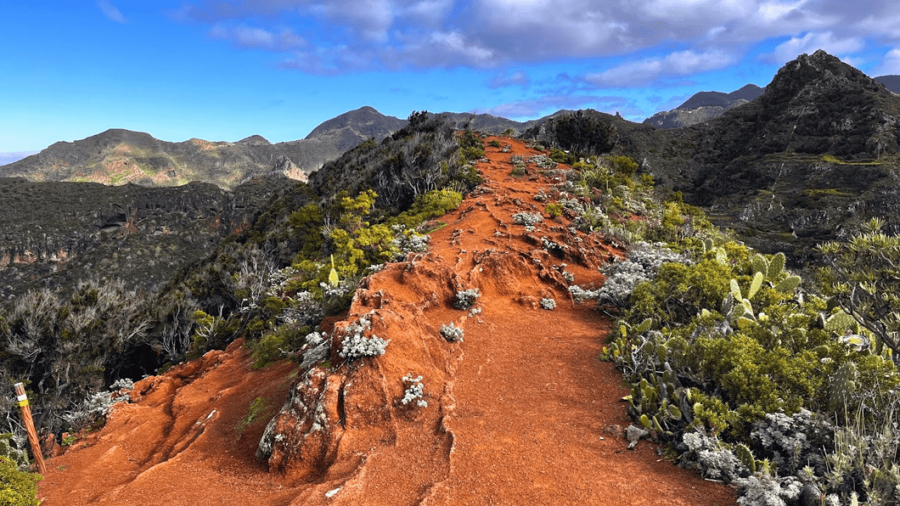
This trail gives you plenty of opportunities to see the trail ahead, which is something I like very much. In this image, a little bit to the right of the centre, you can see where there you’ll have to hike. The feature image of this post with the orange path comes from the top of this ridge.
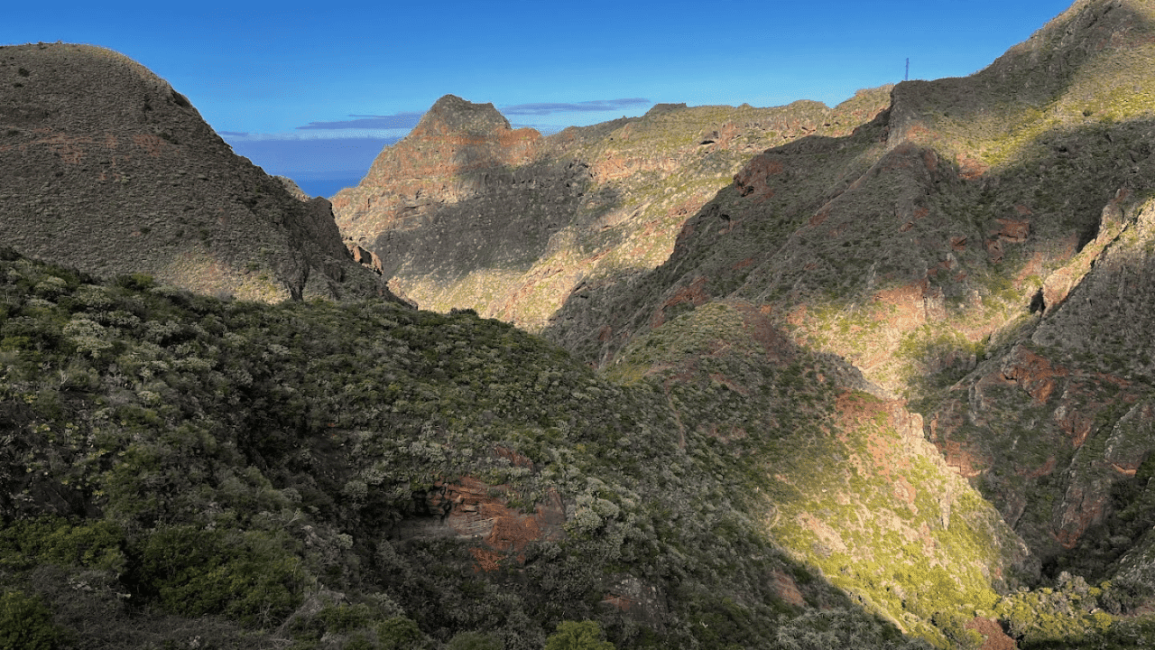
Another image of the Chinamada caves, as you are getting closer and closer to them.
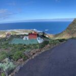
Perfect lunch spot
This is probably the best lunch spot on the entire trail. Especially if the weather is poor and you are looking for some natural cover. This is the Google Maps location of this site so you know how far you have to go to reach it.
This will be the panorama that you will get while enjoying your lunch.
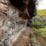
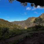
Cave – a possible wild camping spot
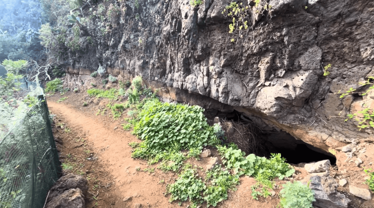
In this location you will see a rock opening. It hides a small cave. It is possible to climb in there and get to the other side of the small rock.
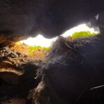
This is what it looks like from inside the cave towards it’s opening.
While wild camping is not allowed in Anaga. If you decide to do it, this is one of the best spots where to stay overnight. You have a nice shelter to protect you from the elements, you are shielded from the trail so will have privacy and uninterrupted rest.
Look back at the trail towards Bejia village
One more picture of looking back over your shoulder. I like this picture because it shows you how the trail leaves over the mountain.
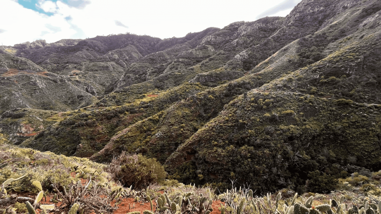
Trail near Chinamada caves
This is among my top 3 photos from our time on the island.
The TF-11 trail passes over the ridge. Once you reach this hard to miss spot, make the very short detour until the end of the ridge to get some of the best views of the Chinamada cave. Precise location of this spot.
Chinamada caves panorama No. 1.
Chinamada caves panorama No. 2.
As usual, pictures don’t fully convey the majesty of nature here.
Approaching Punta del Hidalgo
This is what the approach to Punta del Hidalgo looks like. Nothing particularly interesting about this very last section of the trail. However, it’s nice to know that you’ll be able to take a swim in the ocean if you fancy one.
Punta del Hidalgo is well connected to bus routes taking you back to La Laguna, so you will be able to hop on a bus by not waiting more than 20 minutes.
Chinamada caves viewing spot if you don’t want to hike
If you don’t want to hike, but still want to see the Chinamada caves, it is possible to reach an excellent lookout by simply driving a car there (although be aware that the road is quite steep and narrow, so it’s not for novice drivers). This is the precise location of the lookout on Google Maps.
This is the panorama that you will get from the lookout location.
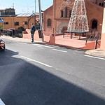
Punta del Hidalgo
This is the trail-end in Punta del Hidalgo. It’s the town’s main street, and there’s a bus stop a bit to the left to get you to La Laguna.
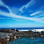
However, if you have any strength left, I suggest that you consider also visiting the beach. It’s not swim friendly itself, however, there are several rock pools where one can take a dip.
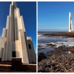
The beach also has this interesting modernist light house. To get to the beach, will add about a kilometer, 0.7 miles to your hike, and to get to the lighthouse, it’s another kilometer. Judge yourself if it’s worth it, but I liked the beach a lot.
If you are hungry, there’s one beach cafe with food and drinks. If you want something more fancy, there are plenty of restaurants in Punta del Hidalgo proper.
How to Get to the Trail Head in Cruz del Carmen
By Car
As the TF-11 is a linear trail, getting to any of the trailheads by car is problematic, unless someone drives you there.
Very fit hikers do the TF-10 and TF-11 hikes in one go to return to their cars either at Cruz del Carmen or Punta del Hidalgo, but this is not a useful tip for most persons. If you decide to do both hikes, in one go, it’s almost 25 kilometers and at least 1400 vertical ascent meters / 4600 feet. I would only recommend this to the very ‘creme de la creme’ of our hiking community.
Parking both in Cruz del Carmen and Punta del Hidalgo is free, but finding free parking spaces is often a challenge. In Cruz del Carmen you might have to wait up to 30 min before a spot frees up. In Punta del Hidalgo you might have to park a few hundred meters / yards from the trail start.
By Bus

The TF-11 trailhead in Cruz del Carmen is served by 4 bus routes: 076, 077, 273 and 275 (click on the link to go to the relevant bus route schedules on the Titsa.com website). Titsa is the Tenerife public transport authority.
In my experience you could also rely on the schedules in Google Maps. However, if timing is very important to you, always check the Titsa website as there might be recent changes that are not yet reflected in Google Maps.
Hiking with a Guide
For those who prefer a guided excursion, there are local companies offering guided hikes on the TF-11 and other trails in Anaga.
We had a very good experience with getting guides through the Get Your Guide website. I’ve reviewed one of these experiences – canyoning in the Barranco de Los Arcos ravine. Several guided Anaga hikes and other Tenerife experiences are shown below, but you can find many more on the platform.
This post may contain affiliate links. If you click one, we may earn a commission at no cost to you.
These organized tours provide certified and knowledgeable guides who can share the area’s history, flora, and fauna while ensuring the group stays on the right path. Additionally, they often offer transportation directly from Santa Cruz de Tenerife, La Laguna or even South of the island. This eliminates the need to drive on the narrow mountain roads yourself.
Guides can also be found through the Tenerife Hiking Community Facebook group. Hiking with a guide can be a great option for those looking for a more structured and informative experience on the trail. All local certified guides found through Get Your Guide or other channels will provide insurance for participants during the hike.
Insurance during organized hikes is mandatory in Tenerife. If your guide does not provide insurance, the person is not an official guide. I highly recommend also getting a personal insurance in Tenerife as, according to my conversations with local guides, regular rescue costs 1800 EUR upwards, and one involving a helicopter is from 3600 EUR and up.
Markings
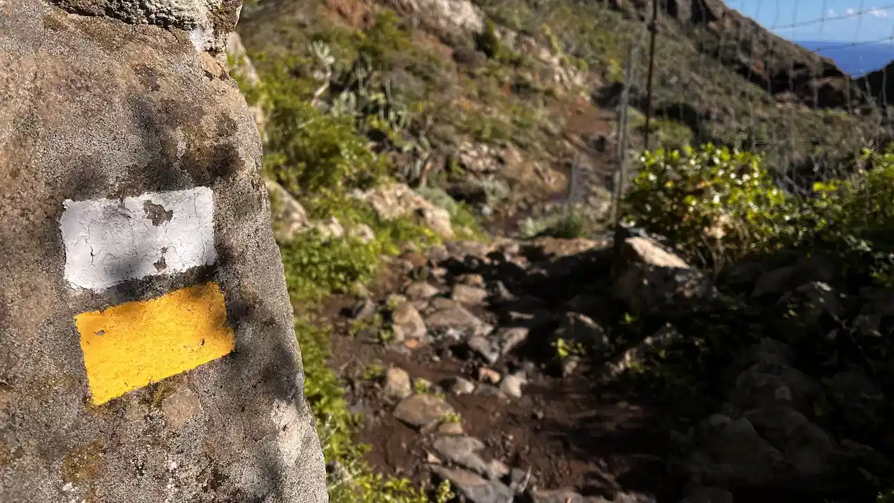
All Anaga trails are well-marked with the typical white-and-yellow flag signs painted on rocks and other objects in places where there’s a chance you might choose the wrong direction. While most Anaga trails are easily navigated even without a map or a GPS device, we recommend to have a trail map on your phone and periodically check if you’re on the right path.
Some trails like TF-11, TF-8, TF-2 and TF-4 have spots where the navigation flags are not easily visible and you can take a wrong turn relatively easily. Our favorite GPS apps were Maps.me and Wikiloc, but others like AllTrails and Komoot are also widely used.
Be sure to download the necessary maps and routes before starting your hike. While there is phone reception on most routes, data connection is frequently spotty / not functioning.
I recommend downloading the TF-11 trail GPX file (link to my Google Drive folder) and uploading it in Maps.me or your favorite hiking app. This way you’ll always know which turn to take.
Facilities on the Trail (Cafes, WCs)
TF-11 goes between Cruz del Carmen and Punta del Hidalgo. There are restaurants at both trailheads, however, there are no amenities on the trail itself.
You can find a picnic spot on the trail in the Bejia village (described above with a photo), that also has a water faucet that’s supposedly portable. But that’s it.
If you start the trail in Cruz del Carmen, I suggest you visit the Tourist Information Centre to ask any questions about your planned hikes, as the guides there are very competent.
Safety
General Tips
Summer: During the summer months, we recommend bringing plenty of water, sun screen, and wearing appropriate headgear and clothing to protect against the sun. The heat can be very intense, so it’s essential to shield yourself, stay hydrated and take breaks when needed.
Rainy Season: In the rainy season, the trails can become slippery and more prone to landslides. Wear shoes with good traction, bring a rain jacket or a rain poncho, and be prepared for sudden changes in weather conditions. Remember that the temperature on average decreases by 1.8 degrees F / 1 degree C for every 100 vertical yards / vertical meters. If the temperature is still pleasant at ocean level in Santa Cruz, it can be quite cold when arriving in locations higher in the Anaga mountains.
Closed Sections of the Trail
The TF-11 might have a formally closed section if the road repairs near Los Batanes village are not finished yet. However, in my experience the trail is perfectly “hikable”.
Do You Need a Permit to Hike the TF-11?
No permit is required to hike the TF-11 trail.
Only Sendero el Pijaral (former TF-7 trail) requires a free permit in the Anaga Rural Park.
Do You Need a Guide to Hike the TF-11?
You do not require a guide to hike the TF-11. You might want to book a guide if you want to get a nice introduction to the history of the region, its culture, as well as flora and fauna.
Dangerous Animals and Plants
Tenerife has no dangerous fauna, and very few somewhat dangerous plants that can cause skin and eye irritation. These are not an issue on the TF-11 trail.
If you hear something rustling in the grass, it’s just a family of lizards, as there are no snakes on the island (thank god!).
Can You Hike the TF-11 with Children?
TF-11 is not a child-friendly trail. It’s physically demanding and relatively long. There are also a few trail sections with steeper sides.
If you are looking for child-friendly trails in Tenerife, we recommend Sendero de los Sentidos (starts at Cruz del Carmen and partially intersects with TF-1 trail), TF-4, or TF-5, all in Anaga. Outside Anaga we recommend the circular trail around the Guimar Volcano. In Teide National Park we very much liked the Chinyero loop around the Chinyero volcano, the short, but super scenic loop around Roques de Garcia, and the moon-like Sendero de Samara trail. Another child-friendly trail is a hike around the Montana Negra, however, definitely get a GPS app for this trail as it’s easy to wander of course.
All links in the previous paragraph go to the trail head in Google Maps that can be reached by a car.
Mouflon Hunting
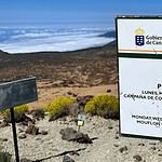
Mouflon hunting may rarely take place in the Anaga Rural Park. If it’s planned or ongoing, there will be signs at the trailhead and at regular intervals. Choose another trail if mouflon hunting is ongoing.
Forest Fire Warnings
Forest fires can be a risk in the Anaga Rural Park, especially during the hot season. There are years when the trails are closed for days or weeks due to forest fires or their risk.
Anaga Rural Park Rules
Lighting a Fire
Lighting a fire is strictly prohibited, even gas stoves.
Wild Camping
Wild camping is officially not permitted.
I’ve asked park rangers about wild camping, and the unofficial policy appears to be that as long as you clean up after yourself and leave a location as you found it, you should not run into trouble. Camping should be done only in groups of 1-2 persons.
Collecting Flora and Rocks
Preserving Anaga Rural Park’s unique biodiversity is crucial. Therefore, it is striclty prohibited to collect flora (plants, flowers, fruits, etc.) or rocks from within the park.
Border guard and customs officials regularly check for plants on the border. For example, my wife’s plants purchased and collected on the island outside protected areas were anyway confiscated by customs officials when she arrived on Spanish mainland with a ferry.
Taking Trails Without a Permit
There areas in Anaga which are strictly of limits such as the Monte Aguirre area close to Cruz del Carmen.
The only trail requiring a free permit is the Sender El Pijaral trail. If you are caught on this trail without a permit, or in any of the prohibited nature reserve areas, the fine can go up to 601.01 euros.
This post may contain affiliate links. If you click one, we may earn a commission at no cost to you.
Where to Stay in Anaga (Recommended Hotels and Homestays)
There are not very many options of staying overnight in the Anaga Rural Park itself and these are concentrated in the largest villages like Taganana, Almaciga and Benijo. I’ll add recommended options for hikers at a later date. In the meantime, search Booking.com for Anaga, read the reviews and check the accommodation’s proximity to hiking trails.