TF-2 Taborno Village – Valleseco Trail Guide: A Hike Through the Greenest Part of Anaga
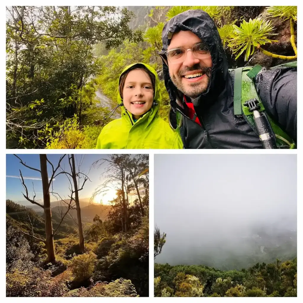
WHY TRUST THIS INFORMATION? I hiked A LOT, including a quest to hike all Anaga trails during my family’s year in Tenerife from 2022 to 2023. This and other articles are based on my personal experience, while hiking alone and with our kids.
TF-2 ‘Business Card’
TF-2 is a scenic one-way trail from theTaborno village to Valleseco town and beach of the same name. TF-2 is not only a great visual cross-section fo the Anaga Rural Park, but it also passes by the Old Pico del Ingles road (Camino Viejo al Pico del Ingles), which is among the top 5 most instagram-able locations in the whole of Tenerife.
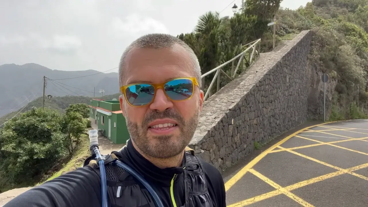
Our TF-2 hike video
If you have any questions about this hike, please leave them below or under the video on YouTube, and I’ll try to respond ASAP.
You are welcome to check out videos of all other official Anaga hiking trails from TF-1 to TF-12 on our YouTube channel.
TF-2 Ranking Among Other Anaga Hiking Trails
If you do not want to do further research, below is an overview of all Anaga hiking trails ranked from best to not so impressive.
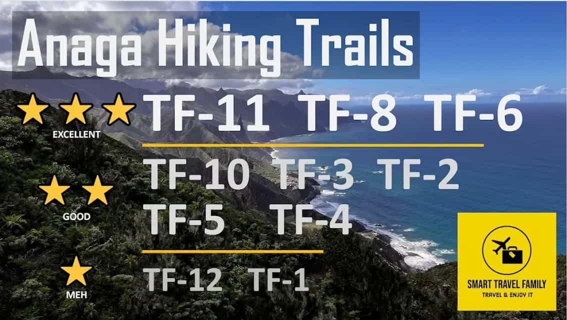
This rating should be useful for the average hiker, travelling without children and not having any health issues or low physical form. If you are looking for a list of trails arranged by ease, child-friendliness and other criteria, read this article about all Anaga Rural Park hiking trails.
TF-2 is definitively a trail to consider after you have done at least one of the top Anaga trails: TF-11, TF-8 or TF-6. You also could do the TF-2 if you are doing the circular walk around Roque de Taborno (only around 2.5 miles / 4 km) and want to do some more scenic hiking.
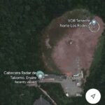
Map of TF-2 trail
The TF-2 trail is marked in red in the above map.
The above trail length and elevation numbers are based on my GPS watch readings when doing the trail. They may differ from figures in information of the Anaga Rural Park Administration. In general, there was at least a slight discrepancy between official and hikers’ GPS readings for most Anaga trails.
This article describes the trail as done from Las Mercedes village towards Cruz del Carmen (Carmen’s Cross, a location with a viewpoint, Tourist Information Centre, a parking lot, and a restaurant). You can do the trail in any direction. Quite many people descend from Anaga back to villages surrounding La Laguna.
How to Make Sense of Anaga Trails? Which to choose?
There are 12 official trails in the Anaga Rural Park in the North of Tenerife.
These trails are numbered from TF-1 to TF-12 and some have additional sections like TF-6.3 to add variety to your hikes or connect trails or villages with car parking locations and bus stops.
| Trail | Length (miles / km) | Vertical ascent (feet / m) | Difficulty | Additional Information |
|---|---|---|---|---|
| TF-1 | 2.36 / 3.8 | 1014 / 309 | Easy | Child-friendly |
| TF-2 | 7.46 / 12 | 1562 / 476 | Medium | Child-friendly |
| TF-3 | 6.03 / 9.7 | 2133 / 650 | Hard | Circular |
| TF-4 | 2.11 / 3.4 | 66 / 20 | Easy | Child-friendly, downhill trail |
| TF-5 | 6.84 / 11 | 1230 / 375 | Medium | |
| TF-6 | 7.89 / 12.7 | 3044 / 928 | Hard | Circular, top choice |
| TF-7 | 4.77 / 7.68 | 1089 / 332 | Easy | Child-friendly |
| TF-8 | 9.63 / 15.5 | 3353 / 1022 | Hard | Circular, top choice |
| TF-9 | 3.85 / 6.20 | 667 / 203 | Medium | |
| TF-10 | 7.41 / 11.91 | 853 / 260 | Hard | |
| TF-11 | 7.71 / 12.40 | 1292 / 394 | Hard | Top choice |
| TF-12 | 7.12 / 11.45 | 331 / 101 | Easy | Child-friendly, boring |
In all cases, I took the trail from the middle of Anaga Rural Park to the ocean side. The vertical ascent shown in the table is in the direction of the ocean. If you would take any of the trails in the opposite direction, they would be much harder.
The internet is full of Anaga trail suggestions that present a segment of these 12 trails as a unique trail, confusing both novice and experienced hikers.
The table above provides a useful overview of the 12 trails. You should also read our Guide to All Official Routes in the Anaga Rural Park.
Why Is the TF-2 Trail Worth Hiking?
One would hike this trail for the following reasons:
- Relatively easy to hike, once you get up to the Anaga peaks after the first 1/3 of the trail. You can also join this trail from the Pico del Ingles lookout, as from there it goes mostly down.
- If you like ridgewalks and want to do the TF-2.1 variant.
- Want to do a longer trail after going around Roque de Taborno.
- The trail is well connected to public transport (by Tenerife standards) at both trailheads – Taborno and Valleseco.
Visual TF-2 Trail Guide and Key Landmarks
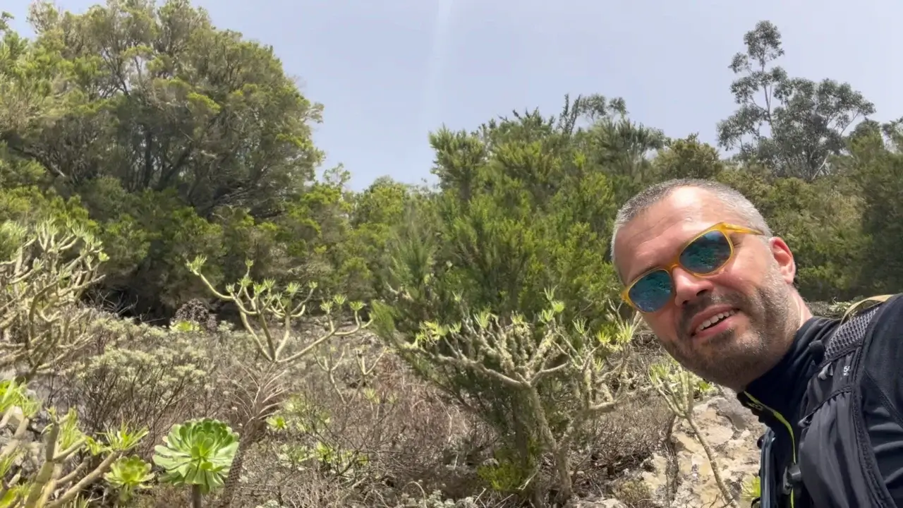
* Apologies if some of the images below are insufficient quality, as I forgot to take many pics during this hike and had to extract them from my video for this article.
Taborno village tour
If you are starting your hike from the Taborno village, consider doing a tour of the village. It will only add a kilometre or less than a mile to your hike, but you will get the opportunity to see a nice location in the Anaga Rural Park.
This is a panorama the Taborno village with the Roque Taborno cliff in the background.
If you think that the hike of 12 km / 7 1/2 miles is too short for you, you can also consider hiking around the Roque Taborno, which is a 4 km / 2 mile hike of easy to medium difficulty that will give you great views of the Anaga mountains and the surrounding ocean.
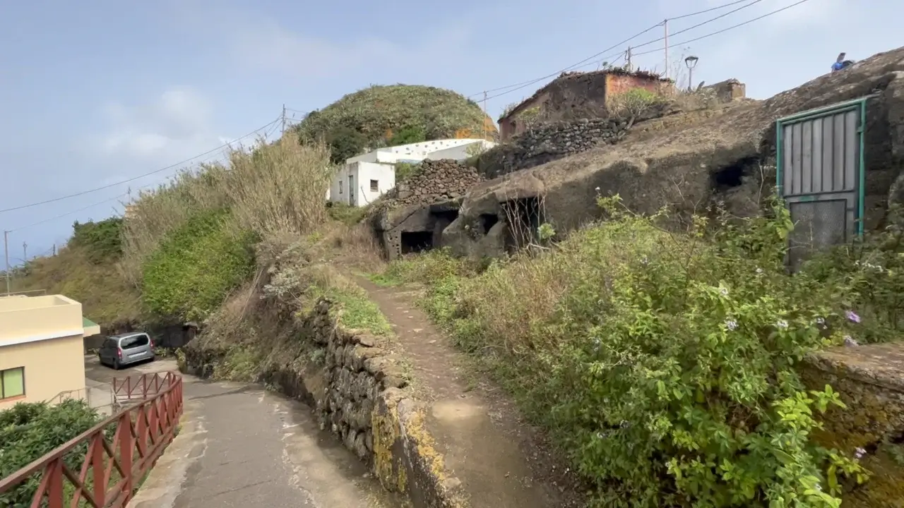
If you haven’t seen these before, the village contains several rock houses that are currently used as storage facilities. However, people likely used to live there in the past.
If you are hungry before your hike, the village has one restaurant and one bar. Consider stopping there to also to support the local economy.
The Taborno village also has a lookout or mirador in Spanish.
This lookout station gives you a nice view of the north of the island, as well as Roque Taborno.
As you walk elsewhere in the Taborno village, you will also see the Las Carboneras village which you will go through if you choose the TF-10.1 trail from Cruz del Carmen to Punta Hidalgo on the ocean coast.
It is also possible to take the TF-9 trail that connects three villages of Anaga Rural Park – Las Carboneras, Taborno village and Afur village.
Taborno village and Roque Taborno
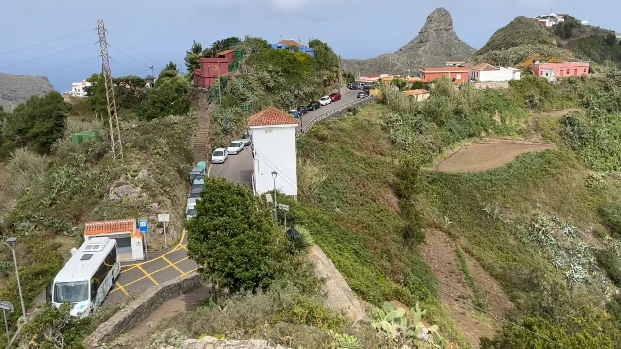
This is what the trailhead looks like – see the paved path uphill. It is at the entrance of the Taborno village right next to the public bus stop.
Taborno village is also the start of the TF-9 Trail that connects to both Afur and Las Carboneras villages.
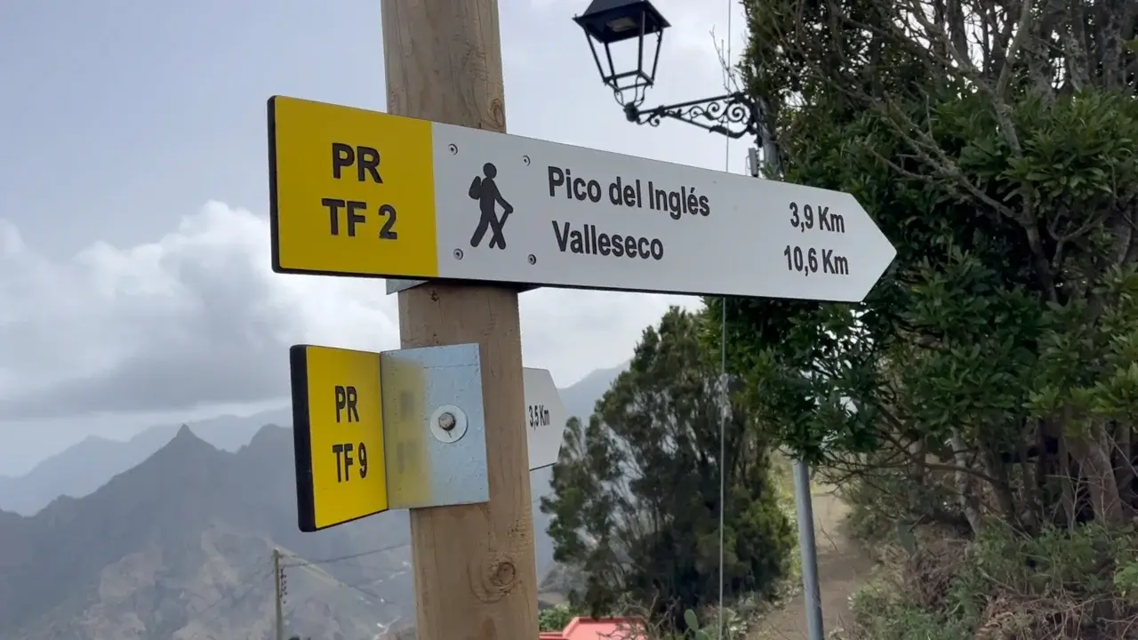
The official signage says that Valleseco is 10.6 km or 6 miles away however it’s more like 12 km / 7 miles.

As you start the trail, this is the panorama that you will get after the first 200 m – the Taborno village and Roque Toborno in the background.

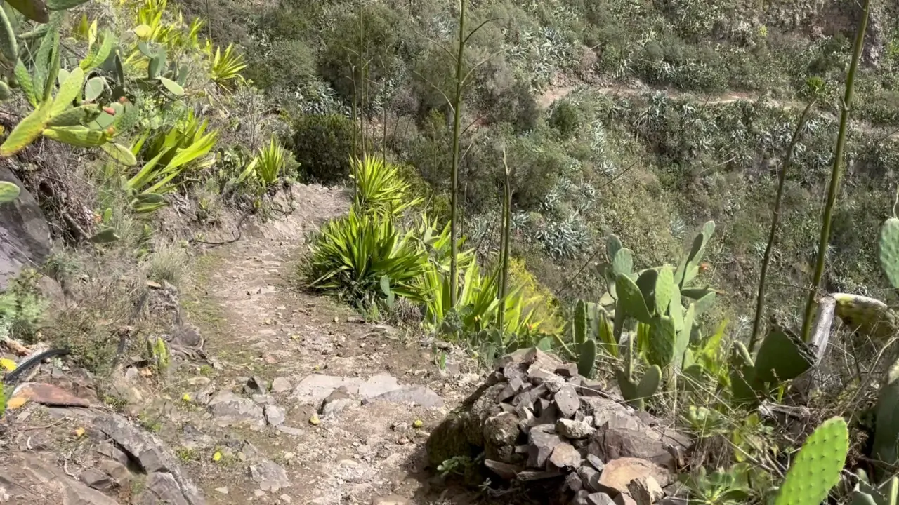
The trail starts out on a rocky ridge and you get nice views on both sides of the trail.
First kilometer / mile
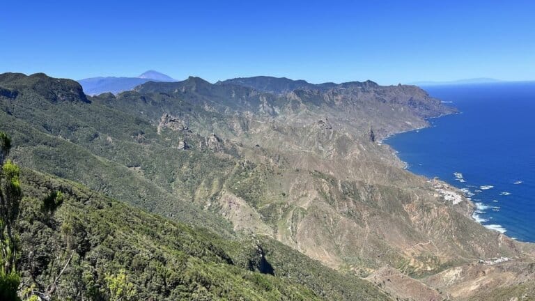
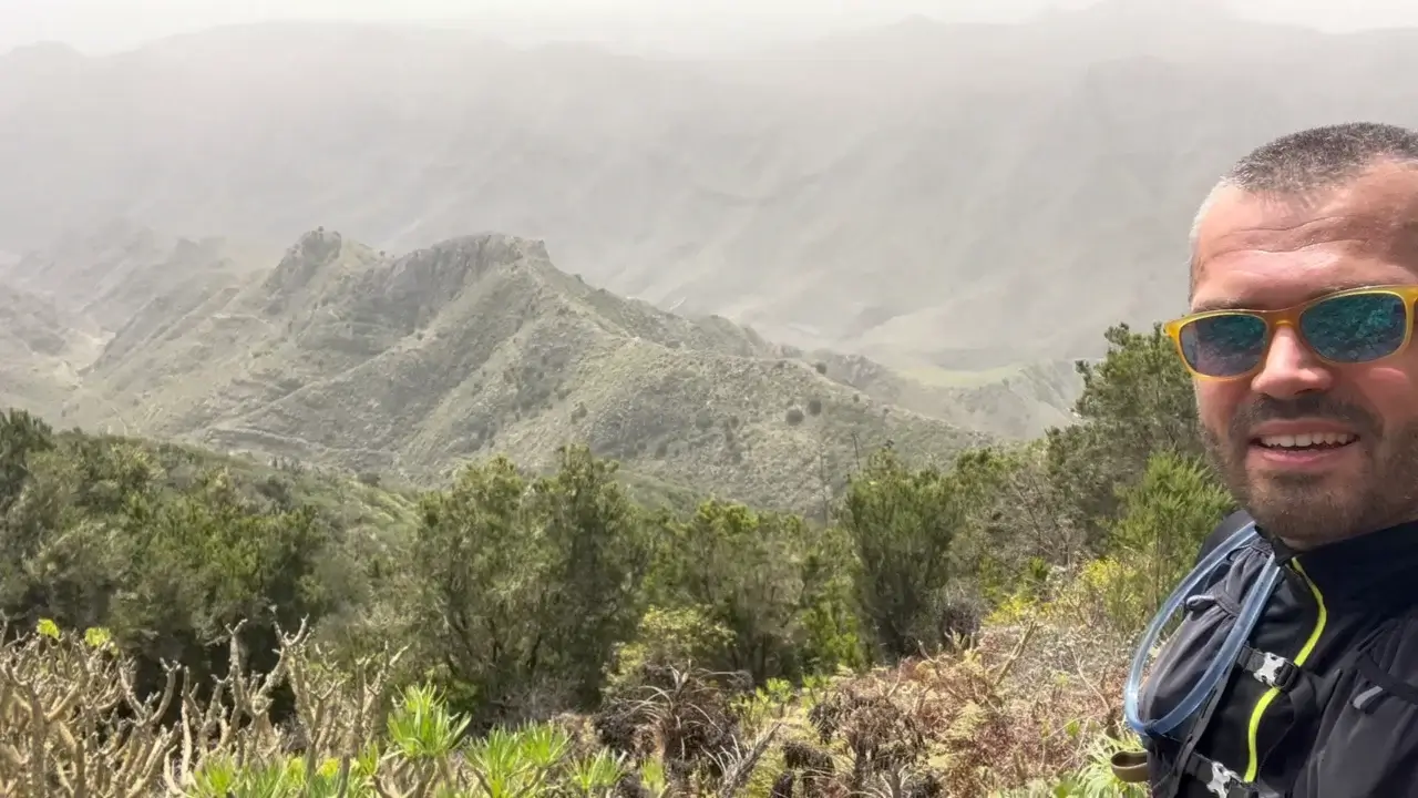
The peak roughly in the middle of the image marks the first 1/3 of the trail where the Taborno radar station and the Pico del Ingles peak are located.

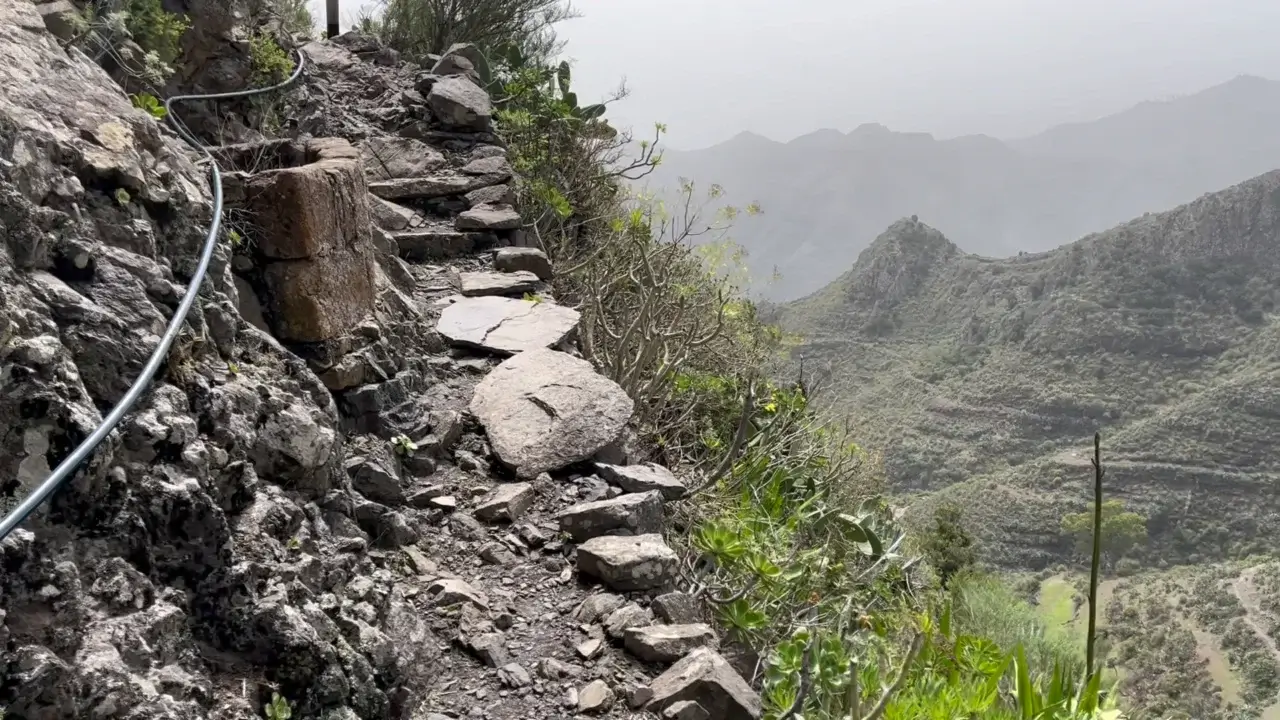
The trail surfaces are mixed on this trail, but most of them are nice to walk on when it’s dry. However, some sections can be slippery during or after rain or fog.
About dangerous animals
One of the most frequent questions I get about hiking in Tenerife if whether it has any dangerous animals or other creatures.
This is something that you don’t have to worry about as if you hear any rustling in the grass, these are only lizards. There are no snakes or other dangerous fauna on the island. Hard to believe, but it’s true. Island life has its benefits.
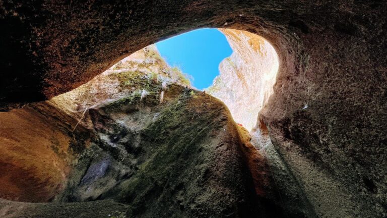
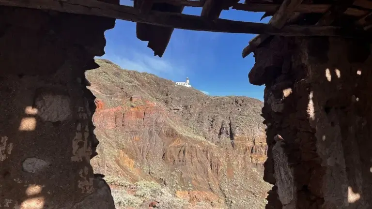
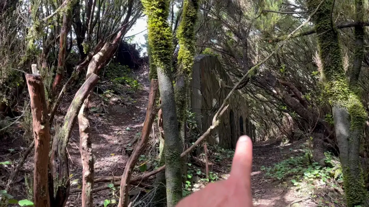
Island’s past on the TF-2 trail
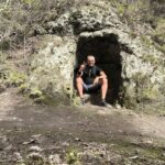
The TF-2 trail (just like other trails) has not been created for tourists’ benefit, but are in fact historical evidence of vibrant local societies that moved around the island.
In this picture, I’m sitting in one of the carved spaces in a rock that served to shelter shepherds and other travelers from the elements.
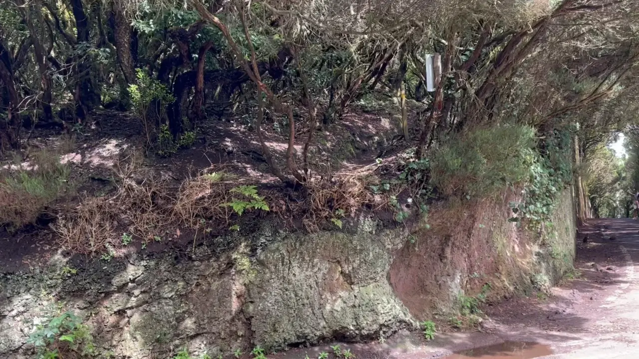
Ascent to Pico del Ingles
The section between the Taborno village and Pico del Ingles peak is the hardest part of the trail because it mostly a sense uphill.In certain sections, your hiking will be eased by steps carved out in either soil or rock, courtesy of the indigenous inhabitants of the island.

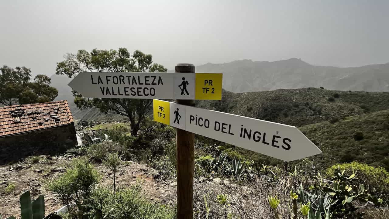
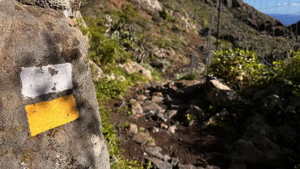
If you reach a crossroads in the trail, always look for the white and yellow trail marker. In this image, it is in the right top corner.
Wrong turns are sometimes, but not always marked with an X in the same colours – yellow and white.
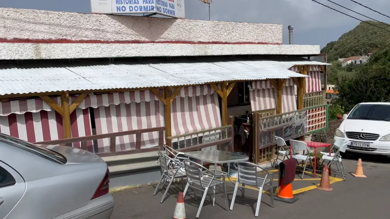
Casa Carlos restaurant
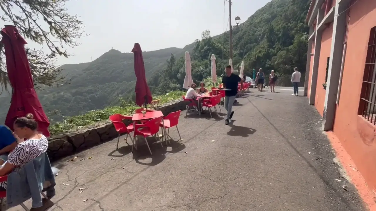
Around kilometre 3 mile / mile 2 you will reach the Casa Carlos Restaurant. Not only has the restaurant splendid views, but it also has decent food and drink.
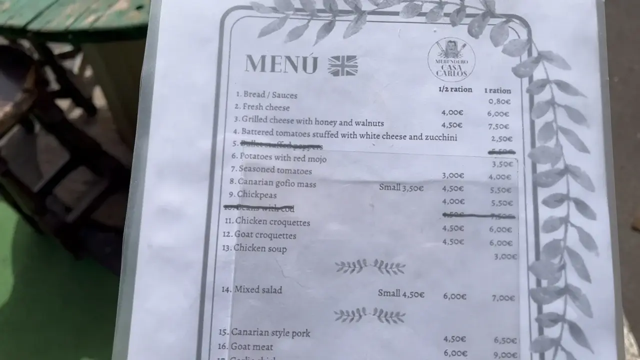
Here’s a picture of the restaurant’s menu that lets you see what’s on offer and how much it costs. All in all the prices are quite fair – you can have a second between six and nine euros and the beer costs roughly €2.
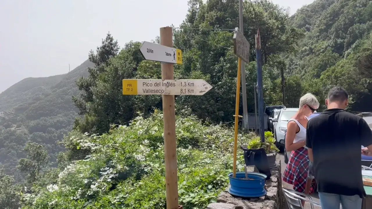
Next to the restaurant there is also this trail marker that lets you see how far you’ve come and how far you still have to go until Valleseco. Just remembered that the distances are slightly open and you will have to walk a bit more than 8 km / 5 miles until the end of the trail.
Paved section after Casa Carlos

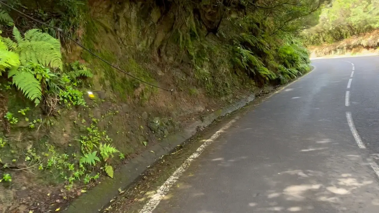
This trail has only one short section that is paved with asphalt. It’s only about 300 meters long. You have to turn right as you exit the restaurant.

As you walk up the road, don’t miss the turn and continuation of the trail. There is again the trail marker – the yellow and white flag that’s this time painted on a rock, as well as the handrail.
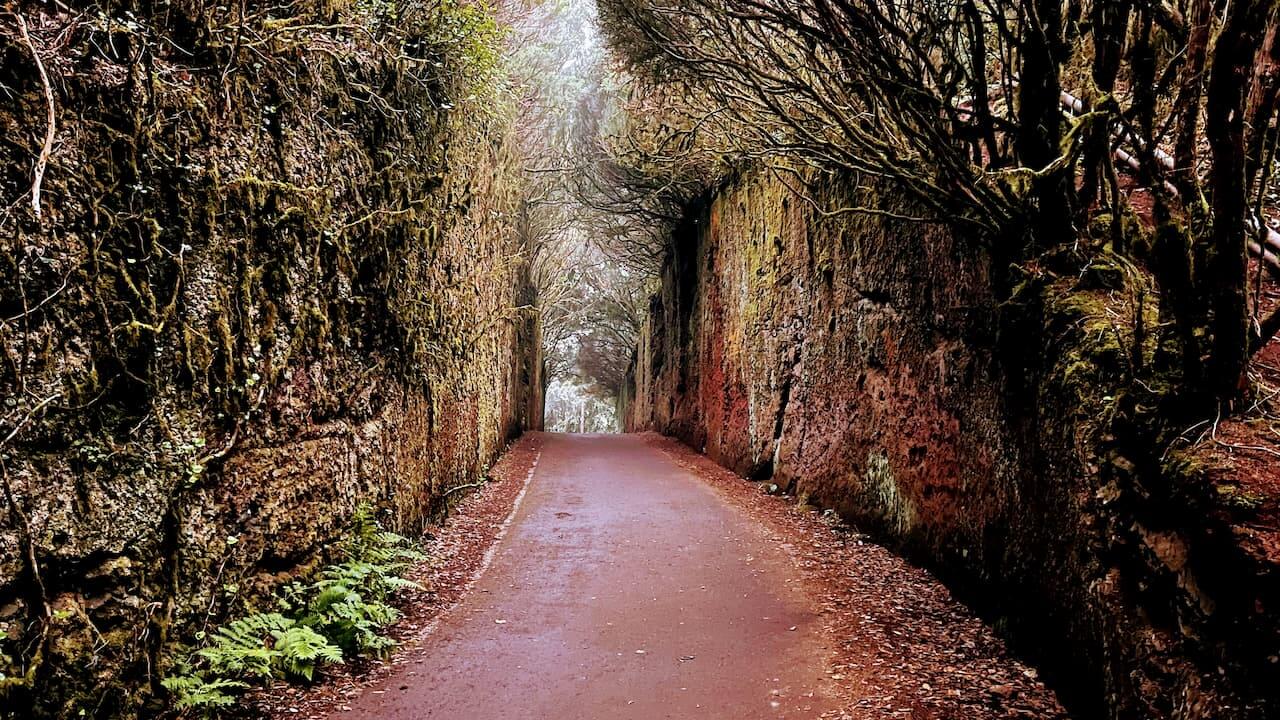
Magic Forest section

Other trails in Anaga have longer sections with what is called the ‘magic forest’, but the Tf-2 trail also lets you enjoy this type of terrain.
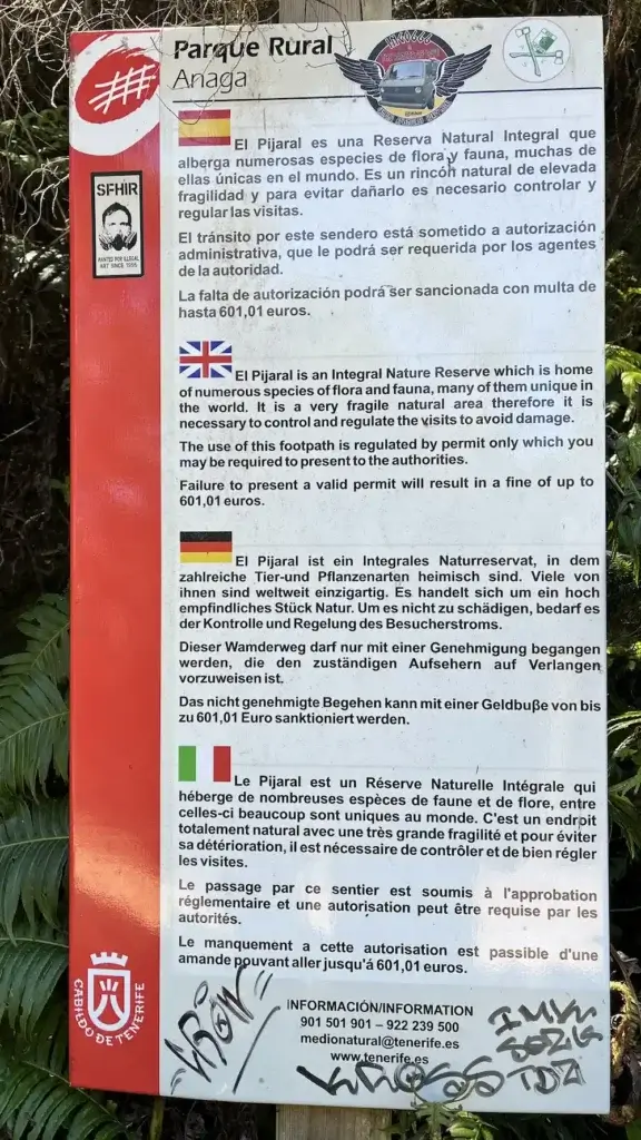
If you want to enjoy longer sections of a forest like in the picture, you have to choose the Tf-7 or El Pijaral trail. However, you need a free permit to hike this trail.
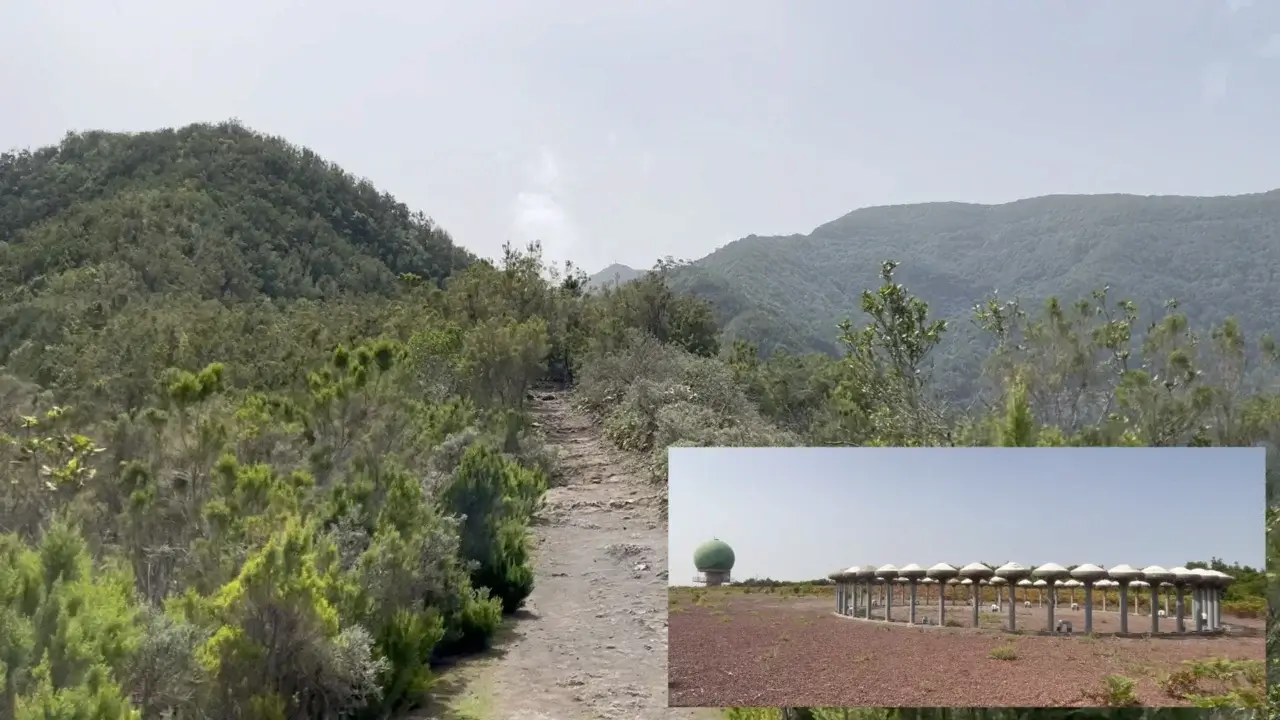
Taborno radar station
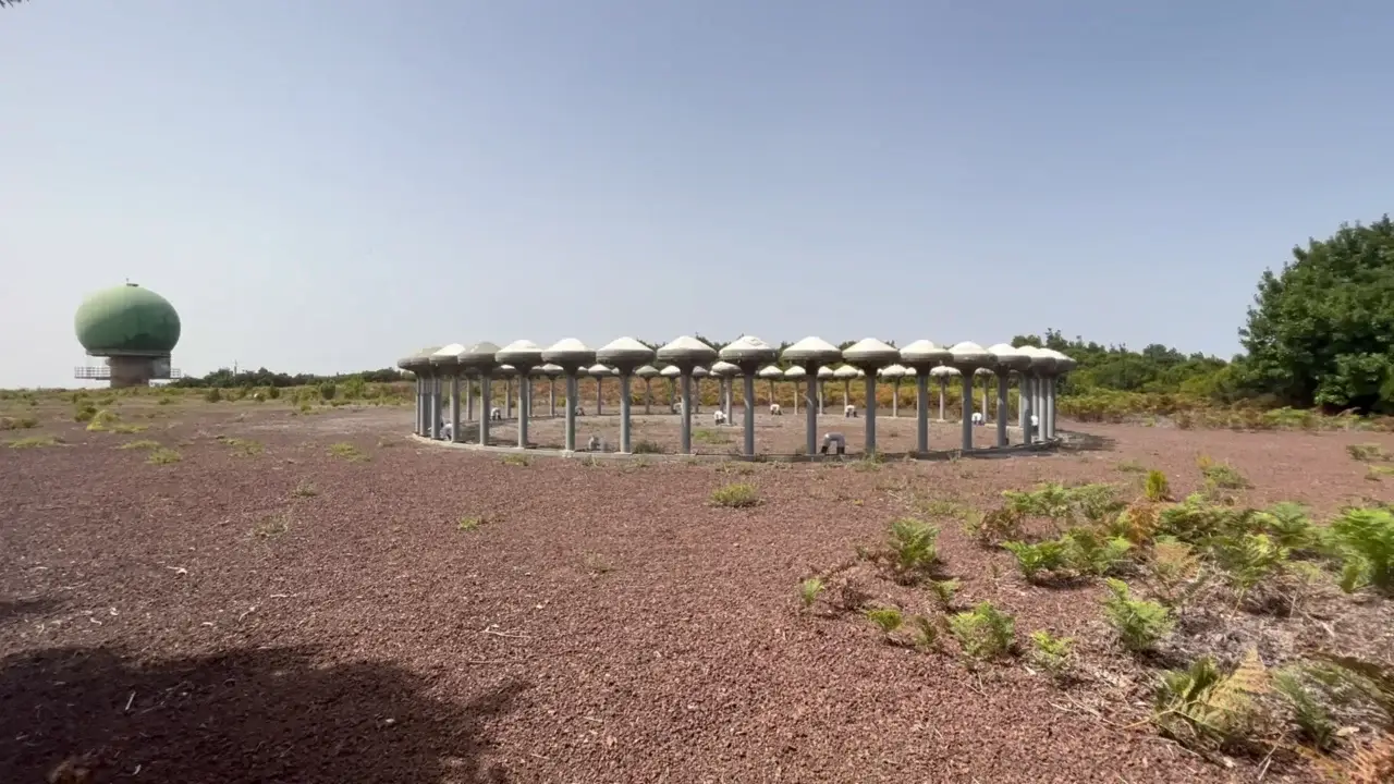
One of the weirdest locations on this trail is the Taborno radar station. I believe it’s a weather radar and it looks like something out of the X-Files television series.
It’s at kilometre three in the trail (2nd mile). This is what it looks from the top.

One way how not to miss it is if you encounter this sign Area de Acceso Controlado that’s fixed onto a barbwire fence.
To take a look at the Taborno radar station, you have to slightly walk up the hill. Once you see a wall like this, you have to walk to the left and there you will have a view like in one of the images above.
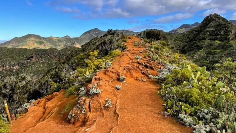
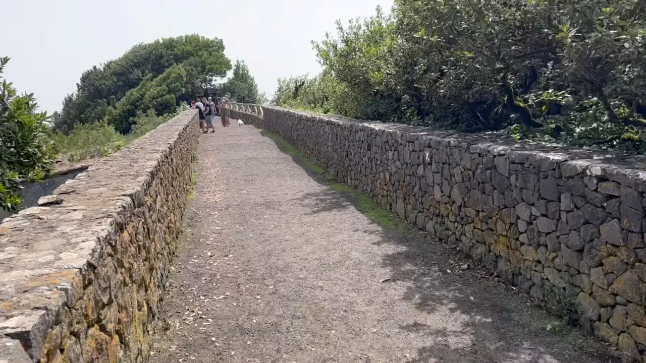
Camino Viejo al Pico del Ingles (Old English Peak Road)
One of the reasons why to choose the TF-2 trail is the old English Peak Road, ‘Camino Viejo al Pico del Ingles’. It’s almost impossible to miss it as you descent the ridge in the centre of the image.

Camino Viejo al Pico del Ingles is definitely among Top-5 Instagram-worthy locations in Tenerife. In case you’re wondering, it’s indeed a road carved out in rock of the mountain.

Surprisingly, it’s allowed to drive on this road, so you can also take pics of your rented ride in the spectacular location.
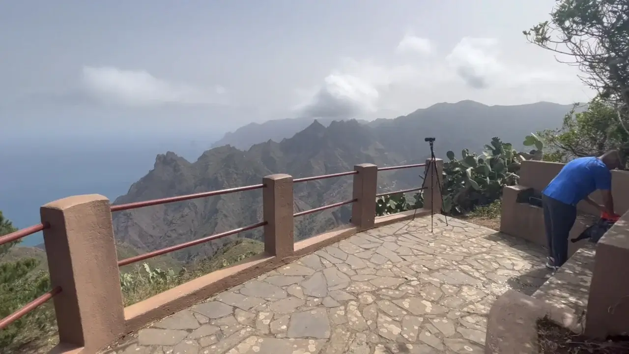
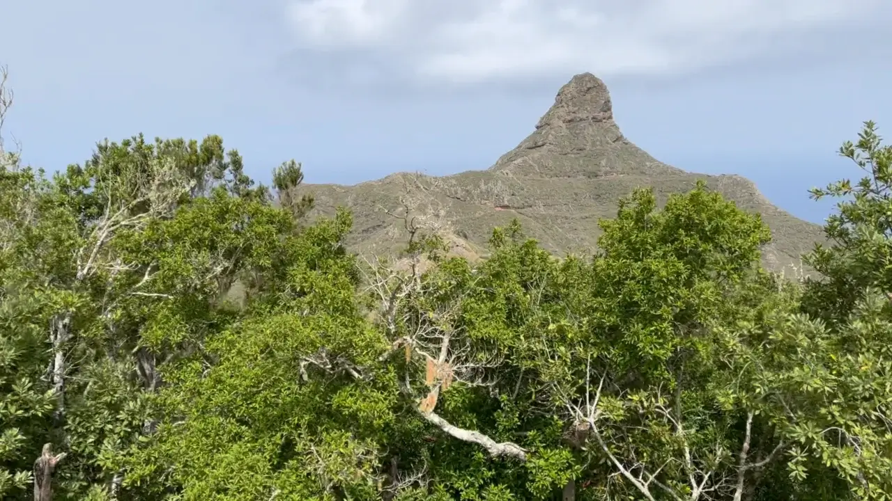
Pico del Ingles and Mirador Pico del Ingles

About 300 meters from Camino Viejo al Pico del Ingles, it the English Peak or ‘Pico del Ingles’ lookout or mirador.
This is the walk to the look out. There is also a parking lot for about eight cars next to the lookout.

On a good day, you can expect to get used like this from the lookout. In the distance, it’s indeed the Teide volcano, so you can see about 50 km / 30 miles or even further away.
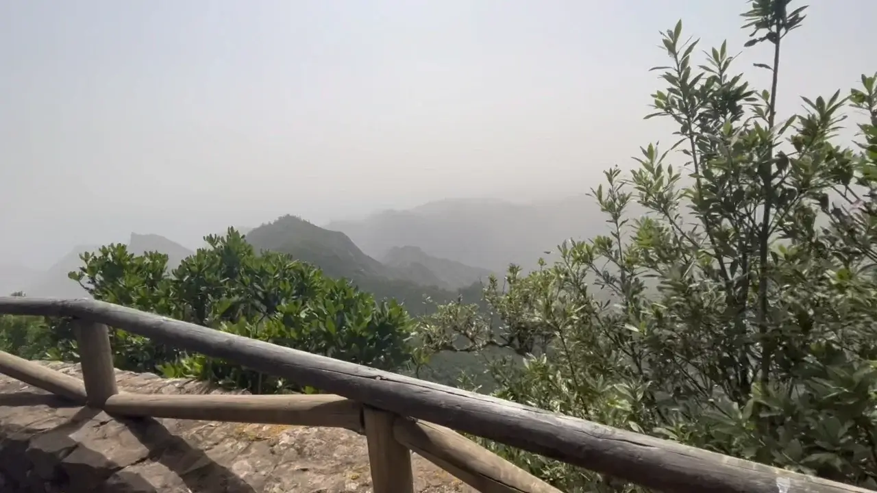
However, if you arrive on a cloudy or foggy day, then you will get views like this.

If the weather will cooperate, you will also see the Gran Canaria Island.

This image allows you to assess how far the Mirador Pico del Ingles is from the Taborno radar station – it’s about a kilometer / 1000 yards.
Volcanic phenomena on the trail

After Pico del Ingles the trail mostly goes downhill. The trail surface alters between rocks and packed clay.

Shortly after Pico del Ingles, you’ll get to observe evidence of the volcanic origins of Tenerife. There is this nice rock outcrop where the rock slabs stand vertically – a sign of the epic geologically processes the island has undergone.
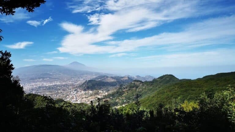
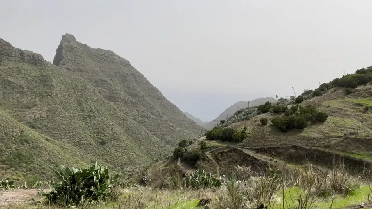
Valleseco and beautiful Anaga vistas towards Santa Cruz

This is the view that you will get as you descend towards Valleseco. Behind the most distant ridge, there is the city of Santa Cruz de Tenerife.
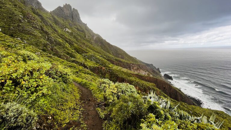
To illustrate what hiking on the TF-2 is like, this is the downhill view.
And this is the uphill view.
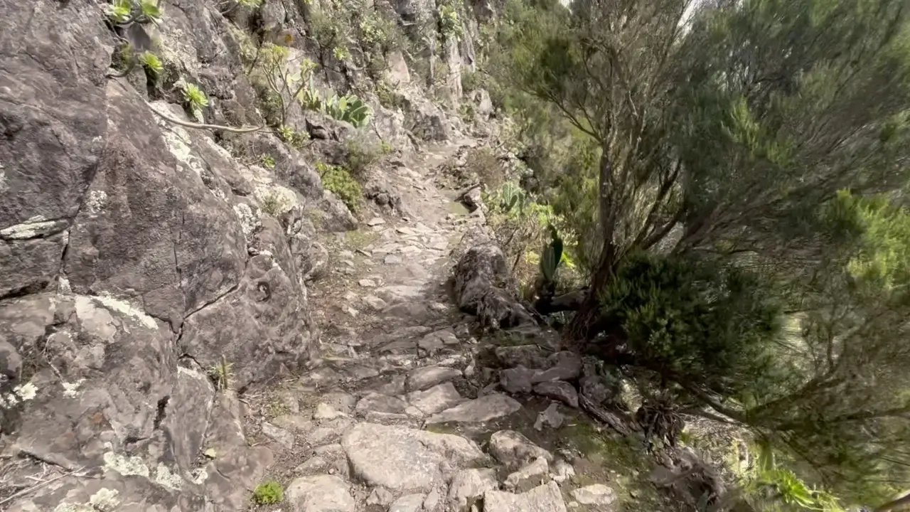
And this is what rocky sections of the trail look like.
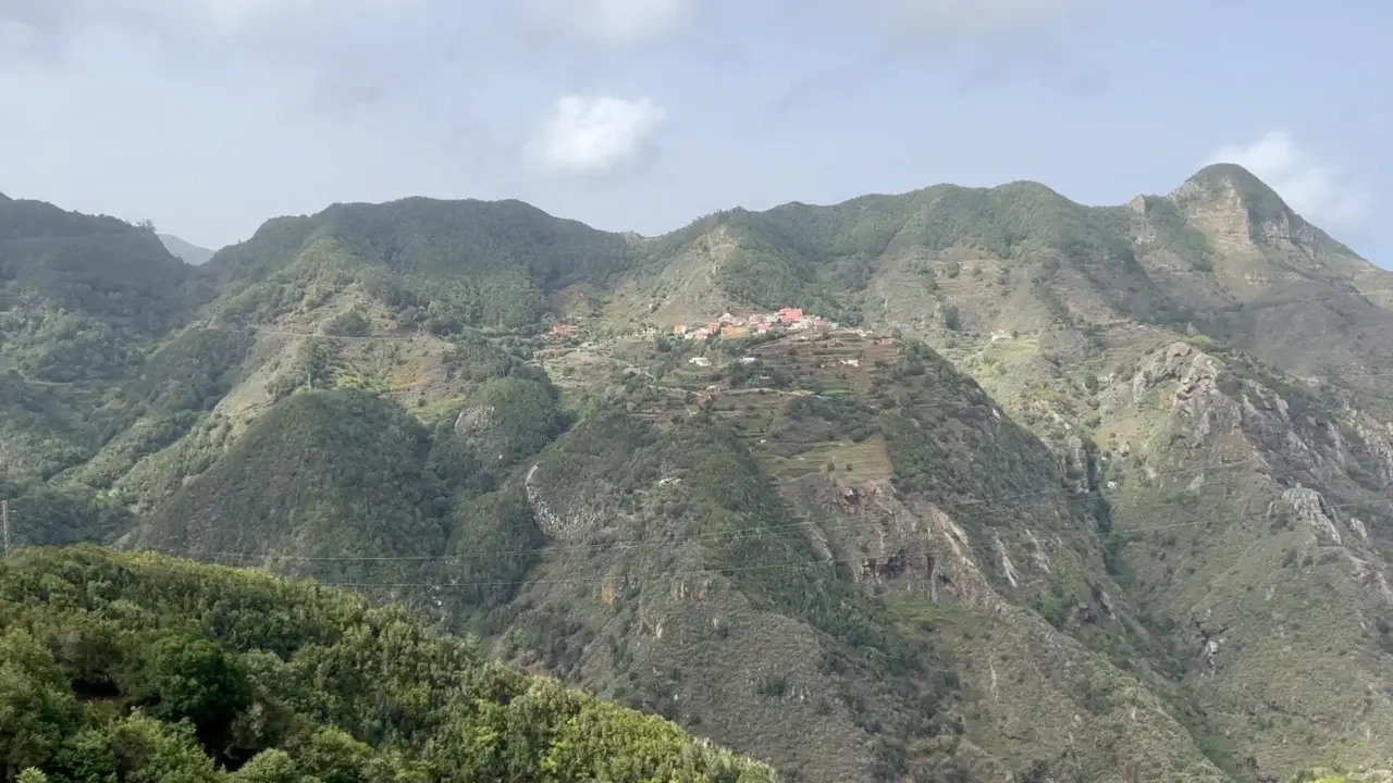
Settlements near Los Catalanes and the halfway mark

This is just a nice image of the trail markers with Valleseco in the background.

Around kilometre six / mile four, you might be tempted to descend down to the valley and to this farm. However, the trails goes on the ridge of the mountain. If you’ll decide to descend, you’ll have to do an arduous ascent back to the trail (like I did as I didn’t pay attention to the trail markers).
This blue house is the mid-trail marker.
Steepest part of the TF-2 trail

Around this location, there are probably the steepest sides of the trail. I wanted to illustrate these for people with vertigo or those hiking with kids or dogs.
The trail itself is mostly quite wide, however, there are sections where you would have to hold your dog or child.
People with vertigo might also abstain from the TF-2 trail because of this relatively short section. It’s just a few hundred meters like this.
You can get a better impression from the trail video to assess whether this trail is for you.

I was regularly amazed at locations that people chose for their houses. This particular house has no roads leading up to it so everything to sustain oneself has to be brought up by foot.
An excellent location for an Airbnb vacation. However, I can’t imagine what it’s like to live here long-term.

This marker shows the 2/3 of the trail are already behind you. Now you are in Valleseco proper.
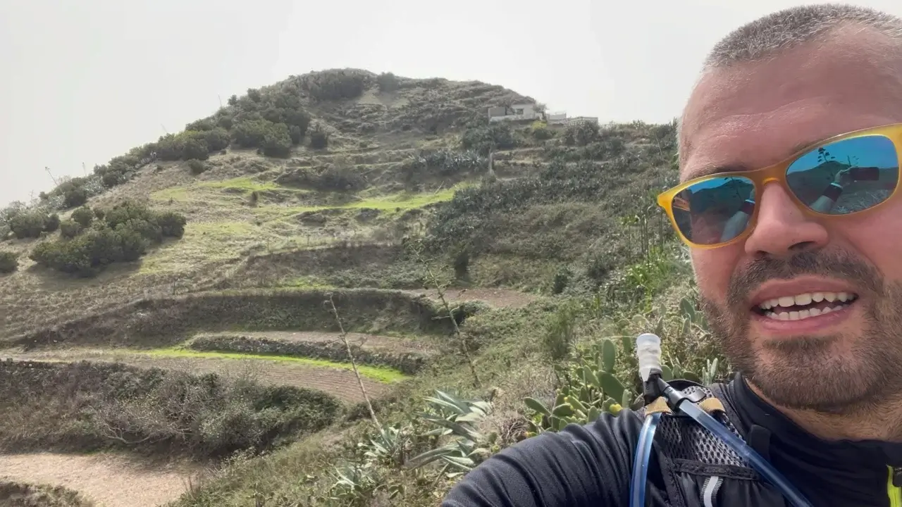
These are the views that characterise VSCO, and all of the trails on this side of the Anaga Rural Park – TF-2, TF-3, and TF-5.
I found it very interesting to observe the agricultural habits and methods on this trail. Amazingly, people found a way how to farm crops on this type of terrain.
Best TF-2 lunch spot

At the kilometre 7 / mile 4 1/2, you will find this spot which is probably the best lunch location on the entire trail because it’s nicely shaded.

Some more views of Valleseco or the ‘dry valley’. However, as you will find out when reading on the Internet or hiking this trailer yourself, Valleseco is actually one of the most humid / vet areas on the entire island of Tenerife.
Waterfall

While Tenerife has no rivers, you will experience the occasional stream in the Anaga Rural Park. These streams are possible due to the occasional rain or humidity accumulating on the mountain surfaces from fog.
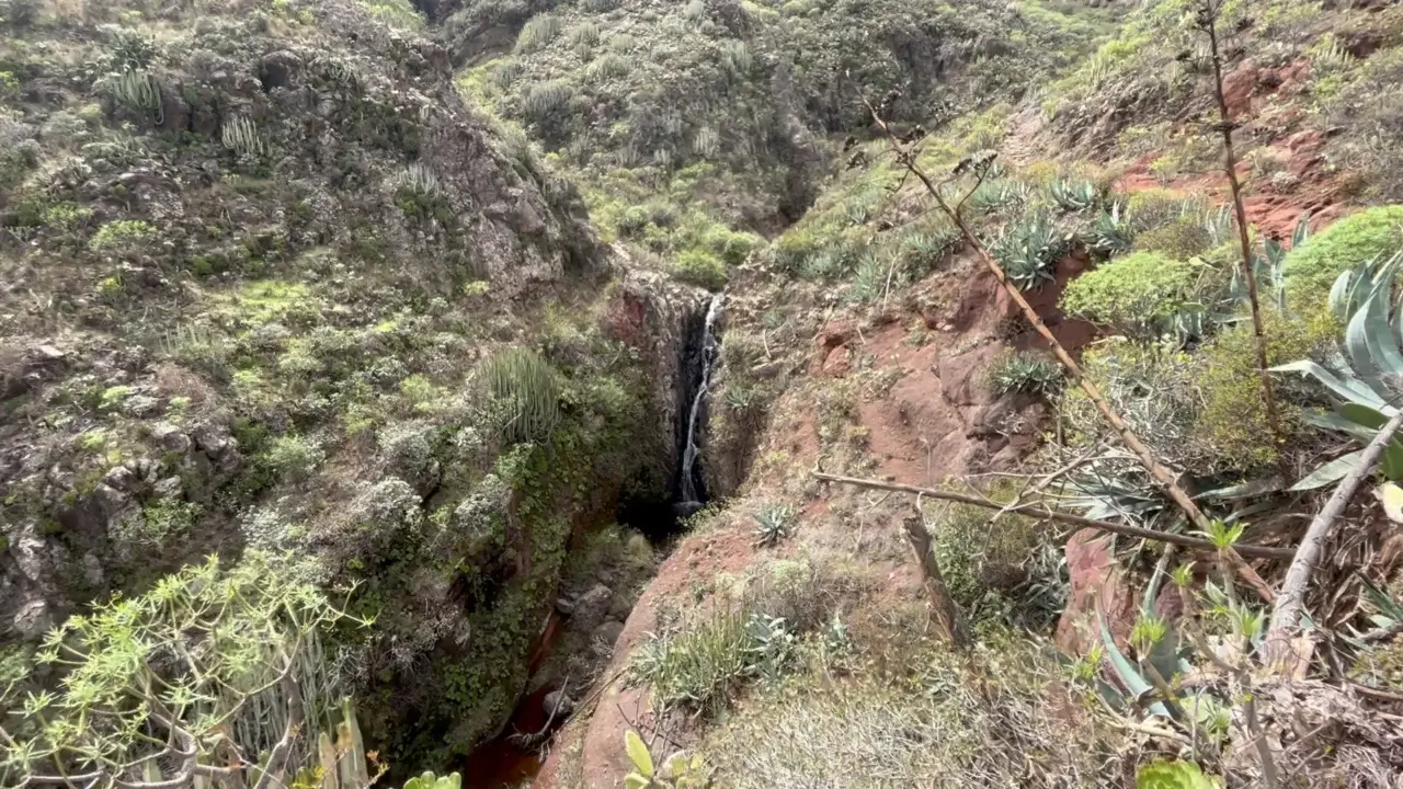
Here and there, you even get a waterfall.
Aquaduct

Transportation of water in the Anaga Rural Park is a major feet of engineering due to the terrain. Here’s an aquaduct.
Approaching Las Cuevas village
As you will approach the end of the trail, you will reach a village. This village will allow you to observe local agricultural methods and what people produce in their fields and gardens.
As you will reach the Las Cuevas Village, it has the terminal bus station. This is where you can catch a ride back to Santa Cruz.
However, buses go rather infrequently to this location, so you might just as well continue the 2 km / 1,51 miles down to Playa Valleseco to reach the main road connecting Santa Cruz and Playa Las Teresitas where more public transport busses stop.

This is the road to Playa Valleseco. While boring, most hikers will appreciate the smooth surface downhill.
TF-2.1 variant with a splendid ridge walk
If you want to experience a very nice ridge walk while doing the TF-2 trail, consider starting it with the TF-2.1 variant.
The TF-2.1 variant also starts in the Taborno village, but connects you to Pico del Ingles through an alternative route compared to the TF-2 route. The TF-2.1 will give you views like in the video below.

The TF-2.1 variant connects Taborno and Afur villages and the TF-2 and TF-8 trails. To complicate things further :), for about half of the ridge walk the TF-2.1 also intersects with the TF-9 “Three villages trail”.
How to Get to the Trail Head in Taborno village
By Car

You can reach the Taborno village by car in 30 minutes from La Laguna and 45 minutes from Santa Cruz. If you are coming from the South of the island, plan for around 1,5 hours.
All major navigation apps will find the village without any issues. Bear in mind that parking in the village is limited, so it’s best to arrive early morning / later afternoon to find a good parking spot.
As the streets are narrow, be prepared for tight navigation, parking close to a rock wall, etc.
By Bus

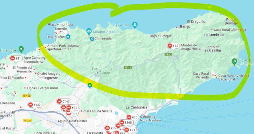
This is a map of all buses serving the Anaga Rural Park. The Taborno village is served by the same busses serving the Las Carboneras village.

Taborno village is served by bus 275 and also bus 172, although the latter is not listed on the map.

This is the bus schedule at the end of the trail in the Las Cuevas village.
You can always find the up-to-date bus schedules on the Titsa webpage.
Hiking with a Guide
For those who prefer a guided excursion, there are local companies offering guided hikes on the TF-2 and other trails in Anaga.
We had a very good experience with getting guides through the Get Your Guide website. I’ve reviewed one of these experiences – canyoning in the Barranco de Los Arcos ravine. Several guided Anaga hikes and other Tenerife experiences are shown below, but you can find many more on the platform.
This post may contain affiliate links. If you click one, we may earn a commission at no cost to you.
These organized tours provide certified and knowledgeable guides who can share the area’s history, flora, and fauna while ensuring the group stays on the right path. Additionally, they often offer transportation directly from Santa Cruz de Tenerife, La Laguna or even South of the island. This eliminates the need to drive on the narrow mountain roads yourself.
Guides can also be found through the Tenerife Hiking Community Facebook group. Hiking with a guide can be a great option for those looking for a more structured and informative experience on the trail. All local certified guides found through Get Your Guide or other channels will provide insurance for participants during the hike.
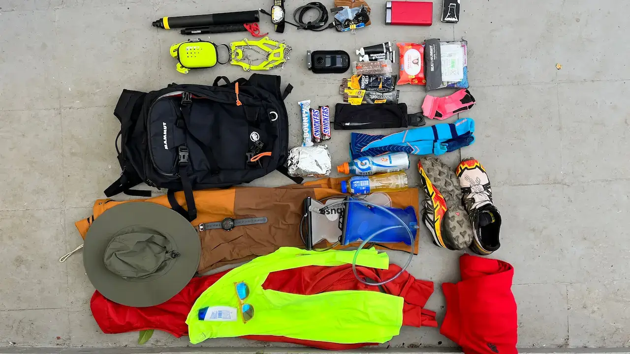
Packing List for Hiking in Anaga
Food and Hydration
When preparing for a hike in the Anaga Rural Park, it is important to ensure you have enough water and food (in that order). Sufficient amount of water is particularly important during the hot season month of May-September as many of the best Anaga trails have large sections in open terrain without tree coverage.
Our suggestions for food items to bring along include:
- Sandwiches. Some towns and villages have restaurants and small cafes. However, there are trails that are less well served. Better to come prepared.
- Trail mix of nuts, dried fruits, and seeds to provide a quick energy boost.
- Bananas and other fresh fruits. Apples and oranges are also good choices as they stand up to heat and don’t get easily bruised.
- Energy bars and energy gels with sodium. Need for these will depend on your physiology and length of the hike, however, I would suggest to take along at least a few energy bars or sodium (and caffeine) gels in this trail to compensate sweat loss, avoid leg cramps and give an extra energy boost. If you haven’t hiked steeper hills in very hot climate before, be ready for significantly higher energy and fluid loss. You can stock up on these in the La Laguna Decathlon.
For hydration, it is vital to carry enough water or other liquids to last the duration of the hike. It is best to assume that there are no water sources en route (very few trails have a cafe on them, and even fewer have a pottable water fountain). A general guideline is to bring 0.5 to 1 liter of water per hour of hiking, depending on personal needs. I personally took 2-3 liters per hike and generally consumed it all by the end of a trail. It might be more during summer months, and less if you’ll hike in the November-March period or are a smaller person.
Equipment
While the necessary gear for hiking largely depends on individual preferences, we’d classify the following as necessary items on hikes in the Anaga Rural Park (in priority order):
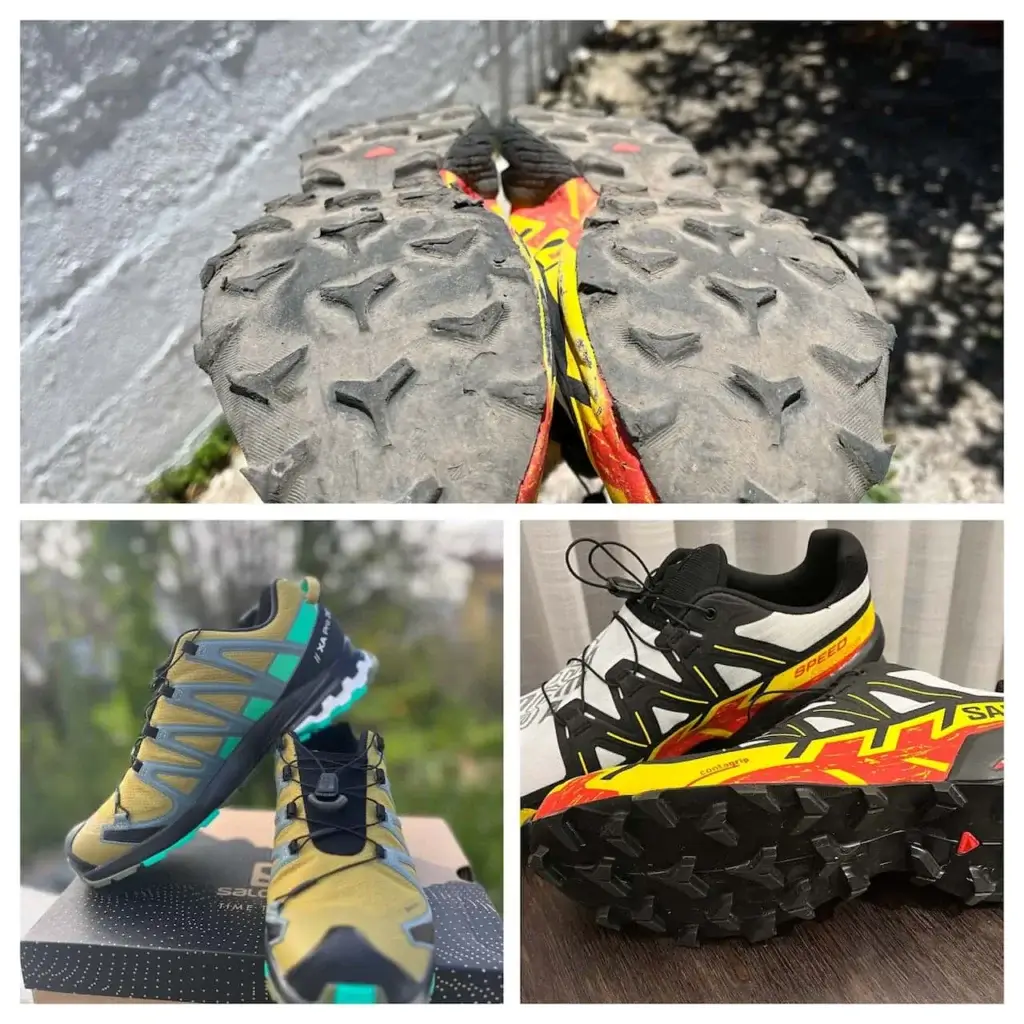
- Comfortable hiking shoes and hiking socks. Hiking boots are not necessary, but definitely get hiking shoes with a good protector and toe protection. Hiking boots might be particularly uncomfortable during the hot season from May to September. We’re quite fond of the Salomon, Merrel, and Hoka trail shoes.
- Water flask or “camelback”. If you use a water flask, carry with you a sufficient amount of water for refills.
- Hiking backpack. A lightweight one-day backpack with comfortable straps will allow you to carry all necessary items during the hike.
- Sun protection. Bring sunscreen, sunglasses, and a hat to shield you from the sun during the hike.
- Power bank to charge your phone, as most people take a lot of pictures and videos when hiking in Anaga. You also should have your phone charged in case you need to call for help, although phone coverage can be spotty on this trail.
- First aid kit. A basic kit with band-aids, pain relievers, and any necessary personal medications can help with minor injuries or illnesses.
- Rain gear (necessary only in the December-February period).
Optional gear:
- GPS watch or a GPS device. This will save your phone battery even if you’re not a ‘quantified self’ zealot.
- Walking sticks, if you are used to them or your sense of balance is not that good.
Markings
All Anaga trails are well-marked with the typical white-and-yellow flag signs painted on rocks and other objects in places where there’s a chance you might choose the wrong direction. While most Anaga trails are easily navigated even without a map or a GPS device, we recommend to have a trail map on your phone and periodically check if you’re on the right path.
Some trails like TF-11, TF-8, TF-2 and TF-4 have spots where the navigation flags are not easily visible and you can take a wrong turn relatively easily. Our favorite GPS apps were Maps.me and Wikiloc, but others like AllTrails and Komoot are also widely used.
Be sure to download the necessary maps and routes before starting your hike. While there is phone reception on most routes, data connection is frequently a problem.
Facilities on the Trail (Cafes, WCs)
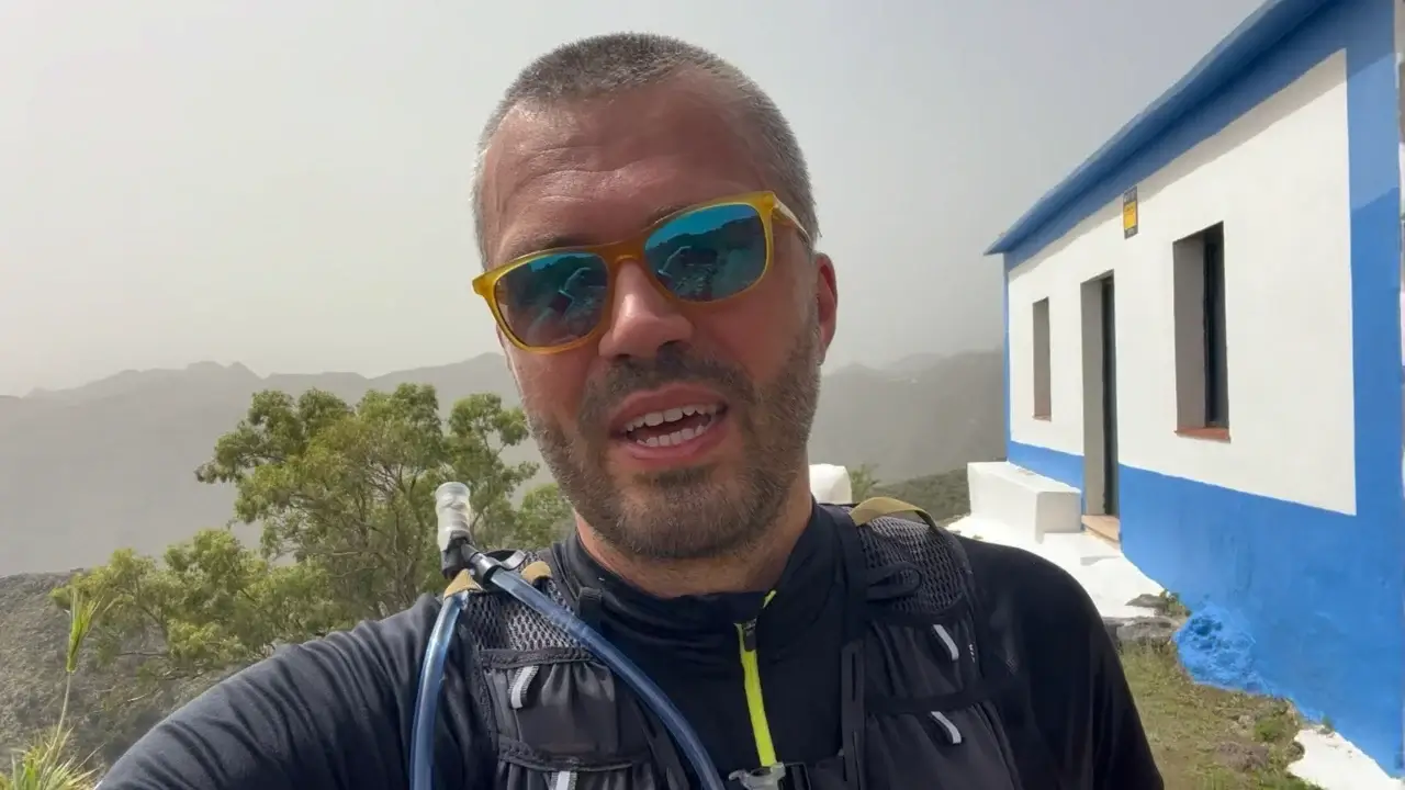
TF-2 ends in the Cruz del Carmen location. There you will find not only the Anaga Rural Park Tourist Information Centre, but also a restaurant named, very originally, Cruz del Carmen.
Safety
General Tips
Summer: During the summer months, we recommend bringing plenty of water, sun screen, and wearing appropriate headgear and clothing to protect against the sun. The heat can be very intense, so it’s essential to shield yourself, stay hydrated and take breaks when needed.
Rainy Season: In the rainy season, the trails can become slippery and more prone to landslides. Wear shoes with good traction, bring a rain jacket or a rain poncho, and be prepared for sudden changes in weather conditions. Remember that the temperature on average decreases by 1.8 degrees F / 1 degree C for every 100 vertical yards / vertical meters. If the temperature is still pleasant at ocean level in Santa Cruz, it can be quite cold when arriving in locations higher in the Anaga mountains.
Closed Sections of the Trail
The TF-2 has no closed sections.
Do You Need a Permit to Hike the TF-2?
No permit is required to hike the TF-2 trail.
Only Sendero el Pijaral (former TF-7 trail) requires a free permit in the Anaga Rural Park.
Do You Need a Guide to Hike the TF-2?
You do not require a guide to hike the TF-2. You might want to book a guide if you want to get a nice introduction to the history of the region, its culture, as well as flora and fauna.
Dangerous Animals and Plants
Tenerife has no dangerous fauna, and very few somewhat dangerous plants that can cause skin and eye irritation. These are not an issue on the TF-2 trail.
If you hear something rustling in the grass, it’s just a family of lizards, as there are no snakes on the island (thank god!).
Can You Hike the TF-2 with Children?
TF-2 is a child-friendly trail, however, the first ascent from the Taborno village to Camino Viejo al Pico del Ingles might be a bit strenuous. If you want to avoid it, start the trail at the Pico del Ingles lookout (mirador).
If you are looking for other child-friendly trails in Tenerife, we can also recommend Sendero de los Sentidos (starts at Cruz del Carmen and partially intersects with TF-1 trail), TF-4, or TF-5, all in Anaga. In the Teide National Park we recommend the Chinyero loop, Sendero de Samara, loop around Montana Negra, or the super-scenic and short Sender Roques de Garcia.
Mouflon Hunting
Mouflon hunting may rarely take place in the Anaga Rural Park. If it’s planned or ongoing, there will be signs at the trailhead and at regular intervals. Choose another trail if mouflon hunting is ongoing.
Forest Fire Warnings
Forest fires can be a risk in the Anaga Rural Park, especially during the hot season. There are years when the trails are closed for days or weeks due to forest fires or their risk.
Weather in Anaga Rural Park in Each Season
In Anaga Rural Park, the weather varies throughout the year, offering different experiences for hikers in each season.
Spring is a beautiful time to visit the park, as the temperatures are mild, ranging from 15°C to 20°C (59°F to 68°F). The chance of rain is moderate, but the lush green landscapes create nice views along the trail. As the laurel forests come to life, you’ll experience best what Anaga is famous for.
Summer in Anaga Rural Park tends to be very hot and dry, with temperatures going over 30 °C (86°F). The heat can make hiking challenging, so it’s vital to stay hydrated and protected from the sun as most of the trail goes in open terrain.
The calima, a hot and sandy wind from the Sahara desert, may occasionally affect the park, reducing visibility and increasing temperatures. Calima negatively affects people with asthma and other respiratory issues. Public authorities regularly warn of calima.
The Autumn season brings cooler temperatures, ranging from 20°C to 30°C (68°F to 86°F), while rain is still uncommon until November and December. Mild showers are possible, but most often these are a welcome respite.
Winter from December to mid-March sees temperatures ranging from 10°C to 18°C (50°F to 64°F). There can be a very high chance of rain, so come prepared with proper clothing, waterproof gear, and footwear. Despite the cooler weather, winter can be an excellent opportunity for hiking the TF-6 trail, as you’ll find fewer crowds and a serene atmosphere.
Anaga Rural Park Rules
Lighting a Fire
Lighting a fire is strictly prohibited, even gas stoves.
Wild Camping
Wild camping is officially not permitted.
I’ve asked park rangers about wild camping, and the unofficial policy appears to be that as long as you clean up after yourself and leave a location as you found it, you should not run into trouble. Camping should be done only in groups of 1-2 persons.
Collecting Flora and Rocks
Preserving Anaga Rural Park’s unique biodiversity is crucial. Therefore, it is striclty prohibited to collect flora (plants, flowers, fruits, etc.) or rocks from within the park.
Border guard and customs officials regularly check for plants on the border. For example, my wife’s plants purchased and collected on the island outside protected areas were anyway confiscated by customs officials when she arrived on Spanish mainland with a ferry.
Taking Trails Without a Permit
There areas in Anaga which are strictly of limits such as the Monte Aguirre area close to Cruz del Carmen.
The only trail requiring a free permit is the Sender El Pijaral trail. If you are caught on this trail without a permit, or in any of the prohibited nature reserve areas, the fine can go up to 601.01 euros.
Where to Stay in Anaga (Recommended Hotels and Homestays)
There are not very many options of staying overnight in the Anaga Rural Park itself and these are concentrated in the largest villages like Taganana, Almaciga and Benijo. I’ll add recommended options for hikers at a later date. In the meantime, search Booking.com for Anaga, read the reviews and check the accommodation’s proximity to hiking trails.
Useful Resources for Hiking in Anaga Rural Park
Tenerife Hiking Community on Facebook
We recommend joining the Tenerife Hiking Community on Facebook to connect with fellow hikers and gather useful information before embarking on your hike in Parque Rural de Anaga. This online community shares helpful tips, experiences, and suggestions from those who’ve previously explored the various trails in Tenerife and other Canary Islands.
Cruz del Carmen Tourist Information Centre
We found it very useful to visit the offical Anaga Rural Park Information Centre (Centro de Visitantes del Parque Rural de Anaga) at Cruz del Carmen close to the park border when driving from La Laguna.
The centre has English-speaking and very competent staff. You can also obtain a printed leaflet for each of the Anaga trails there (if they haven’t run out of these), as well as an excellent material about all trails on one sheet.
Visiting the centre is an excellent way to make a last check whether the information you have gathered online corresponds to reality on the ground in Tenerife.
Address: Barrio Cruz Carmen, 2, La Laguna, Santa Cruz de Tenerife, Spain (Google Maps location)
Working hours: every day from 9:30 AM to 3:00 PM.
Cruz del Carmen is the starting location of the child-friendly Path of the Senses (Sendero de los Sentidos), end-point of the TF-1 trail that comes up from the Las Mercedes village, as well as the more serious TF-10, TF-11, and TF-12 trails.
Hiking Gear Shops
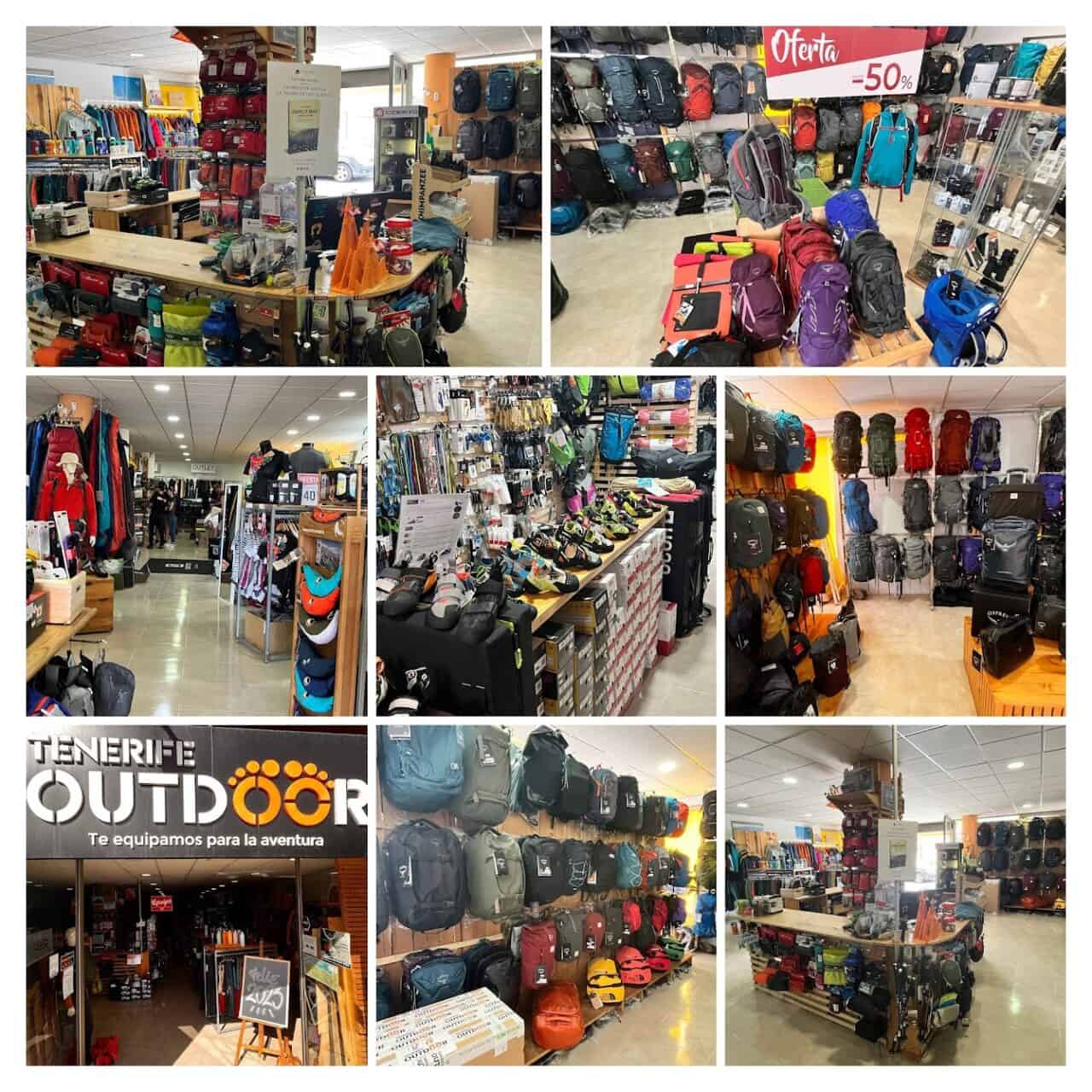
If you are missing some hiking or running equipment or are looking for a possible impulse buy, we recommend you stop by at the Tenerife Outdoor La Laguna store. This is the best hiking and camping gear shop in the North of the island, period. Below are two other recommendations you can also check out before you head out to the Anaga Rural Park.
- Tenerife Outdoor La Laguna, Av. de la República Argentina, 79, Local Bajo, 38208 La Laguna, Google Maps link. A wide selection of top brands of outdoor goods. You can also rent hiking and camping gear like walking sticks for 8 euros a day here.
- base: Deportes Salud, TF-13, 153, 38280 Tegueste, Google Maps link. The small store is more focused on regular sports, but has a decent selection of hiking shoes and walking sticks. Stop by for some good deals during sales periods. We managed to get great Salomon hiking shoes at a 50% discount.
- Decathlon La Laguna, Cam. la Hornera, 160, 38205 La Laguna, Google Maps link
Frequently Asked Questions
The initial ascent from Taborno village up to the Old Pico del Ingles Road and Mirador Pico del Ingles can be a bit difficult. After that the trail goes mostly downhill.
Just wear appropriate footwear with good grip and shield yourself from the sun (and rain in winter months).
You can hike the TF-2 all-year round. Use sun protection from April to October as the trail is mostly not shaded by trees.
A guide is not required to hike the TF-2 trail.
Yes. This is one of the easiest trails in Anaga Rural Park.
TF-2 can be accessed by public transport at both trailheads.
Yes. All Anaga Rural Park trails are dog-friendly. There are no snakes or other dangerous animals on Tenerife, so your dog can roam around quite freely. The only things you would have to watch out for are the occasional dog of another hiker, and trails with steep slopes where your dog might slide or even fall off.