Canary Islands’ Top Natural Wonders: What to See and Do in Tenerife?
This post may contain affiliate links. If you click one, we may earn a commission at no cost to you.
This is a list of Tenerife’s natural wonders. We aimed to include all noteworthy objects and experiences we are aware of so that you can create your own list of 10 things to see and do in Tenerife.
We have aimed to create a list where each recommended place or object has a bit of a “Wow!” factor, and that some items on the list will be a novelty even for the well-researched traveler. If more popular objects have made into the list, there’s a good reason why we recommend a place that’s “on the beaten path”.
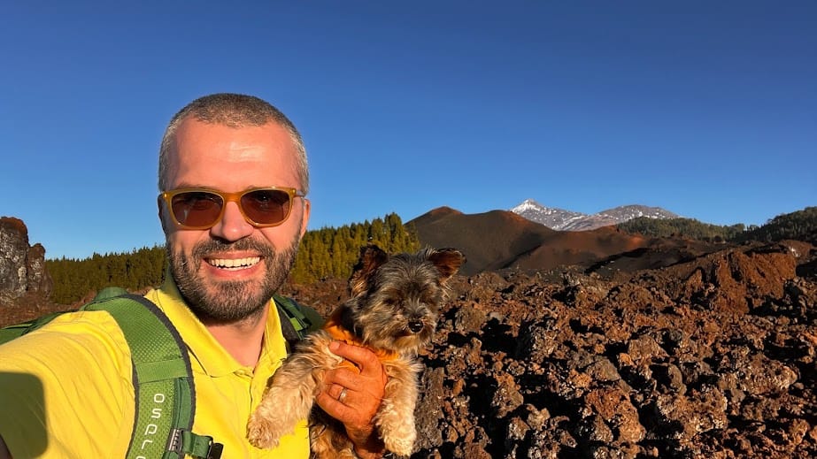
We lived in Tenerife for a year and have visited most of these places ourselves. If a picture below doesn’t have a source attribution, it’s made by a Smart Travel Family member.
Each natural attraction has both a description and also a Google Maps location so you can easily include them in your travel itinerary and visit when you are on the island.
We’ve subjectively arranged them in an order from the most interesting or visit-worthy object or experience at the top.
Is there something we missed? Please add a comment below!
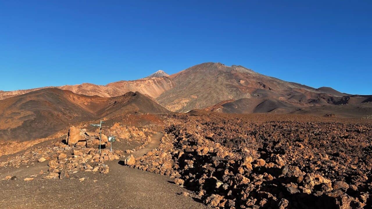
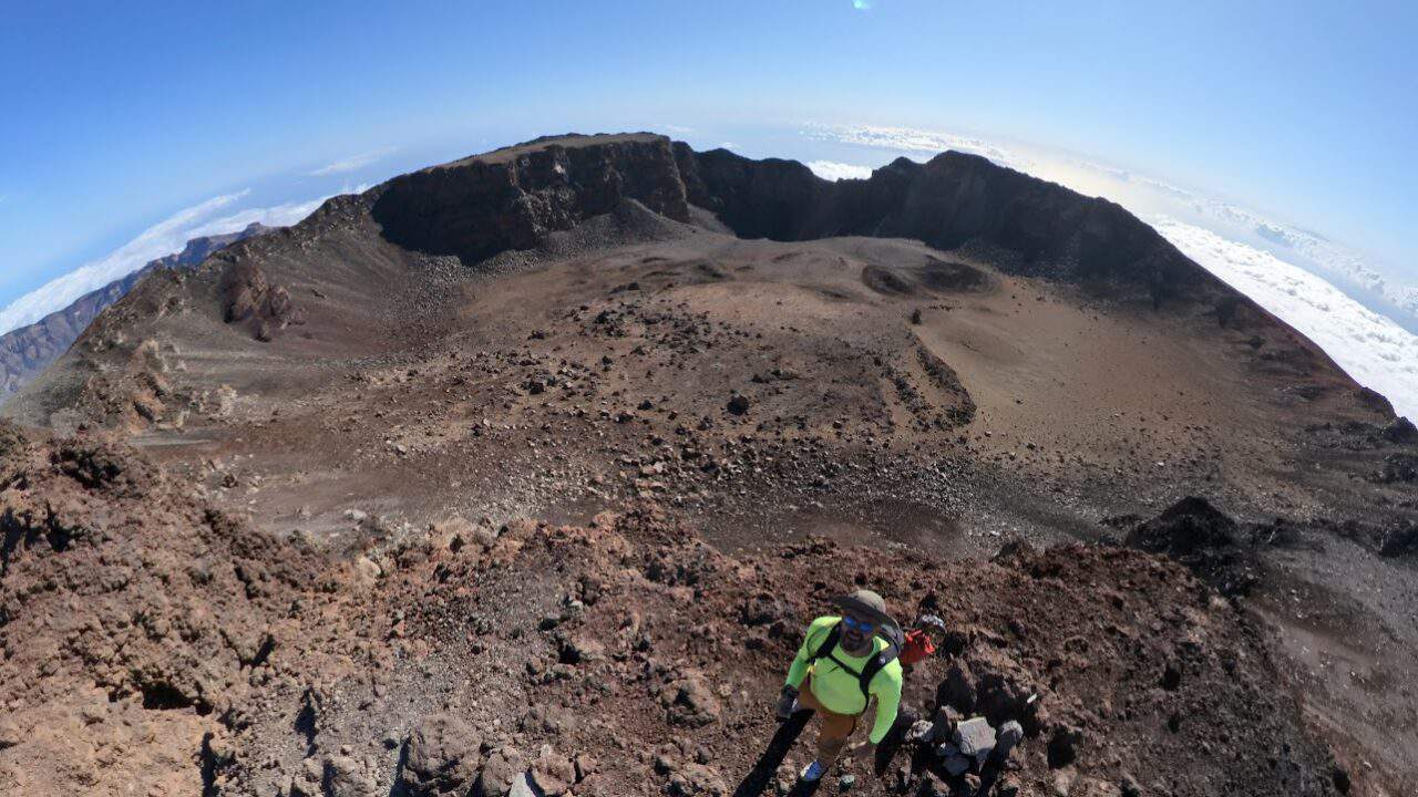
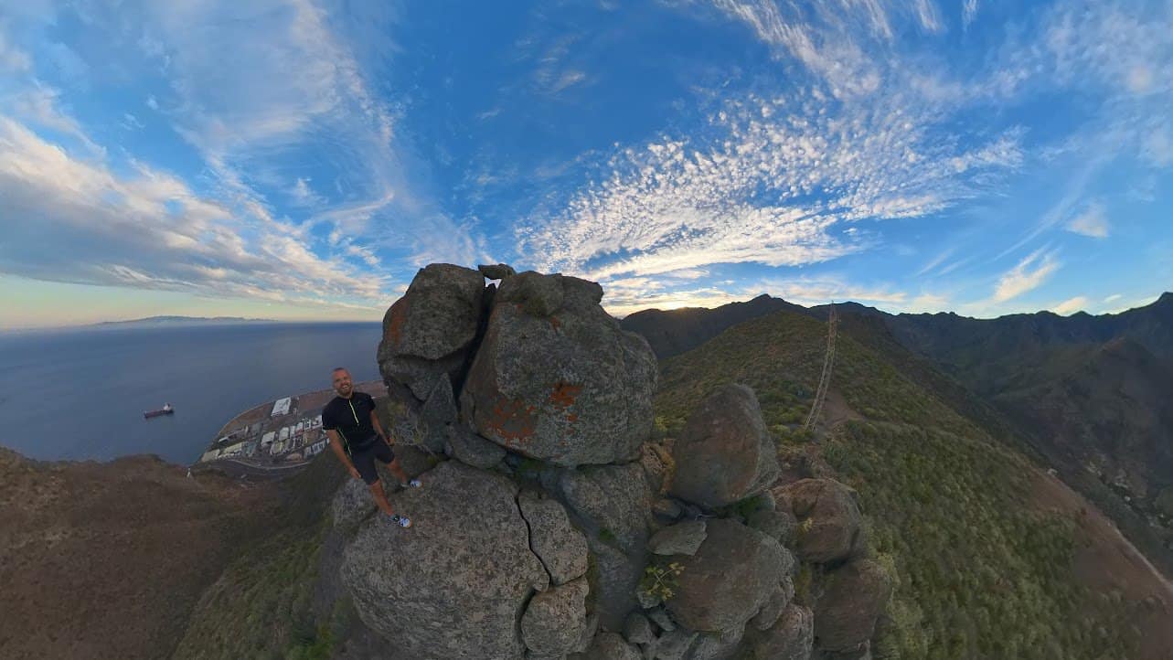
Teide Volcano Peak
While this is probably the most popular location for visitors to Tenerife, there’s a reason for it. The view is just awe-inspiring from the highest peak in Spain, as you see not only the Tenerife island in nearly its entirety but also the nearby islands of Gran Canaria and La Gomera and, if the weather is good, even La Palma. To make the experience truly unforgettable, ascend to the peak by foot in this as one of Tenerife’s bucket list hikes.
🌍Google Maps location of the parking lot next to the cable car
Teide cable car ticket (separate peak access permit required)
Guided hike to Teide WITH PEAK ACCESS permit
Cueva del Viento Lava Tube
This is probably one of the most interesting natural objects that you can visit in Tenerife.
The Cueva del Viento, located in Icod de los Vinos, is a subterranean marvel and one of the most extraordinary volcanic features on the island. Known as the “Cave of the Wind,” it is the largest lava tube system in the European Union and the fifth largest in the world, with its known passages extending over 18 kilometers (approximately 11 miles) in length.
Formed about 27,000 years ago from the basaltic flows of the Pico Viejo volcano, adjacent to Mount Teide, this complex network of underground tunnels presents a labyrinthine world of geological wonders. The constant temperature inside the cave hovers around a comfortable 16°C (61°F), creating a stable environment that supports this diverse biosphere.
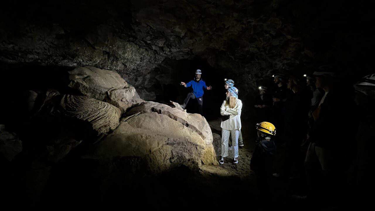
Cueva del Viento has a variety of unique rock formations, including stalactites, stalagmites, and lava cascades. The cave’s biological ecosystem is equally fascinating as it is home to more than 190 species, some of which are endemic to the cave and cannot be found anywhere else on the planet.
The visit is only available with a guided tour, but otherwise, most people would not appreciate how special this experience is. Safe for kids. Not recommended for people with claustrophobia, take this warning seriously.
Buy tickets at least a week in advance to visit on the preferred date. Tours are available in Spanish, English and German.
Los Roques de Garcia
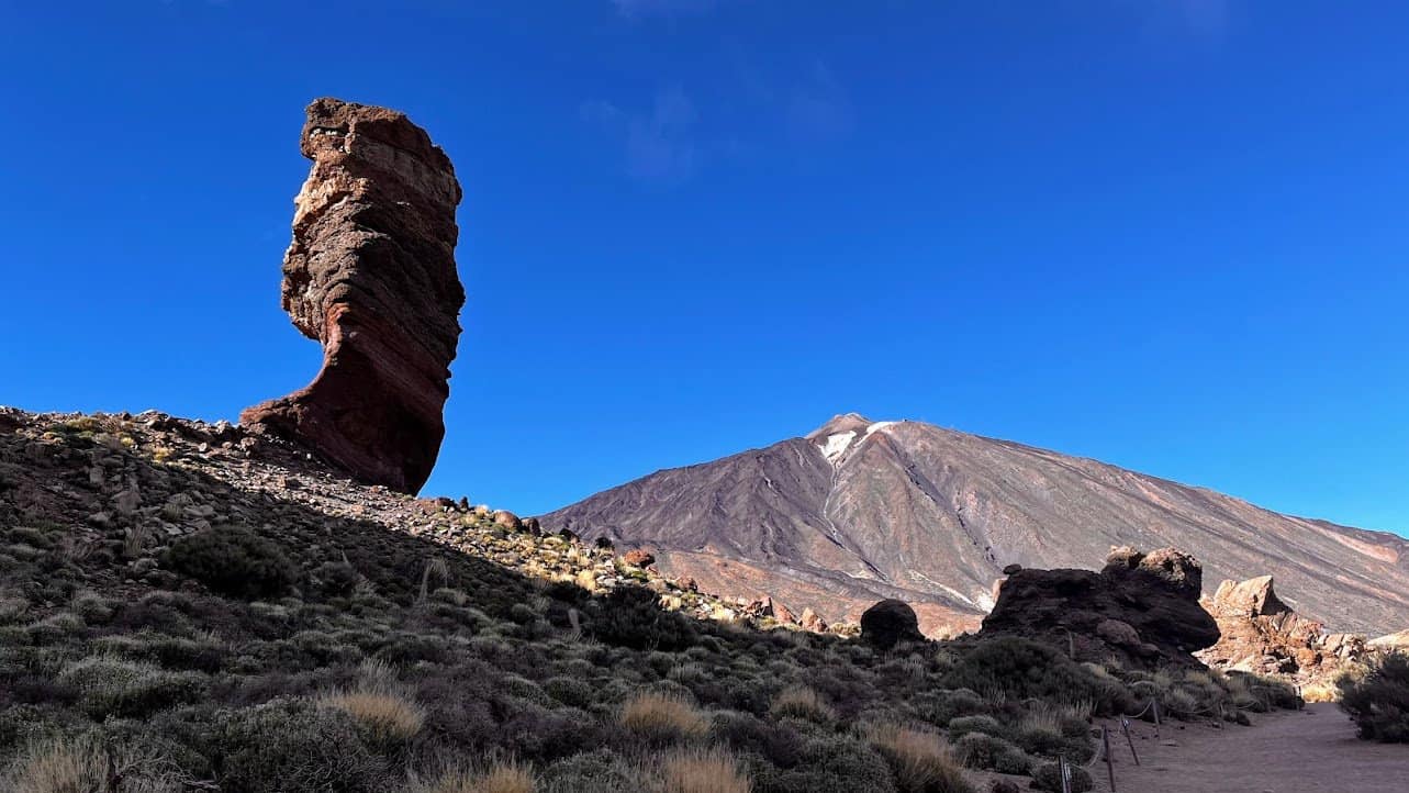
While one of the shortest and easiest hiking (actually – strolling) trails in Tenerife, the Sendero de Los Roques de Garcia has probably the highest concentration of diverse volcanic formations in such a short distance of only a bit over 3 kilometers (2 miles). The trail is right next to the Teide Volcano and should be included in your itinerary when visiting the Teide National Park. It can easily be done by people with no hiking experience.
Chinyero Volcano loop trail
Did you know that this trail goes around the volcano that most recently erupted on the island and as recently as in 1909. The Chinyero Loop (trail TF-43) gives a great introduction to Tenerife’s volcanic origins as well as nature as it partially goes through Canary Pine forests. The trail is very easy and can be done by children and unfit adults, as the only challenge is its length of 7.5km (4.5 miles). In several places the trail goes through lava fields that have quite abrasive rocks so don’t wear your best shoes on this trip.
Parking is difficult at the exact Sendero del Chinyero trailhead, so we suggest to park in the nearby Mirador de los Poleos parking lot that’s legal and has more space.
World’s largest dragon tree
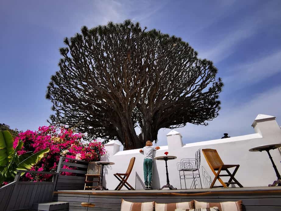
The majestic Drago Milenario in Icod de los Vinos is the world’s largest dragon tree. Visit while it still stands as these old trees are known to collapse from time to time. The tree is advertised as being 1000 years old, although scientists put the age at 400 years which is still impressive.
Legend has it that these trees were once thought to harbor mystical powers, and when you stand beneath its vast shade, it’s easy to understand why. The dragon tree’s sap, which turns a deep red upon contact with air, is known as “dragon’s blood” and has been revered for centuries. The Drago Milenario Park has an excellent and reasonably priced on-site restaurant where you can lunch in the shadow of this special tree.
🌍Google Maps location of entrance to the Drago Milenario park
Sea of Clouds
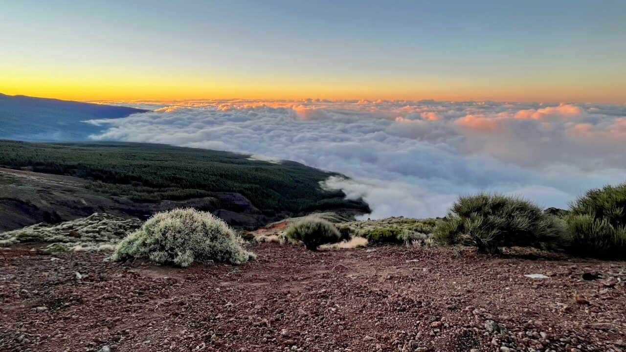
As the rare day comes when Tenerife experiences a cloudy or even a rainy day, head up to the Teide National Park at 2000 meters (6500 feet) above sea level. This will allow you to not only escape gloomy-ish weather for an abundance of sunshine but also experience the breathtaking spectacle of the ‘Mar de Nubes’ or sea of clouds, a natural phenomenon that is likely to leave you spellbound. As the Teide plateau is above clouds, you will see Tenerife as a bird or an airline passenger while still standing on hard soil. It’s hard to describe the impression, but it’s quite surreal.
🌍Google maps locations of best places to observe sea of clouds:
La Rosa de Piedra (lava rose)
La Rosa de Piedra is a very interesting volcanic phenomenon located on the island of Tenerife, showcasing a unique geological formation that resembles the shape of a rose. This large rock formation is the result of lava flows cooling in a very particular way and having solidified into this fascinatingly symmetric pattern.
🌍Google Maps location, the lava rose is situated on the TF-21 road a little above La Orotava.
Pino Gordo
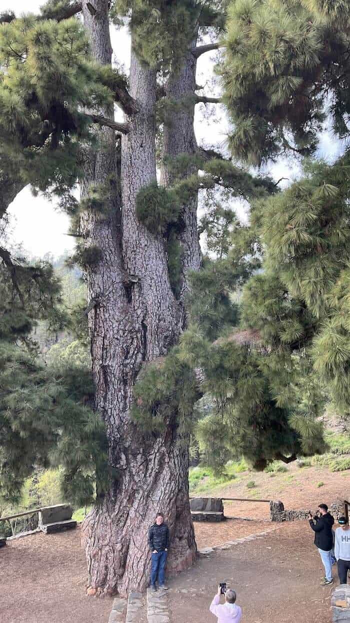
When you go to Vilaflor, the highest inhabited village in Spain (we recommend you do for an afternoon), do not miss Pino Gordo, the world’s largest Canary Pine or Pinus caraniensis.
This genus of pine is unique in that it can withstand forest fires with temperatures of up to 800 degrees Celsius (1470 degrees Fahrenheit) through unique adaptations like a thick, protective bark, branches that regrow quickly, cones that release seeds after fire exposure, and rapid regrowth of needles allows that allows these pines to quickly resume photosynthesis to feed the tree.
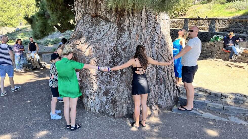
Did we mention that Pino Gordo is 45 meters (about 148 feet) tall with a diameter of 3 meters (9 feet) and takes around 8-10 people to hug it? About 100 meters from it is a tree that doesn’t get as much attention – the 2nd tallest Canary Pine in the world, if you really want to push the “tallest and thickest” envelope.
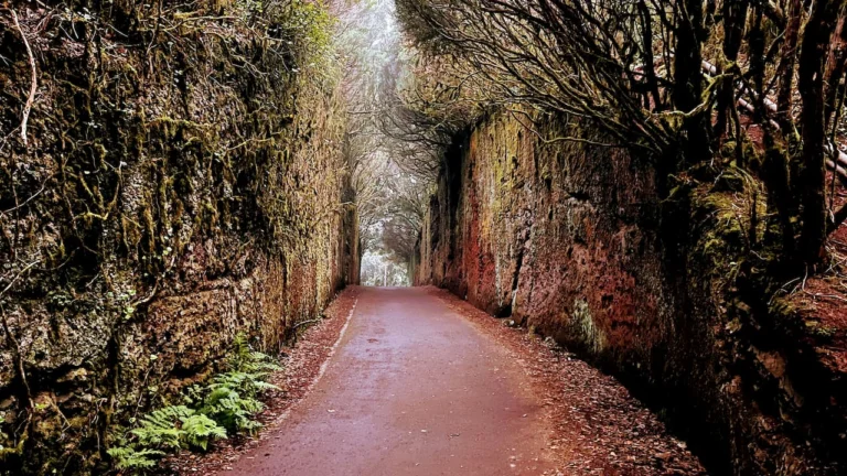
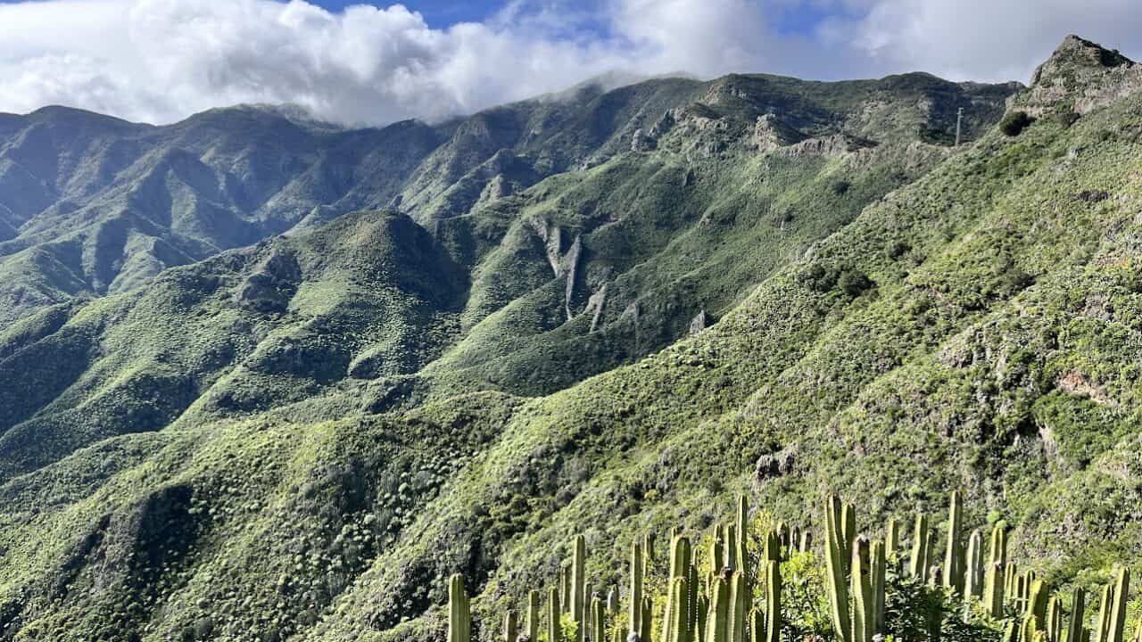
Laurisilva forests of Anaga
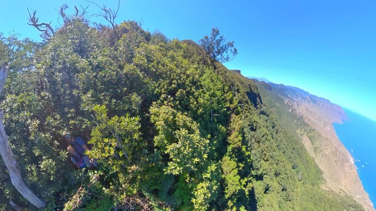
The Anaga Rural Park is home to some of the most unique environments in the world – Laurisilva forests. These primeval woodlands are a sanctuary for unique species of flora and fauna that date back to the Tertiary period. In the forest’s canopy attentive visitors might hear the distinctive calls of Bolle’s Pigeon and the Laurel Pigeon, birds found nowhere else on earth. Here’s a birdwatcher’s dream!
The understory is rich with endemic plants like the Canary Islands heath and the aromatic Laurus novocanariensis, from which the laurel forests derive their name. Ferns, mosses, and lichens festoon the landscape, thriving in the moist conditions sustained by sea clouds that appear every night and sometimes also during daytime. The rich biodiversity extends to the forest floor, where a myriad of specialized invertebrates reside, many of which are endemic to this environment.
You can observe the Laurisilva forests throughout the Park in most locations that are at 600-800 meters (1970-2600) above sea level, however, the most undisturbed forests can be observed when hiking the Sendero el Pijaral and Monte de Aguirre Exclusion Zone trails. These two trails require securing a free permit. If you do not have a permit, one of the nicest Laurisilva stretches is the Casa Forestal – Taganana stretch of the TF-8 trail called Las Vueltas. The easiest but most civilized way to experience this type of forest is the Path of the Senses (Sendero de los Sentidos) right next to the Anaga Rural Park Tourist Information Centre.
🌍Google Maps locations:
- Las Vueltas trailhead at Casa Forestal
- Path of the Senses
- Sendero el Pijaral trail (aka Enchanted Forest, also the former TF-7 trail)
- Monte de Aguirre Exclusion Zone trail
Montaña Samara hiking trail – a true trip to the Moon’s surface
The Teide Natural Park is known for having moon-like features. But where exactly are they? In our experience, the short and flat Samara volcano hiking trail offered the best opportunity to see what it might be like on the Moon, while still basking in a beautiful Teide panorama.
The environment is so different compared to most other places on the island that it’s definitely worth a visit. This is a child-friendly trail and even toddlers could walk most spots, although a stroller would struggle. The trail number is S-13 according to the Teide National Park numbering system.
🌍Google Maps location of the Montaña Samara trailhead
Pico Viejo Crater
If you want to see another Mars-like landscape and are up for a more serious hike than the Montana Samara easy walking trail, consider going up to the Pico Viejo crater from Roques de Garcia.
Formed during a powerful eruption in 1798, Pico Viejo is both a crater, but also Tenerife’s second-highest peak after Teide. With a diameter of approximately 800 meters (about 2625 feet) and a depth of 150 meters (roughly 492 feet), the crater is a vast, open caldera that visitors can marvel at from several vantage points. Standing at the edge of Pico Viejo’s crater, one can’t help but feel humbled by the sheer scale and power of nature’s geological forces.
🌍Google Maps location | To reach it, start hiking from the 🌍Roques de Garcia trailhead
Chinamada Caves
The Chinamada caves system in Anaga Rural Park is probably the most impressive such geological formation on the island. Created through wind and water erosion of the volcanic rock, the caves are not only a natural monument. As the stories go, the caves have also been used by the Guanche people as homes and storage areas in the past.
You can visit the caves while doing the TF-10 and TF-11 trails in the park. You can also go to the caves and back if you just go to the Chinamada village and its only restaurant.
Whale Skeleton and Basalt Columns at Los Silos
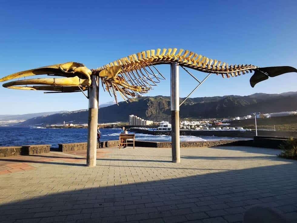
In the quaint town of Los Silos, Tenerife, there’s an excellent marine biology example: the skeleton of a colossal whale that beached on the island’s coast in 2003. When alive, it was a sperm whale that was an imposing 15 meters long and weighed 30 tonnes. This will be an educational and memorable experience for children, but also adults fascinated by the natural world. Right next to the skeleton, there’s also a very good natural pool.
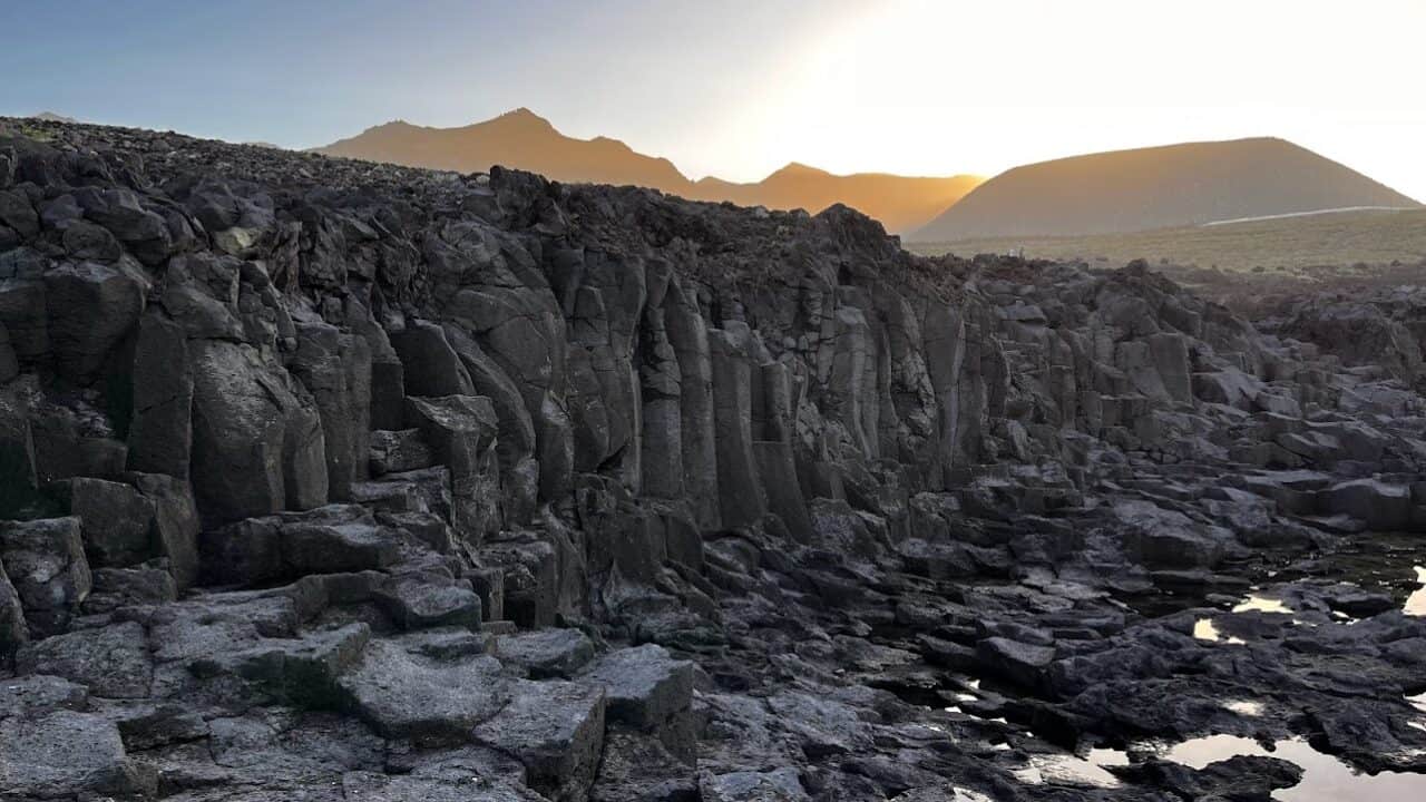
Los Silos is also the location of some of the nices basalt columns in the whole of Tenerife. The are an impressive display of nature’s geometric artistry that will be appreciated not only by geology enthusiasts. The columns are formed as lava flows and slowly cools, and then contracts and cracks, creating these clearly visible hexagonal pillars. If the temperature or cooling is not perfect, the columns turn out slightly bent and crooked, like in Los Silos. The basalt columns are a must-see for anyone visiting the area around Los Gigantes, Masca or Garachico that beautifully illustrates the island’s volcanic heritage.
If hungry, we can recommend the democratic, but tasty El Boreal restaurant nearby. Keep an eye on the local ice cream van as well!
Blooming of Teide brooms aka Tajinaste (time-sensitive)
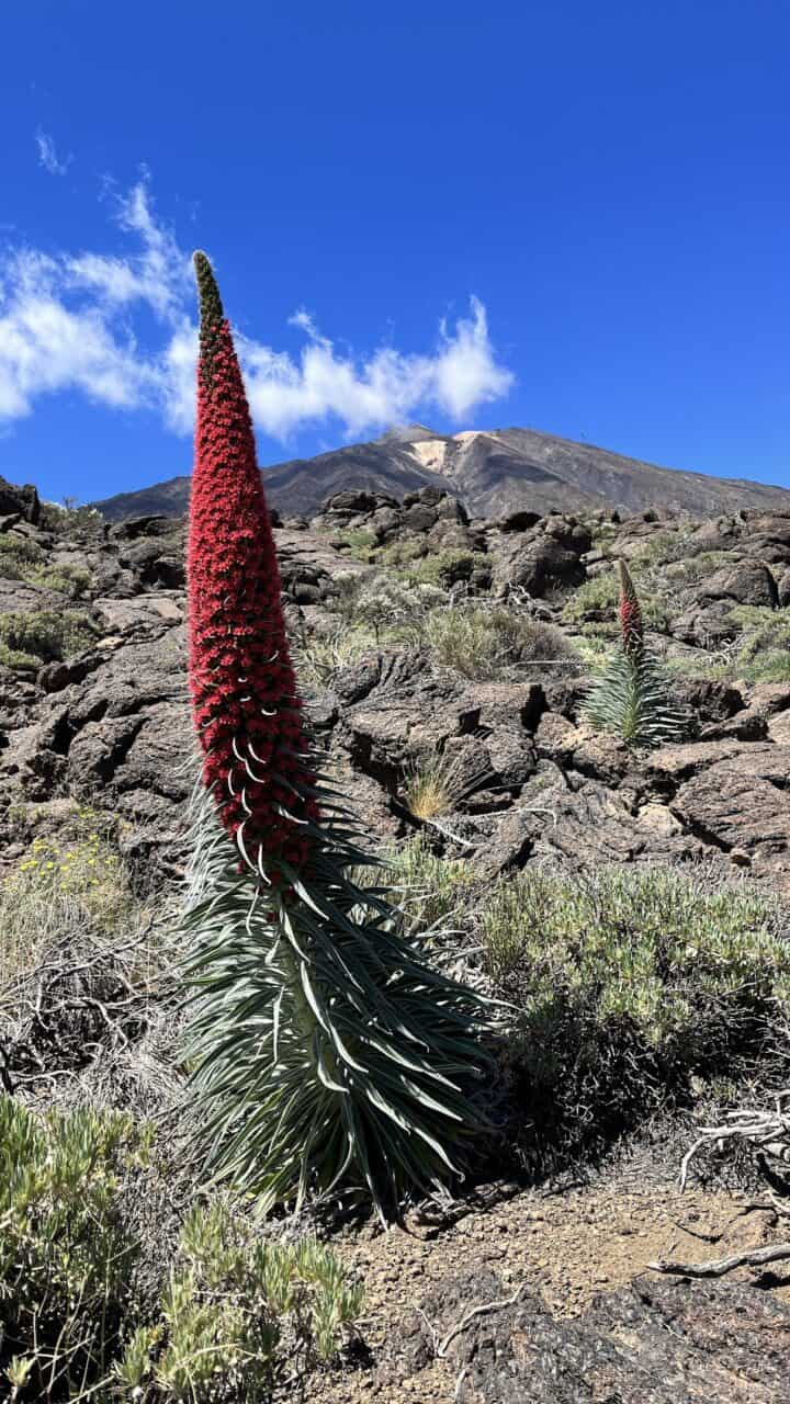
The blooming of the Teide brooms (Tajinaste in Spanish) in Teide National Park is one of Tenerife’s most spectacular natural events, transforming the rugged volcanic landscape into a vibrant canvas of color. Tajinastes, with their distinctive spires of bright red flowers, bloom en masse during the late spring and early summer months, typically between May and June.
These towering plants, some reaching up to 3 meters in height, are endemic to the Canary Islands and provide a stark contrast to the park’s otherwise muted tones of rock and soil. The Teide brooms play a crucial role in the local ecosystem, supporting a variety of pollinators like bees, birds and even lizzards.
Tajinaste blooming can definitely be observed in areas around the🌍 Teide cable car parking, 🌍Roques de Garcia trail, 🌍Parador de Cañadas del Teide hotel and Guajara mountain trails near the hotel. You will also witness plenty of these flowers if you will ascend to the Teide volcano peak from the 🌍Southern direction near Pico Viejo crater.
Spring almond blossoms near Santiago del Teide (time-sensitive)
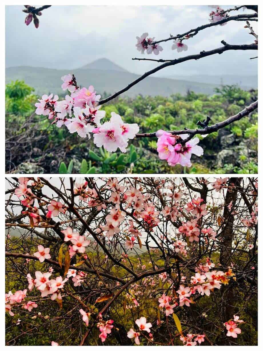
The blooming of almond blossoms around Santiago del Teide is another special Tenerife experience akin to Sakura blossoming in Japan and elsewhere. Every year, usually from late January to early February, the almond trees burst into delicate shades of pink and white, creating a soft and alluring landscape that contrasts beautifully with the rugged volcanic scenery in the distance.
While almond trees blossom everywhere on the island, only in Santiago del Teide do the almond trees grow in such concentration because of the particularly suitable microclimate and fertile soil.
There are at least two routes one can take to experience this event, and both begin at the 🌍Plaza publica de Santiago del Teide. The shorter 5 km (3 mile) route ambles through the area of Las Manchas and ends in the nearby town of Arguayo. The longer route overlaps with the TF-43 trail towards the Chinyero volcano and rest of the Teide Natural Park.
Parking is a notorious problem in Santiago del Teide during the almond blossoming period. Instead of fighting for the limited parking space around the main road, head a bit into the town towards the Teide volcano. 🌍This and 🌍this were good spots with lots of free parking spaces.
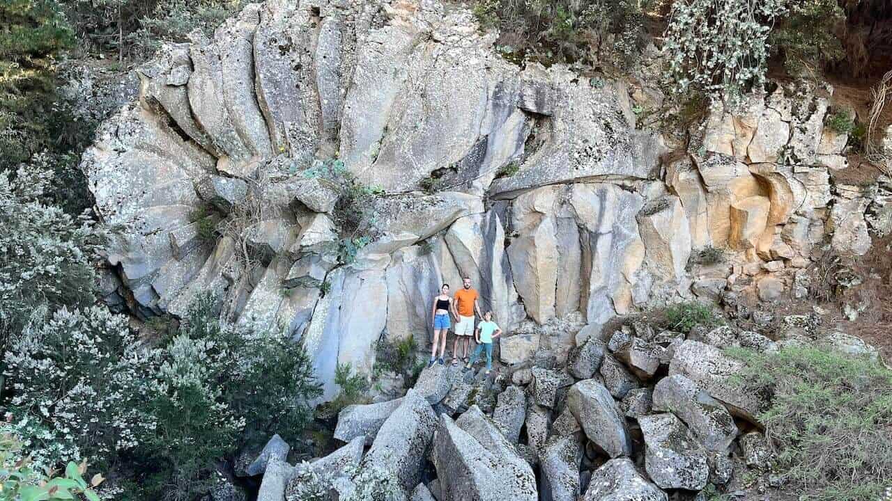
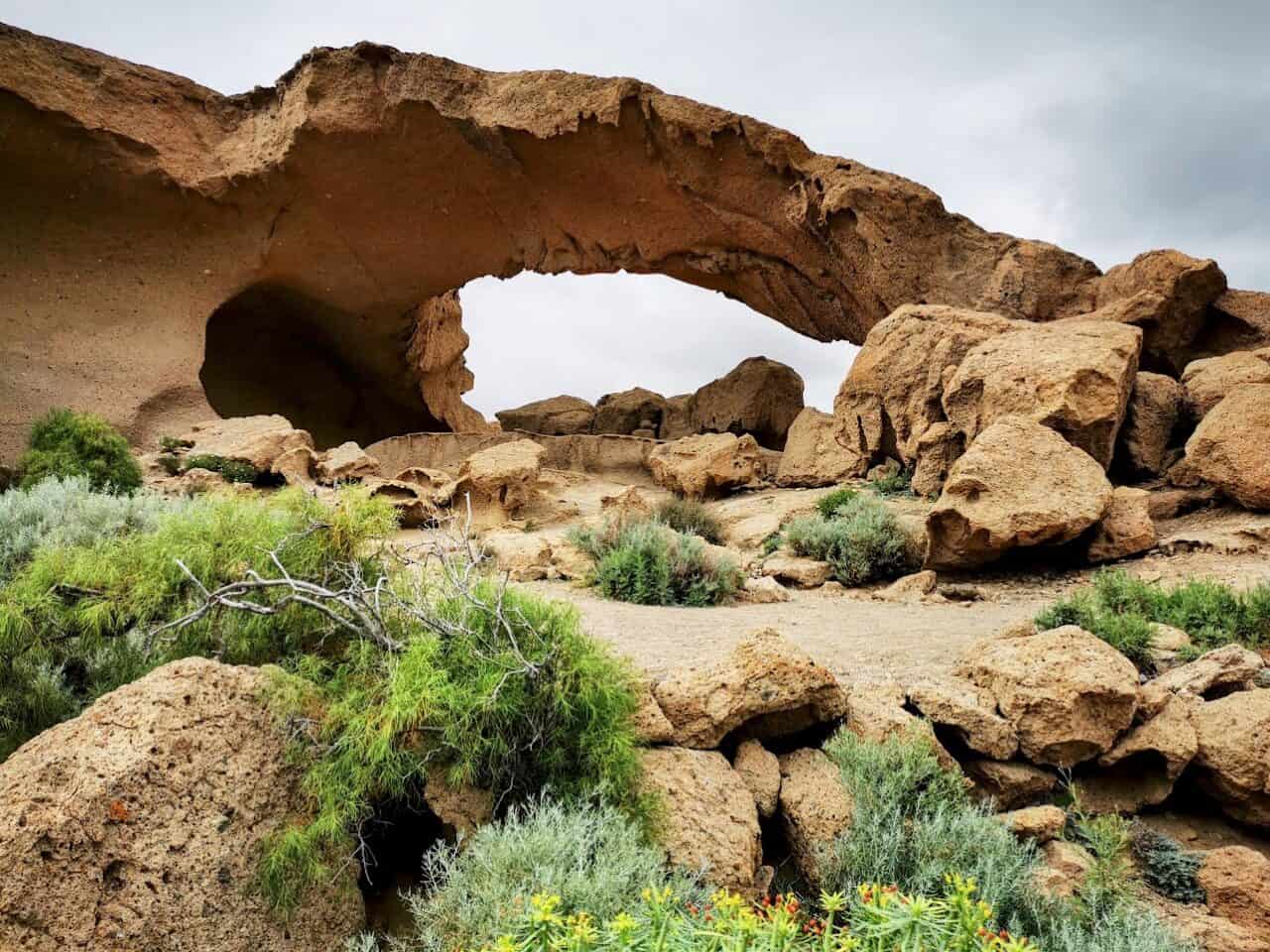
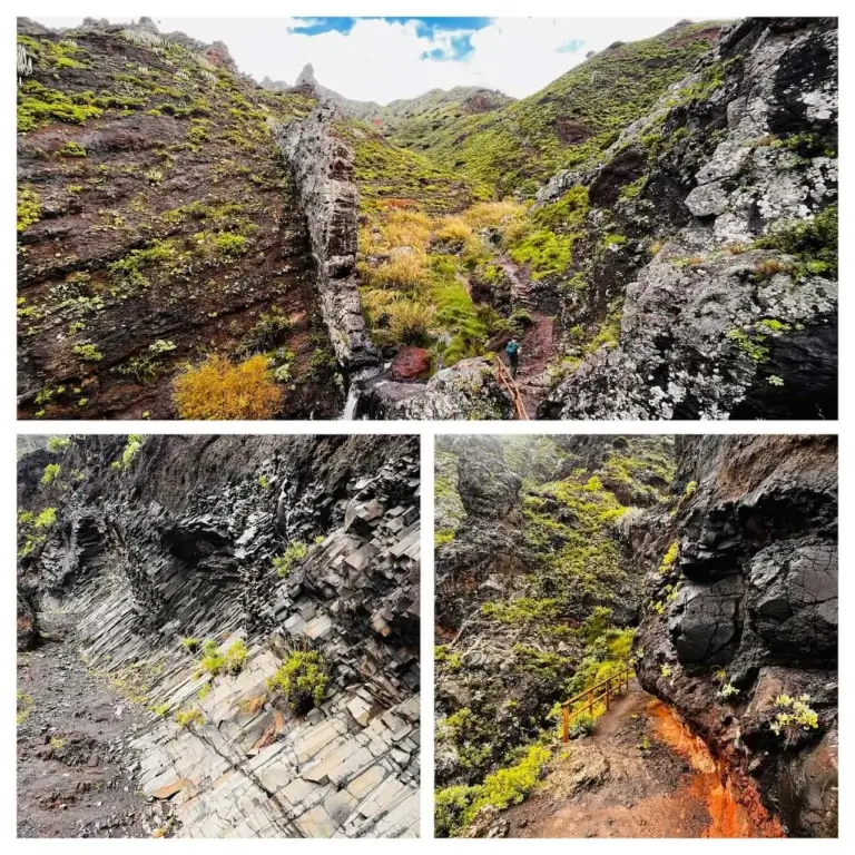
Barranco de Los Arcos de Chimoche
The Barranco de Los Arcos is probably the most beautiful canyon in Tenerife. It’s almost as impressive as the Canyon de las Vacas in Gran Canaria and a distant relative to the Antilope canyon in Arizona, USA.
The canyon is located above the La Orotava town and is very close to the Piedra de la Rosa lava formation, which is also featured in this article. The pictures on internet do not lie – the views created by the arches made from volcanic ash in the canyon are really stunning. However, a lot depends on the time of day when you visit as afternoons on sunny days will yield the best pictures.
Barranco de Los Arcos was formed by massive deposits of volcanic ash in distant eruptions during the island’s formation which compressed to form the modern-day hard canyon walls and floor. However, as the minerals forming the canyon are softer than basalt, these could be carved by water over millions of years.
A peculiar fact about this canyon, shared by our guide Jorge, is that the Barranco de Los Arcos has this sandy/orange color which is unique as most other canyons in Tenerife are gray or black. This has to do with acidity of lava or volcanic ash that forms the canyon. The more acidic the mineral, the blacker the canyon; the less acid, the more of those nice sandy and orange colors you get.
🌍Google Maps location of the canyon
🌍Google Maps location of Mirador de la Bermeja – nearest parking area
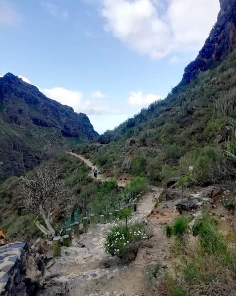
Barranco de Masca
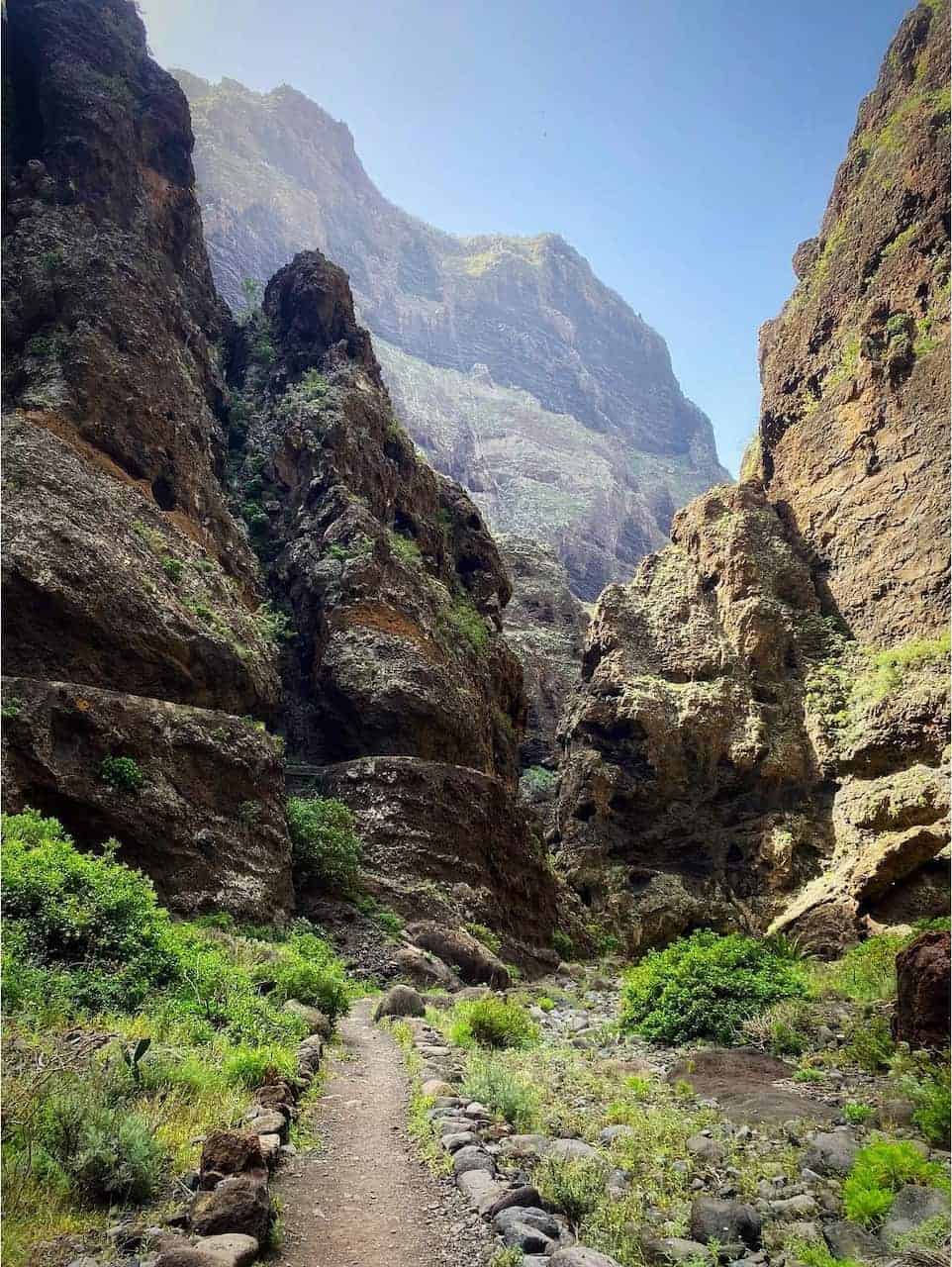
The Barranco de Masca trail is one of Tenerife’s most popular hikes and for a reason. It offers visitors the chance to walk through a breathtaking ravine that slices through the Teno Mountains and showcases ancient rock formations dating back 7 to 5 million years BCE while doing it in controlled circumstances as this is one of the most developed trails.
When it comes to numbers, the trail stretches approximately 4.5 kilometers (about 2.8 miles) one-way and descends from the Masca village (600 meters (nearly 1970 feet) above sea level) down to the Masca beach. Due to the descent and ascent, this is a medium difficulty trail, but can be done by most people if you pace yourself.
The hike is a journey through time, with the path winding through ancient rock formations, some dating back 7 to 5 million years, and past unique flora and fauna endemic to the Canary Islands. The Barranco de Masca is a geologist’s dream, showcasing the dramatic effects of erosion and volcanic activity that have sculpted the island’s rugged terrain. Hikers are treated to awe-inspiring views of towering cliffs, which can soar up to 600 meters (1970 feet) high, and the verdant, palm-filled valley floor, creating a stark contrast against the stark rock walls. The trail concludes at a secluded beach, accessible only by foot or boat, where the clear waters offer a refreshing reward after the challenging trek. The Barranco de Masca trail is not just a hike; it’s an immersive natural experience that epitomizes the wild beauty of Tenerife.
This is one of the Tenerife trails that require a permit and hiking shoes are a requirement for admission by Teno Park administration. If you cannot secure the free permit for your favored dates, consider a paid Masca gorge tour that has the permit included in the price.
🌍Google Maps location of the trailhead
Paisaje Lunar or Moon Landscapes trail
The Paisaje Lunar or “Lunar Landscape” is a unique geological formation in the southern part of the island roughly between the Vilaflor village and Guajara mountain. The hike up to the Paisaje Lunar is moderately challenging due to the ascent, and visiting this location can be incorportated into longer trails both from Vilaflor, but also the Parador de Cañadas del Teide hotel and the Guajara mountain.
These interesting rock formations known as ‘hoodoos’ have been sculpted by the forces of erosion acting upon layers of pumice and tuff left behind from the explosive volcanic activity of the Las Cañadas volcano around 2 million years ago. The hoodoos rise to a height of 5 meters (about 16 feet).
🌍Google Maps location of Paisajes Lunar | 🌍Trailhead to Paisajes Lunar at the Campamento Madre del Agua, but you can also do a longer hike from Vilaflor
Barranco del Infierno
The Barranco del Infierno, aptly named “Hell’s Ravine,” is another noteworthy hiking destination that offers a glimpse into the diverse landscapes and ecological richness of Tenerife. This protected natural reserve is home to the trail, which meanders through one of the most verdant gorges in the South of the island.
The trail itself is a moderate 6.5 kilometers (approximately 4 miles) round trip, with an altitude gain of only 200 meters (around 656 feet), leading hikers through a terrain replete with native vegetation and rare wildlife. Known for its historical significance, the Barranco del Infierno was once a pathway for the indigenous Guanche people and later for Spanish settlers.
The ravine’s high walls, reaching up to 80 meters (about 262 feet), encase the trail in a dramatic embrace, while the sound of the stream and the sight of waterfalls, including the highest waterfall in Tenerife, add to the sensory experience. The waterfall is theclimax of the hike with its impressive cascades that end in a natural pool.
Due to its ecological importance, access to the Barranco del Infierno is limited to a certain number of visitors per day, ensuring the preservation of its delicate environment and making the experience all the more exclusive and memorable.
This is one of the Tenerife trails that require a permit and hiking shoes are a requirement for admission by park administration. If you cannot secure the free permit for your favored dates, consider a paid Barranco del Infierno tour that has the permit included in the price.
Guimar Volcano and Malpaís de Güímar Nature Reserve
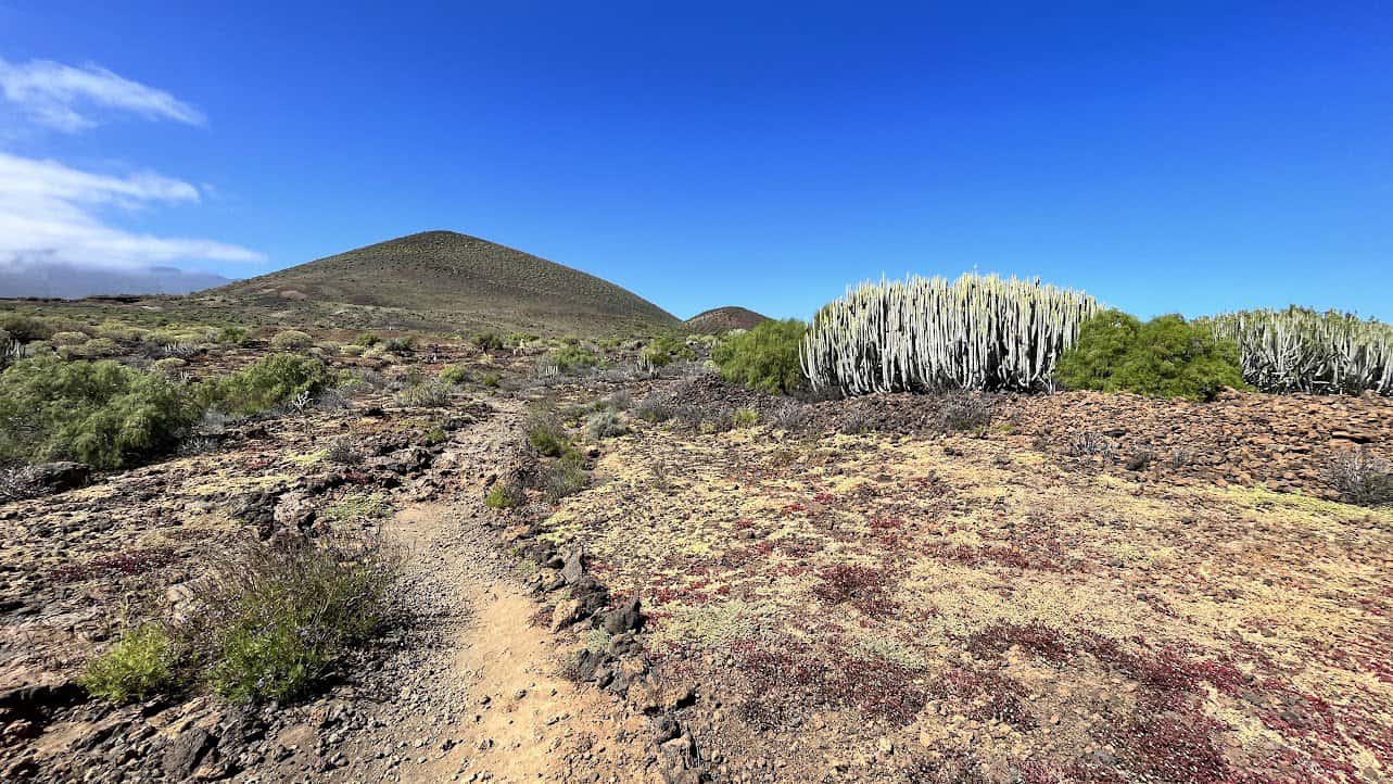
The Güímar Volcano is something you notice as you drive on the TF-1 highway between the South and the North. While height-wise it’s not tall, the volcano is nicely contained and begs to be explored.
Of course, this is a small volcano, but there are not that many opportunities on the island where you can so easily explain a volcano in its entirety. The volcano was created “only” around 10,000 years ago. The main cone, Montaña Grande, stands at a height of around 276 meters (approximately 905 feet) above sea level, but its impact on the landscape is anything but small.
Covering an area of about 290 hectares (approximately 717 acres), the Güímar Volcanic Field showcases a variety of volcanic features, including lava fields, craters and even lava tubes (which you don’t see as they are underground).
🌍Google Maps location of the Guimar volcano
🌍Best parking so you explore the nature reserve on your way to the volcano
🌍Parking closest to the TF-1 highway if you want to get up and down the volcano quickly
Arco de Tajao arc
If you are driving on the main South-North TF-1 road in Tenerife, if you make just a 5 minute detour you can visit this photogenic object – Arco de Tajao. It’s only a 10-15 minute drive from the Tenerife South Airport.
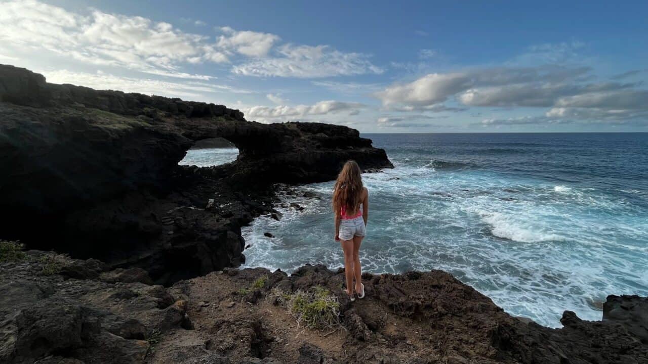
This natural arch is also a product of the island’s dynamic volcanic history and was created by rapidly cooling lava. Over time, the persistent work of coastal winds have eroded the softer minerals around the arc, leaving it in the open for us to admire and take epic Instagram pictures.
🌍Google Maps location of the arc
Playa el Bollullo – probably the nicest black sand beach
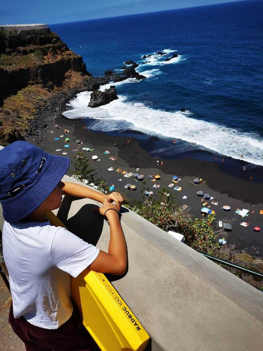
Nestled along Tenerife’s rugged northern coast lies Playa el Bollullo, a tucked-away gem of a beach whose sand is not only black, but also magnetic.
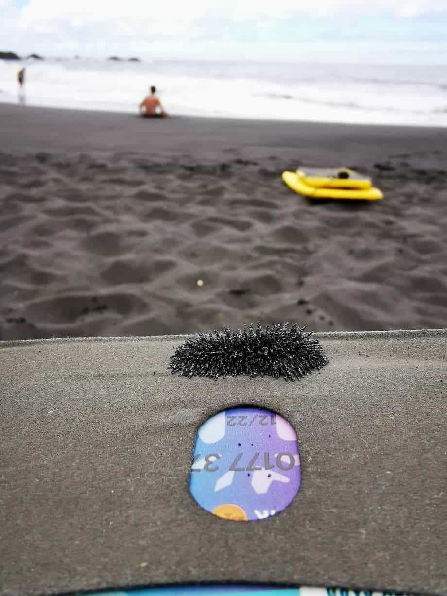
You read that right – the sand is truly magnetic as it contains particles of naturally occuring metals.
While small, the beach has decent amenties like a life guard, an on-beach bar Bollullo Chiringuito, a nearby parking and restaurant up on the cliffs. The parking costs democractic 3 EUR per day, card payments are accepted and the fee is waiwed for restaurant guests. The Restaurante Bollulo Beach is of good quality and serves great seafood as well as other dishes.
The beach is located at the end of narrow and steep one-lane road through banana plantations. You can walk down to the beach from the El Rincon town that’s near La Orotava. Only drive a car down if you’re a confident driver, as it can be tricky to exchange with other cars on the road.
La Tarta del Teide
La Tarta del Teide, often referred to as “The Cake of Teide”, is an interesting natural attraction to visit as you explore the Teide National Park. This geological formation resembles a giant layered cake, showcasing a spectrum of colors from whites and pinks to ochres and blacks depending on the light and time of day. These layers are a record of the various volcanic eruptions that have occurred over millennia, with each stratum representing a different geological era. The distinct colors are due to the varying mineral compositions and oxidation states of the materials deposited during these eruptions.
It is located on TF-24, the most scenic of Tenerife’s roads that curves around the Teide volcano, and is impossible to miss as you make one of the curves. Don’t stop at the curve, as there’s a parking lot literally 50 meters from the object.
Roque de Taborno trail
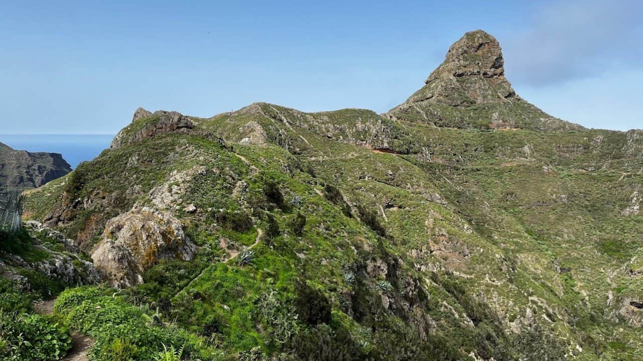
Roque de Taborno near the Taborno village is sometimes called the ‘Matterhorn of Tenerife’ due to its shape. There is a short 4 km (2.5 mile) trail going around it. It’s one of the shortest, but nicest trails in the Anaga Rural Park, though not suited for children and people with vertigo.
As you walk around the Roque de Taborno, you’ll get superb 360-degree views of the rolling Anaga mountains and the Atlantic Ocean. While we certainly don’t recommend it, if you’re crazy you can climb up to the top of the peak for even more breathtaking panoramas.
Legend has it that Roque de Taborno was inhabited by Guanches due to its excellent defensive posture and a water source nearby. It supposedly was one of the last defensive holdouts of Guanches against the Spanish conquistadores.
🌍Google Maps location. To access Roque de Taborno, you have to walk through the Taborno village and descend to a shallow mountain pass first.
Roque de Las Animas volcanic plug
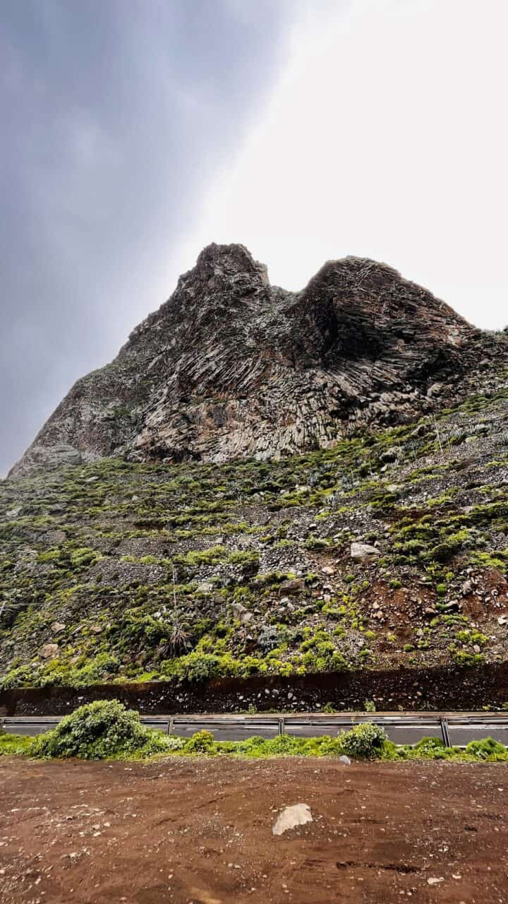
The Roque de Las Ánimas is one of the most striking and probably the largest example of a volcanic plug in Tenerife. It’s a truly giant slab of rock whose name translates to “Rock of the Souls”. In case you’re wonding what are ‘volcanic plugs’, they are formed when magma solidifies within a vent while still inside the volcano. The volcanic plugs we see today have appeared as the surrounding softer material of the volcano erodes away, leaving the harder plug exposed and creating a prominent landmark.
Visit Roque de las Animas when you explore Anaga on your way to Taganana and Almaciga villages, as well as the excellent beaches of Playa del Roque and Playa del Roque de las Bodegas with good seafood restaurants.
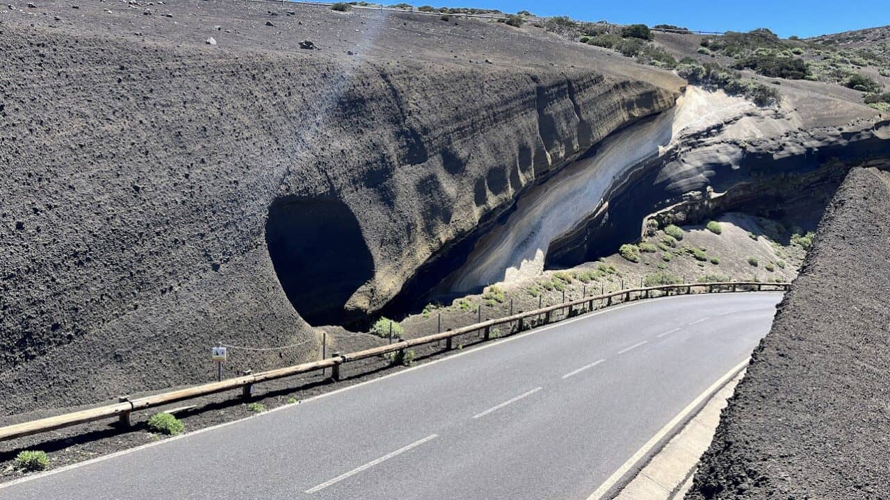
Volcanic dikes
Tenerife’s volcanic origins are spectacularly showcased by some impressive lava dikes. These geological formations are created when molten rock was forced into cracks in the existing rock and solidified. Similar to lava plugs, the lava dikes were once covered by the softer surrounding material that has eroded away over time, leaving the harder, erosion-resistant stone exposed in striking vertical formations. In some locations on the island it’s hard to believe that these “stone walls” are were not made by humans.
The dikes can be observed in many locations on the island, but two particularly nice specimens are near Igueste de San Andrés and the Afur village on your way to Playa del Tamadite.
🌍Google Maps location of the dike in the picture near Igueste de San Andres town, on the TF-5 trail from Chamorga to the ocean.
Another 🌍great dike is located on the TF-8 circular trail between the Afur village and Playa del Tamadite (upper picture). On the way to the dike you will also see plenty of other volcanic phenomena like mini basalt columns (bottom left image).
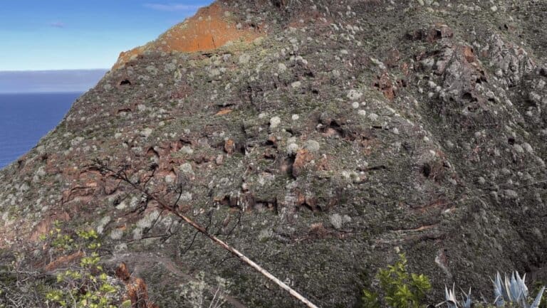
Cuevas de San Andres
We were not able to find much reliable information about the Cuevas de San Andrés, however, this is a nice geological landmark and should definitely be visited if you go up to the Bunker de San Andres. If you are accompanying someone to the Las Teresitas beach but are not much of a beachgoer, create yourself a nice 4 km (2,5 mile) hike to visit these two destinations which are just 300 meters (900 feet) apart.
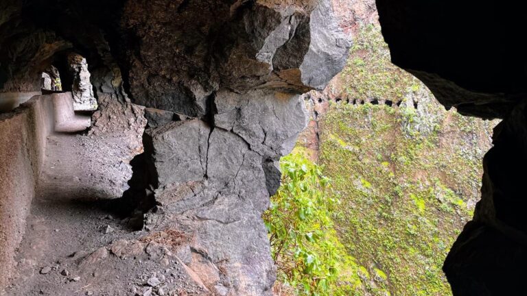
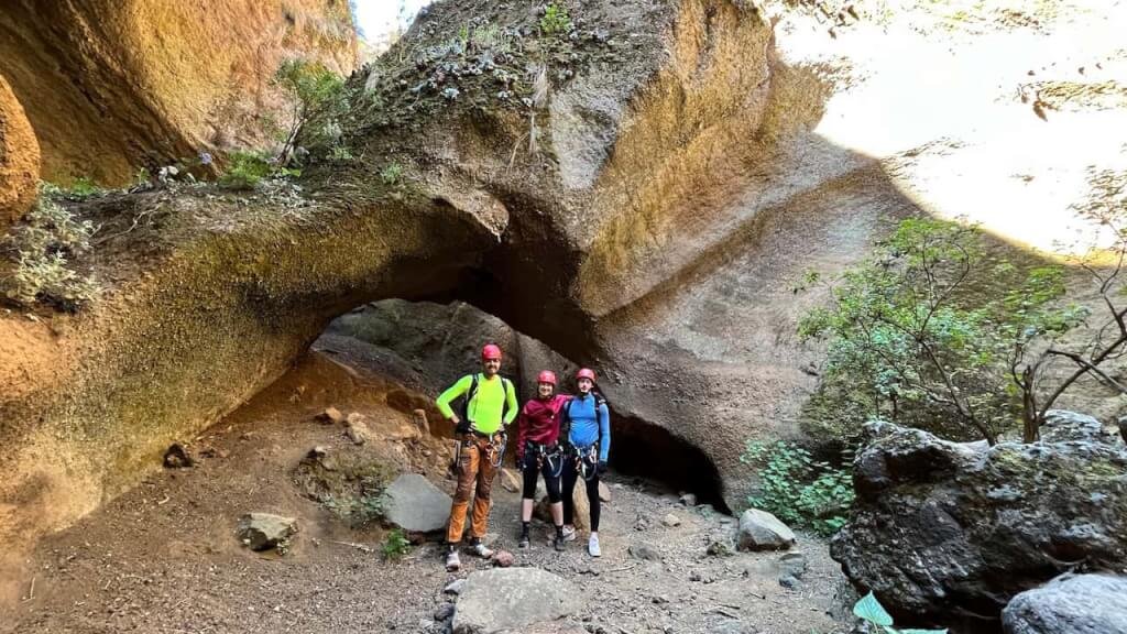
Cueva Jurada arc
The Cueva Jurada, located in the Anaga Rural Park in Tenerife, is a lesser-known yet captivating natural formation that offers an intriguing adventure for those looking to explore the island’s geological wonders. This arc-shaped cave is a product of the intense volcanic activity that has shaped the Canary Islands over millions of years. It is a nice example of the dynamic processes that have created and transformed Tenerife’s landscape. See this object when visiting the Jover natural pool in Tejina.
Did we miss something on this list? Please mention it in a comment below and we will update the article.